It’s going to be cold, it’s going to be wet, and above all it’s going to be windy. An “atmospheric river” will flow over both the coast and the interior starting tonight and continuing over the next few days, bringing not only the aforementioned unpleasantness but also monstrous surf.
Below please find: A hazardous weather outlook just issued by the good folks at the National Weather Service on Woodley Island.
REDWOOD COAST
3:55 pm, Tuesday, Dec. 8, 2015Wind advisory in effect from 10 pm this evening to 7 am Wednesday…
Day One: This Afternoon and Tonight.
A wind advisory is currently in effect.
An approaching frontal boundary will increase south winds this evening and bring periods of heavy rain to the region tonight.
Days Two through Seven: Wednesday through Monday.
A wind advisory is currently in effect through Wednesday morning.
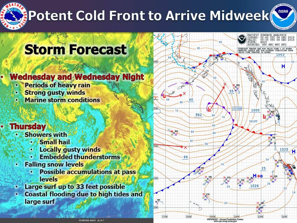
A wet and unsettled weather pattern will continue this week bringing periods of widespread heavy rain and gusty winds on Wednesday and Thursday. Then a cold unstable air mass will bring lowering snow levels … hail showers … and potential thunderstorms on Thursday.
A large swell will have to the potential to bring high surf to northwest California beaches Thursday into Friday. Some coastal flooding will be possible.
NORTH COAST INTERIOR
3:55 pm Tuesday, Dec. 8, 2015Wind advisory in effect from 10 pm this evening to 7 am Wednesday.
Day One: This Afternoon and Tonight
A wind advisory is currently in effect.
An approaching frontal boundary will increase south winds this evening and bring periods of heavy rain to the region tonight.
Days Two through Seven: Wednesday through Monday.
A wind advisory is currently in effect through Wednesday morning.
A wet and unsettled weather pattern will continue this week bringing periods of widespread heavy rain and gusty winds on Wednesday and Thursday. then a cold unstable air mass will bring lowering snow levels…hail showers … and potential thunderstorms on Thursday.
CLICK TO MANAGE