All things considered, the invention of the internal combustion engine was seriously bad news for animals. Before long, strips of asphalt crisscrossed their native habitat, and 4,000-pound machines were hurtling through at speeds critters couldn’t fathom. The era of roadkill was upon us.
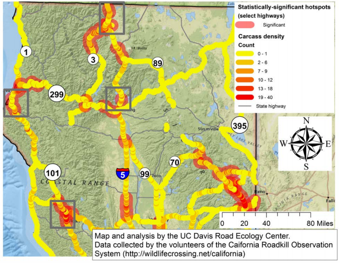
The map above, which comes from a new report by the U.C. Davis Road Ecology Center, shows the areas in far-northern California where animals are most in danger of going splat. These collisions (and swerves to avoid collisions) are dangerous for us humans, too. The report notes:
Animals entering roadways pose a hazard to drivers, who may collide with the animal, or try to avoid the animal and have an accident suffering vehicle damage, injury, and even death. Wildlife populations may suffer significant losses due to collisions and highways with high rates of WVC may cause ripple effects into surrounding ecosystems.
Here in Humboldt we have a roadkill “hot spot” that extends roughly from Humboldt Redwoods State Park north along Highway 101 and then east along State Route 299 to the county line. The gray rectangles on the map identify areas with “high concentrations of deer-vehicle conflict.”
Be careful out there, folks.
# # #
DOCUMENT (with graphic roadkill photos): Wildlife-Vehicle Conflict Hotspots Along California Highways, 2009-2015
CLICK TO MANAGE