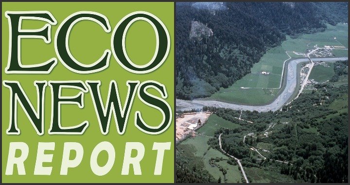
Photo: The lower stretch Redwood Creek in the 70s. Photo: RNSP Flickr. Public domain.
###
In 1968, Congress created Redwood National Park — or at least part of it. Nicknamed “the Worm,” the park extended only .5 miles on either side of Redwood Creek. It was apparent that this was not enough and work began on a park expansion. Of course, expansion was opposed by local logging companies. In an attempt to blunt the expansion efforts, logging companies ran crews — sometimes 24 hours a day — in an attempt to cut the remaining old-growth in the Redwood Creek watershed, with the rationale that if logged, it would be less attractive to incorporate into the Redwood National Park. That plan failed. In 1978, Congress expanded Redwood National Park and took in many of the cut over lands, with only a fifth of the new land
This decade of intense logging left a major impact on Redwood Creek. Large clearcuts, poorly cut roads, landslides and major floods sent a massive wave of sediment streaming into Redwood Creek. The National Park Service has spent the past 40 odd years cleaning up this mess and studying how Redwood Creek is (and is not) recovering.
Two expert geomorphologists with decades of experience studying Redwood Creek join Gang Green to talk about their research. Mary Ann Madej is the author of the recent report, Redwood Creek Watershed Studies: Summary of Geomorphic Research at Redwood National Park and Vicki Ozaki is a staff geologist at Redwood National Park.
AUDIO:
“The EcoNews Report,” April 17, 2021.
REQUIRED READING:
CLICK TO MANAGE