Today’s Operations Update with Team 4 Operations Section Chief Jake Cagle. | Photos and video by CIIMT4
The Emerald Triangle skirted a potential barrage of new wildfires this week thanks to a forecast of dry thunderstorms that never came to fruition.
Eureka’s National Weather Service office says that’s because, contrary to its predictions, the atmosphere wasn’t unstable enough to produce lightning between Sunday evening and Monday night.
“If we were going to be wrong, we are thankful our error was on the side of less lightning rather than more!” the NWS shared on social media.
The Salmon Creek Complex wildfire burning northeast of Hoopa, meanwhile, is now 19,839 acres in size and 41 percent contained.
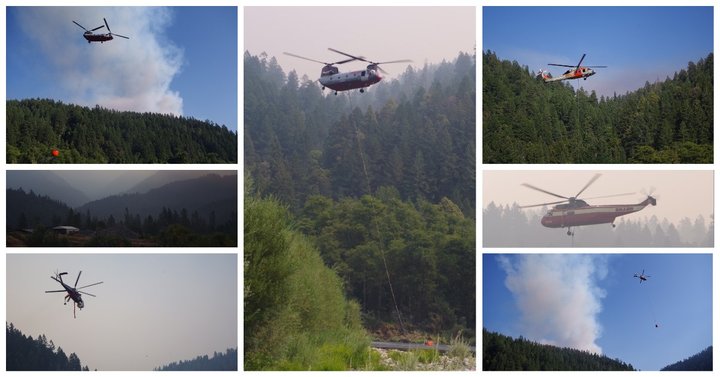
California Interagency Incident Management Team 4 reports that the fire had no significant growth last night.
“Today’s firing objectives include keeping the Red and Salmon fires east of Packsaddle Ridge, west of High Point Ridge, north of the Soldier Creek Trail and south of Lunch Creek to Salmon Summit Trail to Red Cap Peak,” the CIIMT stated in a press release.
Yesterday’s Red Flag warning has been lifted and thunderstorm are not in today’s forecast.
CLICK TO MANAGE