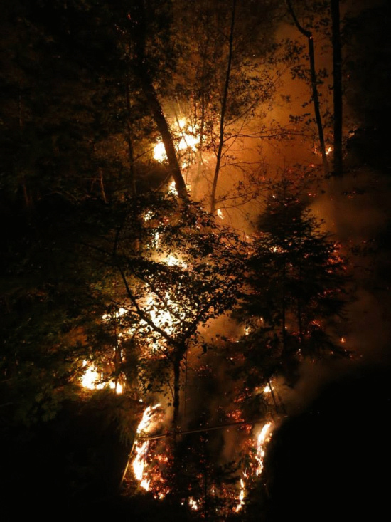
 Fire rages near the northeastern border of Humboldt Co. and western Siskiyou Co. (All photos in this article are by Will Harling who is a resident of the area.)
Over 18,000 acres have burned in the Orleans and the Salmon River Complexes so far. According to the InciWeb, “Light rain yesterday kept activity low on the Butler Fire overnight. Today, crews will continue structure protection and begin mop up around the Butler Flat and Nordheimer Flat areas and work on strengthening lines ahead of the active fire (indirect lines), using a variety of tactics.” (See below the fold for complete details on the Orleans Complex. See here for the Salmon River Complex.)
Resident Will Harling who took most of the photos accompanying the article wrote, “The Butler Fire is burning down along Butler Creek, which mostly held with a little help from the Ukonom shots [firefighters] and a Type I [helicopter.]”
Harling’s community lives with frequent fires and tosses off years and areas burnt like football fans describing their teams wins and losses. Harling talks about the current fire like a coach who knows the opposing team’s strengths and weaknesses.
The rain yesterday helped, he believes, but he is still concerned about one area. He wrote,
There is one steep ridge where last night’s IR map shows the fire, despite the rain, continues to creep up the north side towards containment lines along the Monte Creek road system. It is still unclear whether crews can go direct on this piece or if the fire will continue upslope, triggering a back burn along the containment line from Orleans Mtn to Somes Mtn down the ridge between Butler and Monte Creek to the White’s place, or when this burn would be initiated. They are still working on this line, so we will see.
Below is a quick photo walk through what Harling’s community and the firefighter crews have been seeing from the last few days into today.

Sights like this have become almost ordinary to some of the residents near the fire. Harling says about the photo above, “The old ditch line held the fire everywhere except here where rollout crossed and the little chunk of ground below had to be burned out. It was all pretty mellow.”
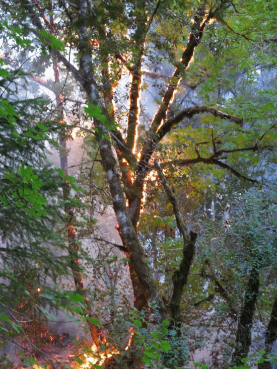
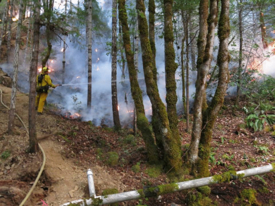
A firefighter wets down the fire’s edge.
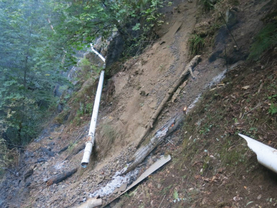
Burnt and broken waterline that services the community at Butler Flats. It provided not only water but power through a hydroelectric system.
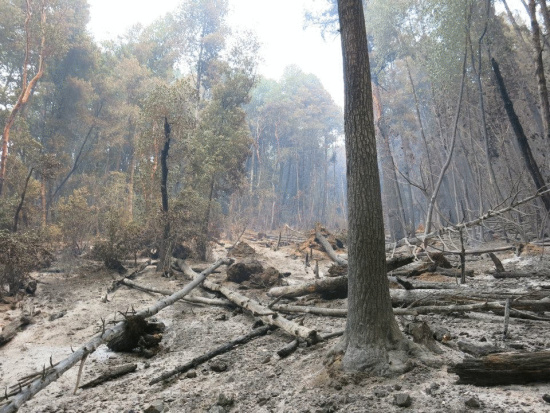 An area that fire has passed through leaving ash and burnt trees behind along the Butler Trail.
Harling wrote that the rain and burned out areas from previous fires will help protect the Butler Creek area of the Orleans Complex. “I do not expect significant fire activity coming out of Butler after this [precipitation] and the pre-treatment effect of the 2006 Somes Fire.”
He is spending today on fixing the water system to his community. He wrote, “Now to the work of repairing our water line and cleaning up from the craziness of the past week. We have 12 breaks in the line, but given the amount of rock that came off the mountain and the heat of the fire, I am pretty impressed by the mitigating effect of the tin and re-bar deflectors and the sprinkler system. It saved about 70-80% of the potential breaks. We live and learn. “
Below are photos from the fire provided by the InciWeb and information from a press release.
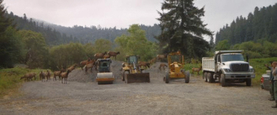 Elk inspect firefighting equipment—Photo from the Six Rivers National Forest InciWeb
Butler Fire Press Release below:
Health Advisory:The North Coast Unified Air Quality Management District (NCUAQM) continues to extend their smoke advisory for Del Norte, Humboldt and Trinity Counties, noting that there are separate advisories for Forks of Salmon, Klamath Glen, Orleans and Weitchpec. For further information call the 24 hour Air Quality Advisory Information at 1-866-BURN-DAY or check the district’s website at www.ncuaqmd.org.Detected: Wednesday, July 31, 10:00 p.m.Cause: Under InvestigationFuels: Timber and BrushEstimated Size: 8,204Containment: 14%Committed Resources: Approximately 1,120Structures Damaged or Destroyed: 0Closures:The following closures are in effect for the public, excluding residents within the closure area:Going into or being upon National Forest System lands in the area beginning at the intersection of Highways 93 and 96, then continuing south along the boundary of Ukonom Ranger District of the Klamath National Forest where it abuts the boundary of the Six Rivers National Forest, then continuing southeast along the boundary of the Ukonom Ranger District of the Klamath National Forest where it abuts the Shasta-Trinity National Forest, then continuing northeast along the East Fork of Knownothing Creek to the intersection with Highway 93, then continuing northwest along Highway 93 to its intersection with Road 39, then continuing east/southeast along but not including Forest Road 39 to the intersection with Forest Road 39N58, then continuing northeast along Forest Road 39N58 to its terminus at Timber Camp Trailhead, then continuing northeast from the Timber Camp Trailhead to the Russian Wilderness boundary, then continuing north along the Russian Wilderness boundary to the intersection with the Pacific Crest Trail, then continuing northwest along but not including the Pacific Crest Trail to the intersection with Timothy Gulch, then continuing northwest along Timothy Gulch to the intersection with Wooley Creek, then continuing southwest along Wooley Creek to its intersection with Highway 93 (County Road 2B01), then continuing west along Highway 93(County Road 2B01) to the starting point, as shown on the attached map.Highway 93 (Forks of Salmon Road) is closed at the Highway 96 intersection and above the Forks of Salmon store. No access to North Fork/Sawyers Bar Road is available at this time.Summary:Light rain yesterday kept activity low on the Butler Fire overnight. Today, crews will continue structure protection and begin mop up around the Butler Flat and Nordheimer Flat areas and work on strengthening lines ahead of the active fire (indirect lines), using a variety of tactics. Firefighters may use backing fire in front of the active front to minimize intensity near control lines if conditions dry and fire activity increases.Please see http://www.inciweb.org/incident/3577/# for updates and a map of the Orleans Complex.
CLICK TO MANAGE