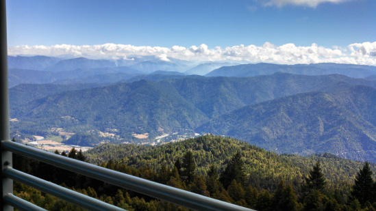
Photo of the Corral Fire from today shows a much quieter looking fire. See here for comparison. (Photo Credit Peggy Phillips)
According to the Forest Service, the Corral Fire is now at 11,732 acres with over a 1000 personnel working on it. In the last day and a half, 5% of the fire has been contained. The latest update from the Forest Service says,
Good progress was accomplished again today on the fire as crews were able to engage in direct fire attack. One and a half miles of direct containment line were completed on the northern portion of the fire. There was minimal fire spread with creeping and backing behavior observed in heavier ground fuels with occasional isolated tree torching. Air attack focused on the southeastern side of the fire to control its spread. Structure defense preparation plans are underway for the communities of Denny and Hoopa Valley Indian Reservation, as a precautionary measure.
Full Six Rivers National Forest Press Update below:
Incident: The Corral Complex was started by lightning on August 10, 2013 and is burning within the 1999 Megram Fire and the 2009 Backbone Fire areas.
Location: Trinity Alps Wilderness
Agency Jurisdiction: Unified Command-USDA Forest Service and Hoopa Valley Indian Reservation.
Cooperating Agencies: VFDs, Humboldt Co. Sheriff’s Office, Trinity County Sheriff’s Office
Current Size: Complex is 11,732 Acres Cause: Lightning
Containment: 5%
Structures Threatened: 125
Current Resources: Crews: 19 Engines: 46 Helicopters: 10 Dozers: 11
Total Personnel: 1,086
Good progress was accomplished again today on the fire as crews were able to engage in direct fire attack. One and a half miles of direct containment line were completed on the northern portion of the fire. There was minimal fire spread with creeping and backing behavior observed in heavier ground fuels with occasional isolated tree torching. Air attack focused on the southeastern side of the fire to control its spread. Structure defense preparation plans are underway for the communities of Denny and Hoopa Valley Indian Reservation, as a precautionary measure.
Three spike camps are now set up at Denny, Groves Prairie camping area, and Box Camp to give firefighters more efficient access to the fire. Weather is expected to be warmer and drier throughout the week.
Evacuations: None currently in place. The structures at risk are outside the fire perimeter.
Road Closures: Road Closures: Big Hill Road, Tish Tang Road and Four Corners on the Hoopa Valley Indian Reservation are now closed due to increased fire personnel traffic and fire suppression activities. Forest Service roads 7N26, 7N53, and 7N04 surrounding the Groves Prairie Spike Camp have restricted public access due to fire crew activity. BE SAFE!
A Temporary Forest Closure Order for the Horse Ridge Closure area is in place. This order prohibits going or being upon National Forest System lands and trails within the Red Cap, Bear Hole, Horse Ridge Trail Closure Area. It is effective from August 22, 2013 through August 26, 2013. To view the entire Forest Order and Map visit http://www.fs.usda.gov/Internet/FSE_DOCUMENTS/stelprdb5433210.pdf
Area & Trail Closures: For public safety and to ensure unimpeded access for firefighters and equipment, public access is restricted in the fire area.
Community Meetings: None scheduled at this time.
For further information, including, maps, photos, links and closures, visit: www.inciweb.org
…Incident: The Corral Complex was started by lightning on August 10, 2013 and is burning
CLICK TO MANAGE