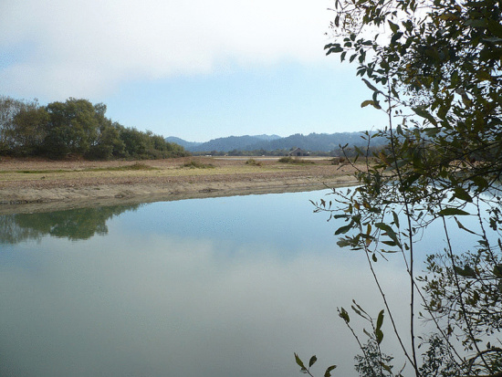
Photo and caption from Wikipedia Commons: The caption says, “The newly reopened western end of the Salt River in Humboldt County, California. The cofferdam and levee were breached between the phase one excavation and the Eel River on October 9, 2013 and the River became tidal again in the lowest section of the restoration. The breech location is to the left (west) of this picture which looks south east toward the Wildcat Hills which are the headwaters and provide tributaries to this river. Between river and barn, notice restoration marsh is also holding water. [Photo by Ellin Beltz]
This morning’s Wikipedia’s homepage under Did You Know features a Humboldt landmark. The entry reads
- …[Did you know] that after 26 years of hydrologic dysfunction, the lower channel of California’s formerly navigable Salt River (pictured) was restored to tidal action?
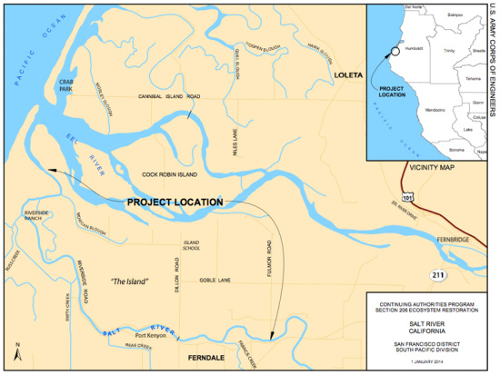
The Salt River (see map prepared by the U.S. Army Corps of Engineers below) was once good sized tributary of the Eel River. It was used by ships to navigate as far as Port Kenyon (near Ferndale) to gather shipments of dairy products which were exported to the rest of California.
But, then, in the late 1800’s, efforts were made to “reclaim” the salt water marshes for ranchland. Sedimentation began choking the river. By 2008 there was almost no river left.
However, a restoration project commenced and, earlier this month, the estuary was reconnected to the newly dredged waterway.
Long live the Salt River!
CLICK TO MANAGE