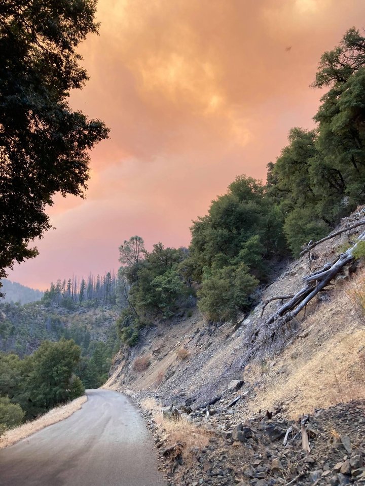
The Hopkins Fire looking east from Penny Glades up the South Fork Trinity River. | USFS Patrol Carson Harris.
Wildfires burning in and around Humboldt County grew by tens of thousands of acres yesterday due to strong winds and dry weather, prompting evacuations in Alderpoint, Palo Verde, Island Mountain, Harris and Denny.
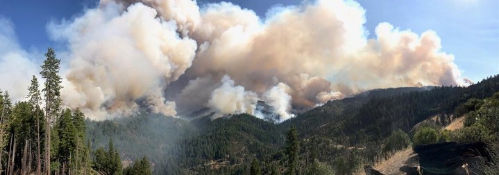
The Hopkins Fire, burning northeast of Covelo in the Yolla Bolly-Middle Eel Wilderness and Shasta Trinity National Forest, grew from approximately 20,000 acres to nearly 50,000 acres in the last 24 hours, according to information from the interagency public-information tool Inciweb.
However, Public Information Officer Kimberly Kaschalk with the Southern Area Blue Team told the Outpost this morning that firefighters really aren’t sure how much the fire has grown at this time.
“We’re still trying to gather that information now,” Kashcalk said. “We’re trying to re-evaluate. We had to make sure it was safe enough to get our people in there.”
As of this morning, the Hopkins Fire was considered to be part of the August Complex. However, Kaschalk told the Outpost that firefighters have regrouped the Hopkins Fire with the Elkhorn Fire, a 50,000-acre wildfire burning in the Tomhead Mountain area west of Red Bluff. This new grouping has been named the “Rock Complex.”
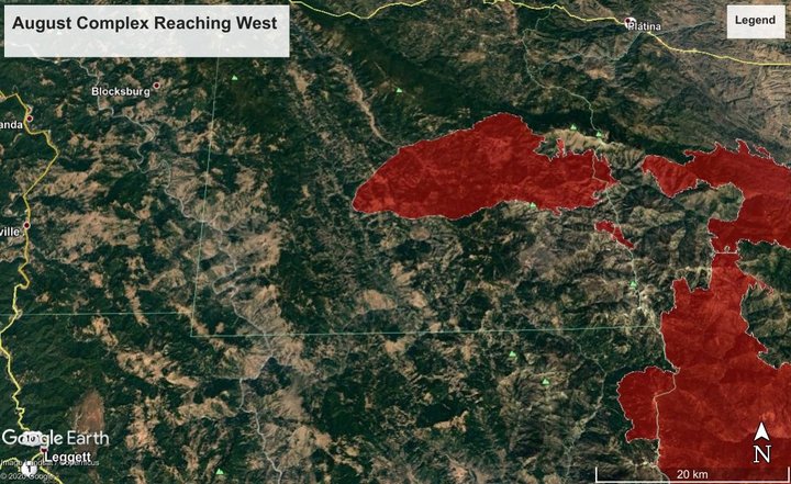
LoCO graphic of the Hopkins Fire (northern red portion of the map) made with Google Earth.
Because the fire has been taken over by a new incident management team this morning, and because firefighters are actively still assessing the fire’s perimeters, there’s no official word on the fire’s containment, how many homes are at risk, or whether the fire is still spreading toward Humboldt County.
The Outpost has reached out to the new incident management team to receive more information.
What is clear is that the firefighters anticipated yesterday’s westward-blowing winds and attempted to hinder the fire’s spread toward Humboldt County.
“We had some really severe winds that were blowing from the northeast toward areas like Covelo,” Kaschalk said. “We had a couple of days where we had the exact opposite, with the winds pushing the fire back against itself. We Attempted to strengthen those lines in anticipation of [yesterday’s] wind event.”
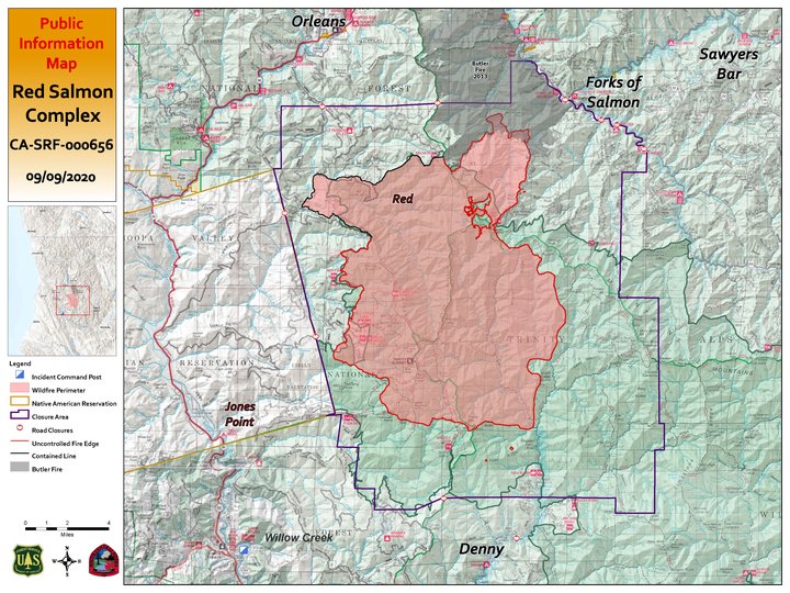
The latest map of the Red Salmon Complex . | Red Salmon Complex incident command team.
The Red Salmon Complex has also seen dramatic growth within the last 24 hours.
Since yesterday, the wildfire has grown from 48,000 acres to 71,610 acres and is 17 percent contained.
The fire has mostly spread to the south and to the east, sparing the Hoopa Valley from evacuation. However, the fire’s incident management team told the Outpost minutes ago that the Trinity County Sheriff’s Office has issued an evacuation order for the entire town of Denny.
Firefighters are actively clearing old dozer lines built during the 2013 Corral Fire near the southern perimeter of the fire in hopes of preventing the flames from reaching the small community. A structure protection crew will also be visiting Denny today to assess how to protect the town.
A temporary evacuation point has been set up at the Burnt Ranch School at 251 Burnt Ranch School Rd.
Nine crews, 29 engines, 7 dozers, 8 helicopters, 26 water tenders and 766 firefighters have been assigned to the fire.
Highway 101 also remains closed between Longvale and Simerson due to the Oak fire, which is 863 acres in size and 10 percent contained.
Red Salmon Complex. | InciWeb
CLICK TO MANAGE