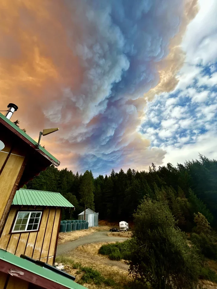
Reader submitted photos of smoke rising from the Hill Fire near Willow Creek on Tuesday
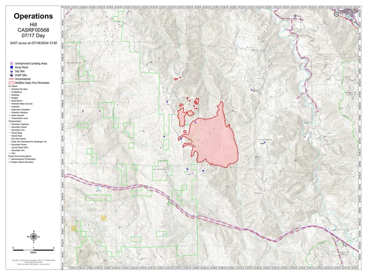
As of Wednesday morning, the Hill Fire burning south of Willow Creek is now listed at 3,437 acres with 0% containment. The blaze continues to be difficult for crews to access from the ground due to the steepness of the terrain where it is burning. Numerous air attack resources are on hand to help manage expansion.
“Due to dry and hot weather conditions today fire activity is expected to be high with the potential for a rapid rate of spread and extreme fire behavior,” said a release from Six Rivers National Forest.
Below is the latest released map showing the wildfire’s perimeter.
Click to enlarge
The following additional information comes from Six Rivers National Forest:
The Hill Fire is now being managed in Unified Command between the U.S. Forest Service and CAL FIRE. In addition, a local Type 3 Incident Management Team arrived today to assist with managing the fire and a Complex Incident Management Team and a CAL FIRE Incident Management Team has been ordered.
The fire is burning in steep and remote terrain making access challenging for ground resources within the Buck Creek and Mosquito Creek Drainages. Federal and state air resources including air tankers, helicopters, and air attack are on scene and will continue to perform retardant drops to try and slow the spread today. The fire is growing to the north in heavy timber.
Due to dry and hot weather conditions today fire activity is expected to be high with the potential for a rapid rate of spread and extreme fire behavior.
Crews will begin to provide structure protection along Route 1 and within the Friday Ridge communities. At this time there are multiple structures threatened. Firefighters are working to construct direct and indirect line to control fire spread to the north and the west.
Additional ground resources continue to be ordered and arrive on scene.
Evacuation Information:
Evacuation order and warning remain in effect. For current updates on evacuations, visit https://www.facebook.com/HumboldtSheriff and https://humboldtgov.org/2383/Current_Emergencies. Conditions are subject to change at any time, visit
https://protect.genasys.com/search for a full zone description.Sign up for Humboldt Alert emergency notifications at
https://humboldtgov.org/2014/Emergency-NotificationsEvacuation Order Issued for Zone HUM-E077-A: Due to the Hill Fire, the Humboldt County Sheriff’s Office has issued an immediate evacuation order for zone HUM-E077-A North of White Oak Creek/Grouse Creek, South of Friday Ridge Road, Forest Route 6N08A, East of Titlow Hill Rd, Twin Lakes Creek, West of Mosquito Creek/Madden Creek. Those in this zone should leave now for their safety.
Evacuation Warning Issued for Zone HUM-E077-B: Due to the Hill Fire, the Humboldt County Sheriff’s Office has issued an evacuation warning for zone HUM-E077-B North of PG&E Rod, Grouse Creek, South of Madden Creek, Forest Route 6N06, East of Mosquito Creek/Madden Creek, West of Trinity County Line. Prepare for potential evacuations, including personal supplies and overnight accommodations. Those in this zone should prepare to leave at a moment’s notice. More information will follow if an evacuation order is issued.
Closures:
Road closure is in place at Friday Ridge Road at Forest Service Route 6N06.
Fire Restrictions:
Forest fire restrictions currently in effect across the Six Rivers National Forest. Campfires and stove fires are restricted to those developed areas listed in the forest order located at https://www.fs.usda.gov/Internet/FSE_DOCUMENTS/fseprd1188610.pdf.
Smoking, welding, and operating an internal combustion engine also have restrictions in place.
Additional Fire Information:
The Hennessey 2, Ridge 2, and Waterman Fires are all staying within their fire perimeters of less than a quarter acre each. This will be the last update for the Hennessey 2, Ridge 2, and Waterman Fires unless significant activity resumes.


CLICK TO MANAGE