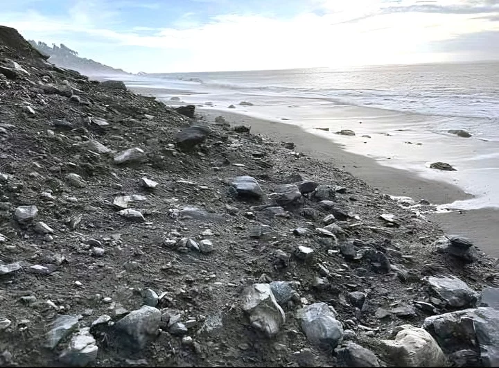
Photo: BLM.
Press release from the Bureau of Land Management:
The Bureau of Land Management is advising Lost Coast Trail hikers in the King Range National Conservation Area to be vigilant near three active landslide areas north of the Black Sands Beach Trailhead in Shelter Cove, and to consider postponing their hike.
Mud, rock and woody debris have been falling onto the trail in areas between Sea Lion Gulch and Randall Creek, and between Shipman Creek and Gitchell Creek. The slides are most active during and after rainstorms, and beach stretches can be impassable. The largest of these slides spans the entire beach about a half-mile north of the Black Sands Beach trailhead in an area popular for day hikes.
“In some areas the slides can block narrow stretches of beach,” said BLM Arcata Field Manager Collin Ewing. “Hikers should consider whether to proceed with their trip. If proceeding, they should assess conditions in slide areas and avoid the temptation to cross the landslides.”
Ewing stressed the importance of contacting the King Range Visitor Center, 707-986-5400, for information on trail conditions, tides, and creek levels before heading out.
The Lost Coast Trail is one of the few coastal hiking trails in the nation. There are no fees or permits required for day hiking, but overnight trips require permits available through www.recreation.gov.
The King Range also offers 80 miles of upland trails. Most are strenuous hikes due to the rugged nature of the King Range. Descriptions and conditions are available in the roads and trails report.

CLICK TO MANAGE