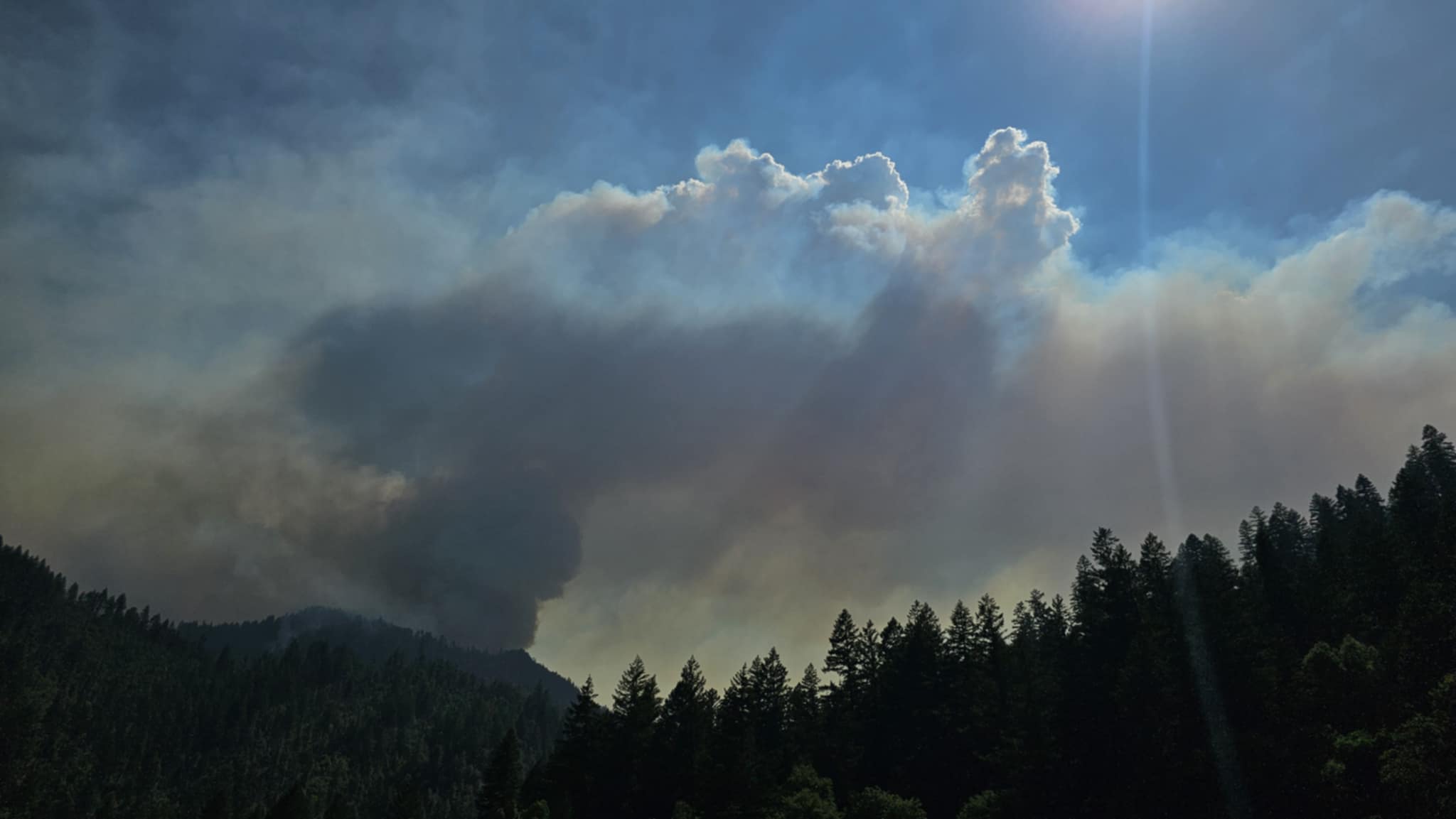
Morning view of the Butler Fire burning at the Humboldt-Siskiyou county line. | Photo: Abel Mattson - Orleans Patrol 25.
Butler Fire — Siskiyou County
The Butler Fire has quadrupled in size in the last 24 hours, growing from 233 acres to 966 acres with no containment. The fire is burning approximately 10 miles northeast of Orleans, near Butler Mountain above Salmon River Road.
There is a mandatory evacuation order in place for zones SIS-1703 and SIS-1708 in Siskiyou County. There are evacuation warnings in place for zones SIS-1704 (Butler Creek, Lewis Creek and Bloomer Mine), SIS-1707, SIS-1710 and SIS-1803-A. Nordheimer and Oak Bottom campgrounds are currently closed for fire suppression activities. Click here for an interactive map of current evacuation orders.
A map of evacuation orders and warnings for the Butler Fire. | Screenshot
The following additional information comes from the Six Rivers National Forest:
Leader’s Intent: The Butler Fire is being managed with a full suppression strategy emphasizing
firefighter and public safety while protecting critical values at risk.
Photo: Kyle Fears - Engine Captain 322
Operational Update: Today the Butler and Nordheimer Structure Groups will continue to focus on
implementing their structure protection plans, with a strong focus by Butler Structure Group on the Butler
Flat Community’s water system infrastructure. Along Salmon River Road, crews will begin to complete
roadside brushing activities as well as continue to prepare the lower section of the Boundary/Orleans Trail
to connect to the work done by crews along the ridgeline.
Crews have been working tirelessly to contain this fire. IR flight data reports that yesterday the fire doubled
in size, making today’s response efforts critical to minimize continued growth. Crews on the ground and
aircraft will begin the day by assessing how the line held overnight and engage quickly where it is safe to
do so. Helicopters will be dropping water on critical locations as conditions allow. Crews will also engage
on the spot fires near the boundary ridgeline in the headwaters of Hammel Creek. Since the fires began on the
ridgetop, the ideal situation is to back the fire down with low intensity from the ridge down towards the
Lewis Creek drainage. The goal is to continue to fully suppress the fire with all means possible, going
direct on the Boundary/Orleans Mountain Trail and utilize air resources to tame critical hotspots.
The Incident Command Post will remain at the Orleans District Office with base camp located at the Oak
Bottom Campground.
One prescribed burn and one cultural burn are planned to occur today. Both of these actions are separate
from the Butler Fire incident management. The Mid Klamath Watershed Council (MKWC) and partners
plan to move forward with the All Hands All Lands Butler Rx plan to burn 6 acres at Butler Flat Meadow
at approximately 4 p.m. This is independent from the Butler Fire, and they provide all their own resources
and plans. If there are questions or concerns, please contact MKWC Fire and Forestry Program at 530-
627-3202. A Cultural burn may also occur directly across the creek from the All Hands All Lands
prescribed fire.
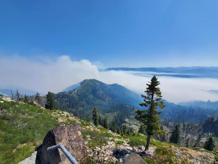
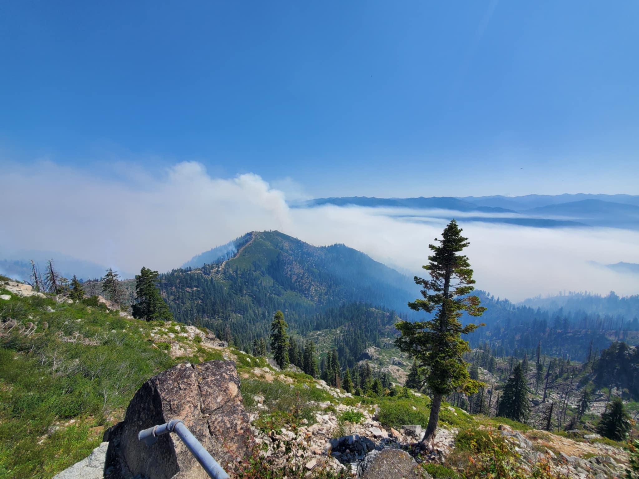
View from Orleans Mountain lookout. | Photo: James McLaughlin - Orleans Crew 20
Community Meeting: There will be a community meeting about the Butler and Red Fires Wednesday,
July 9 at 5 p.m. at the Karuk Department of Natural Resources located at 39051 Highway 96 in Orleans.
For those unable to attend in person, a recording will be available on Facebook after the meeting.
Closures & Evacuations: Siskiyou County Sherriff have evacuations warnings and orders in place for
the Butler Fire. As Evacuation Order has been issued for SIS-1703 (no residents). Warnings apply to
zone SIS-1704 (Butler Creek, Lewis Creek, Bloomer Mine residents and Nordheimer Campground),
SIS-1707, and SIS-1803-A (no residents). There are no planned road closures along Salmon River Road.
However, the public may experience minor delays as crews work on roadside brushing over the next few
days. Nordheimer and Oak Bottom Campgrounds are closed due to wildfire and fire suppression activities.
Weather & Fire Behavior: Local weather will be warm (high 80s) and slightly breezy today (southwest
winds 5-8 mph). Relative humidity remains around 50% to 60%, which may help moderate fire behavior
despite warm, breezy conditions.
Fire Safety & Prevention: The local area is likely to have both wildfire suppression operations and
external prescribed and potentially cultural burning today. These operations are being done with care
and consideration for firefighter and public safety. Area residents and visitors should be aware of their
surroundings, watch for increased traffic in the area and try to avoid being in the fire area. With this
activity and the issuance of evacuation warnings, residents and visitors should review resources at
www.siskiyoucounty.gov/ReadySiskiyou.
Fire Information: For additional fire information and resources, please visit www.linktr.ee/srffirepio.
The Marble Complex and Jacket fires continue to burn further east. As of this writing, the Marble Complex Fire is at 445 acres and five percent containment, and the Jacket Fire is holding at 50 acres with five percent containment.
###
A map of evacuation warnings for the Bridge Fire. | Screenshot.
Bridge Fire — Humboldt County
Fire crews have made significant progress on the Bridge Fire, which ignited near Alderpoint on Sunday evening. The fire, burning on either side of the Eel River, has grown by about 55 acres in the last 24 hours, to 403 acres with 30 percent containment.
There are 300 fire personnel currently assigned to the fire, along with 45 engines, one dozer, nine crews and seven water tenders.
“Firefighters continue to strengthen the perimeter on two vegetation fires burning on opposite sides of the Eel River, in grass, brush, and timber,” according to CalFire.
An evacuation warning is still in effect for residents in zones HUM-E204-A and HUM-E204-B. A previous notification on Watch Duty, a volunteer-contributed fire information resource, indicated that the evacuation warning was lifted on Monday, but that does not appear to be the case. An interactive map of current evacuation notices can be found here.
###
Aerial view of the Red Fire via Six Rivers National Forest.
Red Fire — Del Norte County
The Red Fire, which ignited on Sunday, has burned 28 acres east of Klamath Glen with no containment. There are no evacuations in place at this time. The following additional information comes from the Six Rivers National Forest:
Firefighters are continuing to respond to the Red Fire burning in the Siskiyou Wilderness on the Six Rivers National Forest Orleans Ranger District.
The fire is approximately 28 acres and is located about 1.5 miles north of Nickowitz Peak near Blue Creek. Cause is under investigation and there is no containment. There are no structures or communities threatened.
The Red Fire is burning in heavy fuels and dense vegetation with moderate fire behavior. The fire growth from 3 acres to approximately 28 acres today was driven by steep terrain and winds.
Smokejumpers and rappelers were fighting the fire today after arriving on scene this morning. Aviation resources have been working on suppressing the fire throughout the day.
While firefighters are working on fighting the Red and Butler Fires on the Six Rivers National Forest, as well as supporting incidents throughout Northern California, the public is asked to use caution with anything that can spark a fire.


CLICK TO MANAGE