
Photo: Mile Post 18 Fire Facebook page.
###
UPDATE, 11:15 a.m.: The Humboldt County Office of Emergency Services has lifted evacuation warnings in the following zones:
- HIA-E001-B
- HIA-E003
- HIA-E004
- HIA-E006
- HIA-E014-A
- HIA-E014-C
Evacuation orders and warnings are still in effect on the east side of the Hoopa Valley Reservation. The sheriff’s office urges residents to “remain alert, stay informed, and be prepared to take action if conditions change.”
More information on evacuations can be found at protect.genasys.com.
###
Original post:
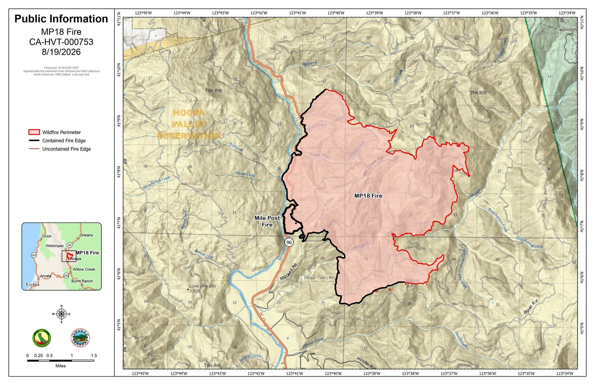
Mile Post 18 Fire update from California Management Team 1:
Acres Burned: 7,292 | 40% Contained| Personnel: 2,009
Operational Update:
Temperatures ranging from 90 to 100 degrees and low humidity spurred active fire behavior, growing the Mile Post 18 Fire to 7,292 acres. Despite this growth, however, firefighters continue to gain the upper hand, outpacing the fire and boosting containment to 40 percent.
CalTrans opened Highway 96 to one-lane, escorted traffic. Firefighters and equipment remain active along the roadway. Motorists should exercise caution and remain alert to ongoing operations and expect delays up to 30 minutes.
Crews closed the gap between the Oil Springs Road and Mill Creek Road containment lines, making steady progress in tightening control along this critical section of the fire’s eastern perimeter. Firefighters are using extreme caution as they navigate the steep, demanding terrain, where footing, visibility, and heat all contribute to challenging working conditions.
Unmanned aerial systems (drones) with infrared technology will help firefighters detect heat signatures near the fire’s perimeter. While isolated heat signatures have been detected around the fire, the highest intensity was found with pockets of vegetation actively burning in the northern corners of the fire’s edge.
Wildfires are no drone zones:
Unauthorized drones can force firefighting aircraft to stop flying, delaying suppression efforts, and allowing fires to grow. If you fly, we can’t. Help protect firefighters, communities, and our nation’s landscapes by keeping personal drones away from wildfires.
Weather:
The stretch of hot weather breaks today, with temperatures returning to seasonal norms in the mid‑70s to mid‑80s accompanied by mild winds. The forecast includes a 15 percent chance of thunderstorms Friday.
Evacuations:
Evacuation orders are in place for HIA-E002-A and HIA-E014-D. Evacuation warnings have been issued for HIA-E001-B, HIA-E002-B, HIA-E003, HIA-E004, HIA-E006, HIA-E014-A, HIA-E014-C, HIA-E014-E, and HIA-E014-F.
Closures may change rapidly, so please consult protect.genasys.com for the latest alerts.
Road Closures:
Closures are in effect for Hostler Ridge Road, Mill Creek Road, and Big Hill Road due to fire activity.
###
CLICK TO MANAGE