Wednesday, March 26, 2025 @ 4:20 p.m. / Pollz
POLL! Do You Think That What Humboldt County Government Calls ‘the Mendocino Coast’ is Actually the Mendocino Coast?
In advance of today’s tsunami drill — we got the text, by the way! success! — Humboldt County’s Department of Health of Human Services issued a notice to the citizenry.
The department’s staff would be participating in the drill, we were told, which was great news. It made everyone who read it very happy.
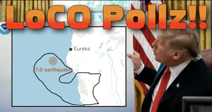
But a paragraph down, the department recalled the 7.0 earthquake that hit our shores last Dec. 5:
In December, the approximately 600 DHHS staff working within Eureka inundation zones successfully walked from their offices to pre-designated assembly points when the tsunami alert was issued following the magnitude 7.0 earthquake off the Mendocino Coast.
Joy turned to bewilderment. The Mendocino Coast? That earthquake didn’t take place off the Mendocino Coast.
The earthquake took place off Cape Mendocino. Which is in Humboldt. We remember it pretty clearly.
Map indicating the Dec. 5 earthquake’s epicenter. The county line is faintly visible in gray well to the south. Feel free to zoom in and pan around if that helps.
But a county representative assured us that we were incorrect. The earthquake took place off the Mendocino Coast.
Did it?
Before you decide, here is some pertinent information. The latitude of the earthquake’s epicenter was 40.374°N. It was a good deal to the north of Shelter Cove, and actually a bit north of Petrolia, which sits at 40.325° N.
Is that the Mendocino Coast?
1,048 votes cast.
PREVIOUS POLL:

CLICK TO MANAGE