Near-live river levels.
Okay, if you haven’t been taking this Rainageddon thing seriously, now might be the time. The Office of Emergency Services in Humboldt has issued the following information which includes the startling tidbit that flooding at Fernbridge could be higher than at any other time besides the ‘55 and ‘64 Floods. (See below for the whole email.)
Also, remember that high tide prediction? Here is a photo of the Moonstone Beach parking lot taken today.
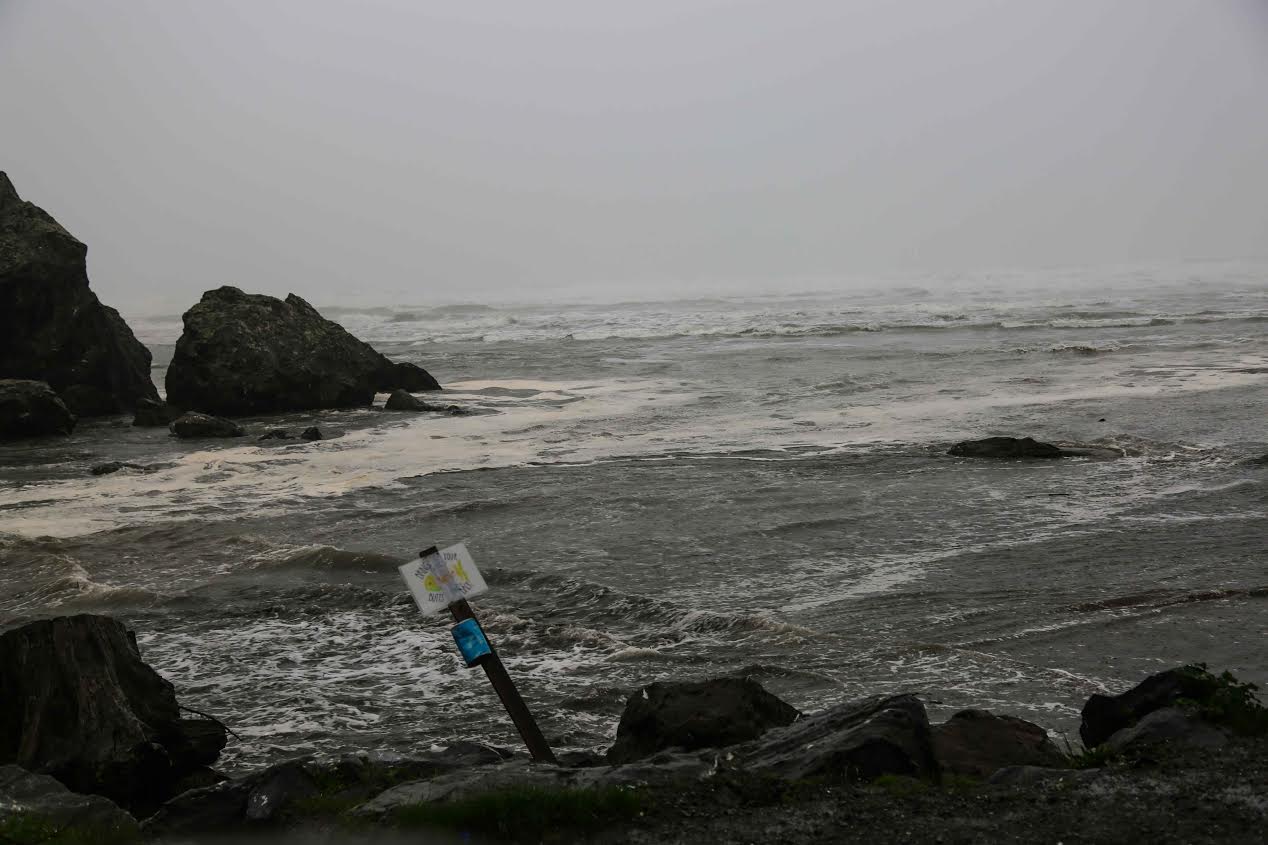
Wouldn’t want to be parking there now!
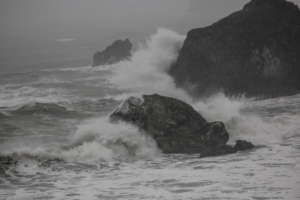
Here’s Camel Rock. Beautiful to look at but wild and dangerous! [Both of the above photos provided by Chris “Mo” Hollis.]
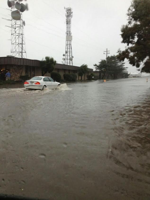
Also, the water is pouring over roads. Here is a photo sent in by a reader of the street in front of Costco looking towards the Suddenlink offices.
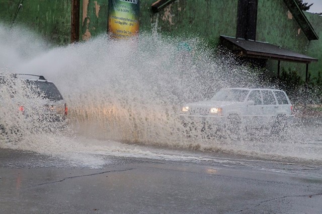
This photo is from the Caltrans’ Facebook page and it shows cars swimming through a small lake on Wabash in Eureka.
Caltrans also provided a list of all places to get sandbags.
With many more inches of rainfall on the way, it wouldn’t be a bad idea to sandbag your property if you haven’t already.
Sandbags can be picked up at the following locations in Humboldt County from various county and local agencies. Fees may apply.
King Salmon: At the turnout.
Ferndale: Fairgrounds.
Eureka: City corporation yard, next to Costco.
Rio Dell: City Hall, behind the recycling bins.
Arcata: Sunny Brae Shopping Center, Westwood Shopping Center, Greenview Market, and the city corporation yard.
McKinleyville: At the Community Services District office ($.50 charge per bag).
The following email from the Humboldt arm of the Office of Emergency Services warns of widespread flooding. Read it to see what might be occurring in your area.
Email from the Humboldt Operational Area of the Office of Emergency Services:
The storm event beginning to impact us now is projected to cause significant main-stem flooding of the Eel and Van Duzen Rivers and widespread localized flooding of various streams and tributaries in our area. The river crest times are projected for mid-day tomorrow on the Van Duzen at Bridgeville (3+ ft. over Flood Stage) and early Friday morning on the Eel at Fernbridge (6+ ft. over Flood Stage). Flood Stage on the Eel will also be exceeded tomorrow at Miranda (3+ ft.) and at Scotia (5+ ft.). You can check-out the projections through this link: http://www.cnrfc.noaa.gov/ Just click on the river location for specific information. The projected flooding level at Fernbridge is significant in that, other than the exceptional flooding events in 1955 and 1964, it could be one of the highest water crests recorded for that location. You can access much more storm-related information at the NWS Eureka WFO web site:http://www.wrh.noaa.gov/eka/
Right now, all OA members should be actively preparing for this storm’s impacts. In addition to the expected flooding, power outages and roadway closures will probably occur. As isolation is a possibility, you should be ready for that eventuality. So, for both your home and work locations, make sure now that you have the both your functional plan in place and the stuff you need to mitigate the impacts of this weather event.
CLICK TO MANAGE