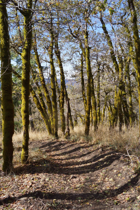
Lacks Creek panorama.
This is the final installment in a series of updates on Humboldt County trails. Featured will be the new Lacks Creek hiking and mountain bike trails, the nature trail at Freshwater Farms Reserve, the effort to develop a safer bike and pedestrian alternative when crossing Little River, and a short trail planned in Manila.
It should be noted that there are many other trail improvements that have not been included in these updates. Redwood National and State Parks recently finished an upgrade to the Elk Prairie Trail that extended an existing accessible loop. The Bureau of Land Management is developing a small picnic area and trail network at the site of the Table Bluff lighthouse. The City of Fortuna is working on the 1.6 mile Strongs Creek Bike and Pedestrian Trail. And there are more still.
Some of the most beautiful additions to our wealth of trails is a network of mountain bike and hiker trails that are being built in the BLM’s Lacks Creek Management Area. Just 30 road miles east of Humboldt Bay, much of this 8,673-acre tract was once industrial timberland but now protects this important tributary of Redwood Creek. With elevations above 3,000 feet, Lacks Creek can be snowbound certain times of the year.
The Management Area encompasses two long ridges with a deep valley in between. Beaver Ridge has been home to a number of walking options but it is only recently that trails have been developed along Pine Ridge. Excellent for mountain bikers and hikers, the trails take advantage of the stunning ocean views to the west, the prairies and mixed oak and conifer woodlands, and the tranquility of this wild country. Some seven miles of a planned ten miles of new trails have been constructed. However, signage is still minimal. Local bike shops have been posting detailed trail maps.
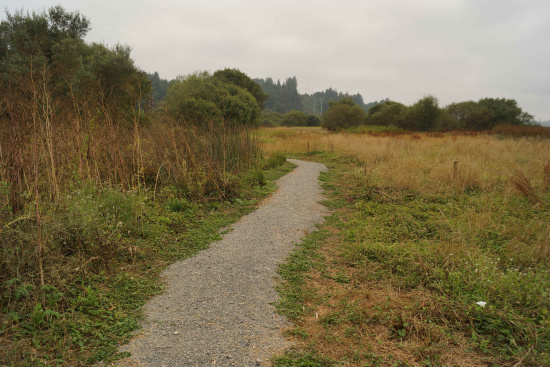
Freshwater Farms Reserve is a 74-acre parcel just southwest (toward Eureka) of the intersection of Freshwater Road and Old Arcata Road owned by the Northcoast Regional Land Trust. The Land Trust has maintained some of the land as working lands while restoring the Wood Creek tidal marsh in an effort to provide salmon habitat. A short .75 mile trail has been developed that begins near the old dairy barn and milking parlor on the property and extends along the bank of Freshwater Creek and Slough to the mouth of Wood Creek. The parking lot is yet to be constructed and open hours established so it too is experiencing a soft opening. Volunteers are being recruited to assist with the monitoring and maintenance of the nature trail. Contact Syn-dee Noel (redwoodpost@suddenlink.net) if you are interested in volunteering.
Gravel path through Freshwater Farms Reserve.
In June 2015, Caltrans and Humboldt County teamed up to apply for Active Transportation Program (ATP) funds that would provide for a short 0.5 mile bikepath within the right-of-way for Highway 255 as it passes through Manila. The multi-user trail would parallel the north side of the highway between Pacific Avenue/Dean Street and Carlson Drive. If funding is awarded (results expected in September), the trail would be constructed in 2018.
And lastly, progress continues, albeit slowly, to create a safe pedestrian and cyclist alternative to crossing Little River on the Highway 101 bridge. Earlier this summer, ownership of a key parcel of land on the north side of the bridge was transferred from Green Diamond to the Trinidad Coastal Land Trust with the intent of facilitating this project. Preliminary design work has been completed by the Redwood Community Action Agency (RCAA) although, at this time, the $4 - 4.5 million necessary for permitting and construction has not been secured. Because it is a barrier impacting the California Coastal Trail, it will remain a funding priority. However, Emily Sinkhorn of RCAA also reinforced the importance of “patience” with this project. Also rising on the California Coastal Trail priority list is the eventual replacement of the Hammond Bridge over the Mad River (Humboldt County applied for ATP funds for this project). Constructed as a railroad bridge in the early 1940s and converted to a bicycle and pedestrian facility in 1983, the steel bridge has not fared well in the salty coastal air and approaches the end of its useful life. If funding is awarded, then construction is projected for 2019-2020.
Changes are occurring frequently, making the trail status reported in these three updates often obsolete by the time it is written. One reality that will not change, however, is the importance of community involvement and support. It is easier to build a trail than to maintain it. Active participation and use is critical to the health and vitality of our trail infrastructure. Your time, your energy, your voice, and, at times, even your money will make an immense difference.
Consider attending the Trails Summit on Saturday, Oct. 10, from 9 am – 11:30 am at the Wharfinger Building. There will be further updates and opportunities to sign up as a volunteer Trail Steward.
In the meantime, embrace the words of Robert Frost who, in his poem “The Wood Pile” says:
Out walking in the frozen swamp one gray day,
I paused and said, “I will turn back from here.
No, I will go farther – and we shall see.”
###
PREVIOUSLY
- WALKING HUMBOLDT: Piece by Piece, the Humboldt Bay Trail is Coming Into Existence
- WALKING HUMBOLDT: New and Planned Ambles Through Our Urban Forestlands
###
DIRECTIONS TO LACKS CREEK
From the intersection of Highways 101 and 299, proceed east on Highway 299 toward Willow Creek. Continue on Highway 299 for 18 miles. Once you are over Lord Ellis Summit, watch for the signed exit (Bair Road) on the left to Redwood Valley near the end of the first long, straight downhill grade (about a mile past the summit). Bair Road drops steeply down into Redwood Valley, crossing Redwood Creek, and intersecting with Stover Road at 3.7 miles. Bair Road turns right and climbs steeply up the east side of Redwood Valley in a series of torturous turns over the next 5.5 miles. This road can be very dusty in the summer, muddy in the spring, and snow-bound in the winter.
Turn left on the access road into the Lacks Creek Management Area (there is a sign at the Bair Road junction). In 0.6 mile three roads split near an informational kiosk. To the left is Lacks Creek Road which leads to Beaver Ridge Trailhead. To the far right is the Pine Ridge Road. Just to the left (west) of the Pine Ridge Road, is the Midslope 4-Wheel Drive Road. Follow the Pine Ridge Road 1.7 miles to an undeveloped trailhead parking area on the left. This is one of several options available along Pine Ridge Road to access the new trails. Although Bair Road and Pine Ridge Road are passable by all road cars, there is certainly peace of mind if driving a higher clearance vehicle. There is also primitive camping in several spots along both Pine and Beaver Ridges.
###
Rees Hughes is working on a walking guide to Humboldt County — Hiking Humboldt (Part 2): Short Day Hikes, Road and Urban Walks on California’s North Coast – that will be published by Backcountry Press as a complement to Ken Burton’s Hiking Humboldt (Part 1): 58 Hiking Adventures on California’s North Coast. He also helps with the coordination of the Volunteer Trail Stewards program, a community-based effort to support the maintenance and care for local trails.


CLICK TO MANAGE