UPDATE, 3:30 p.m.:
Eureka National Weather Service:
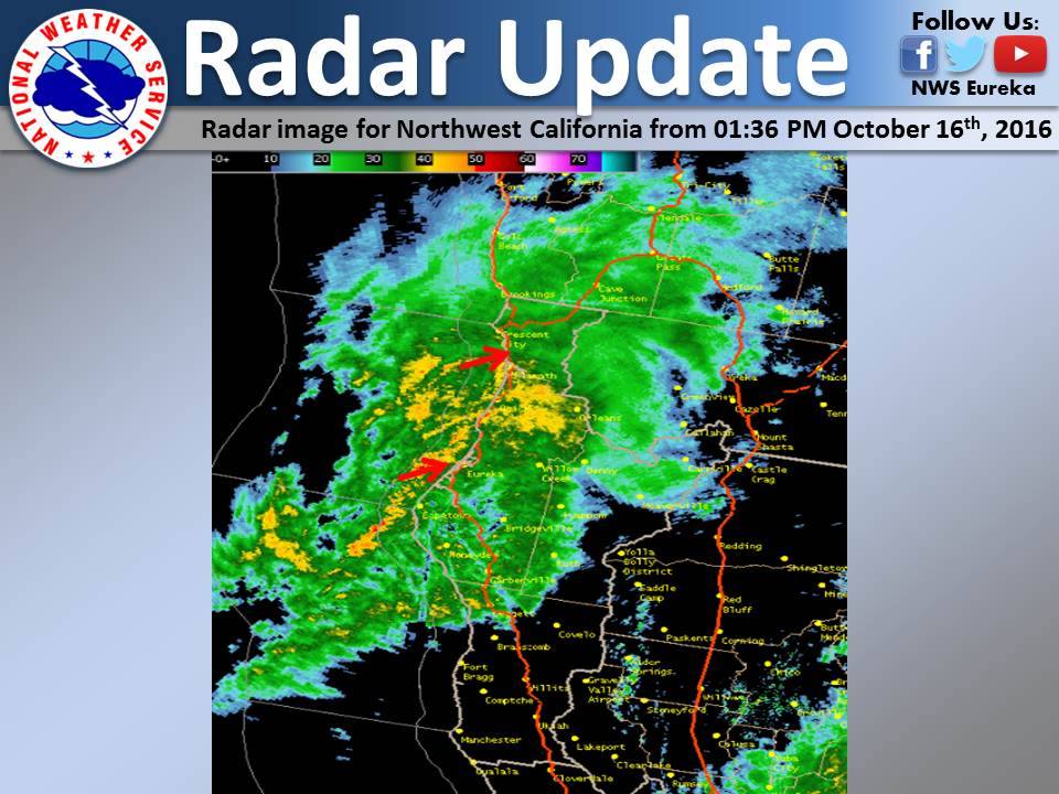
Latest radar image for Northwest California. Scattered to widespread areas of heavy rain can be found across the area. Remember if you are driving to slow down, ease up off the accelerator, do not slam on your brakes, and to avoid over correcting. Additionally, if you come across any flooded roads, remember to turn around and don’t drown!
###
The Eureka National Weather Service:
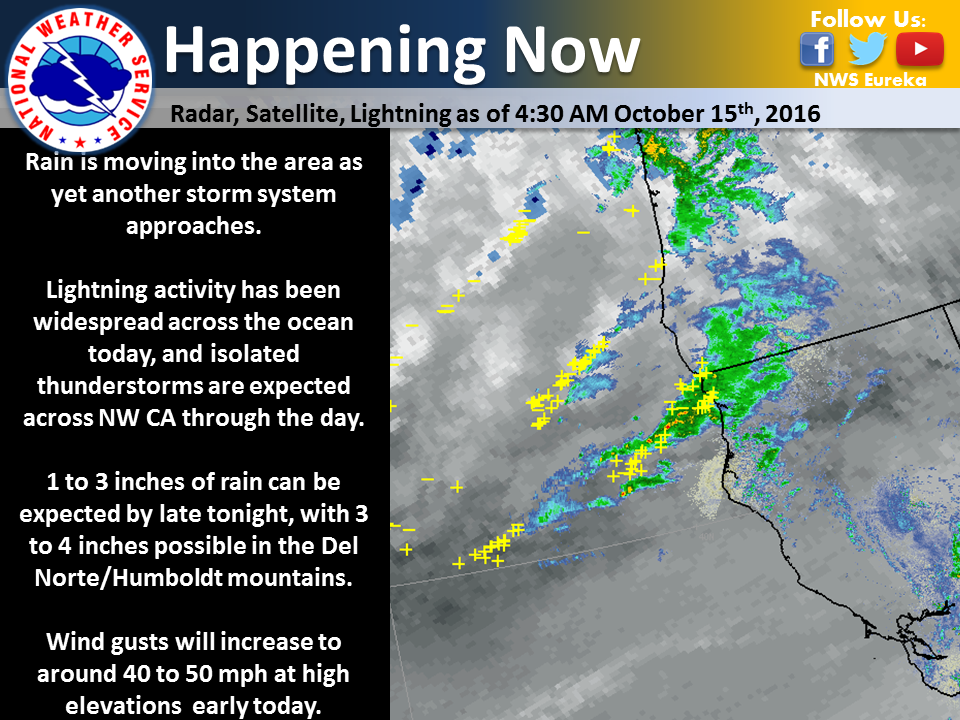
Rain is beginning to move back into the region as the next storm system approaches. Lightning has been widespread across the ocean this morning, and isolated thunderstorms will be possible across much of the area later today. Several strikes have already been detected in Del Norte county! Expect more rain through the day, and gusty winds on coastal ridges.
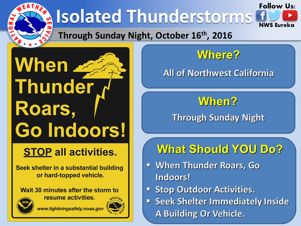
Scattered showers will persist into Monday across Northwest California. Isolated thunderstorms are also expected through Sunday night. The stronger storms will be capable of producing gusty winds, small hail, and heavy rainfall. Remember, lightning can strike without any warning. Stay safe. When thunder roars, go indoors! Stop your outdoor activities and seek shelter immediately inside a building or vehicle.
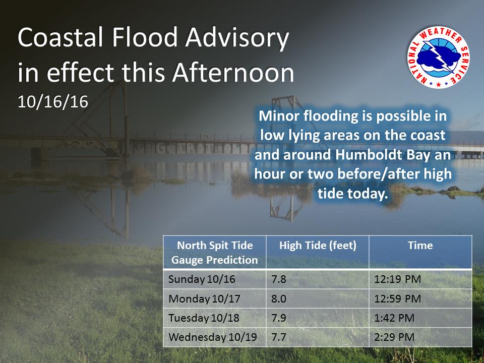
High astronomical tides in conjunction with a surge produced from persistent south winds may result in some minor flooding along low lying areas along the coast and around Humboldt Bay. Areas typically impacted by coastal flooding include but are not limited to: King Salmon, Jackson Ranch Road, and other areas around Humboldt Bay. Low lying areas can experience nuisance flooding an hour or two before and after high tide. Higher than normal tides are predicted into the upcoming week so stay tuned to the forecast.
CLICK TO MANAGE