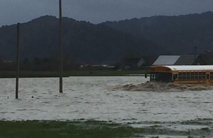
A Ferndale Elementary schoolbus failed to ford Dillon Road yesterday. Story in the Ferndale Enterprise.
The National Weather Service expects a lot of rain to fall on Humboldt County between now and this evening.
A flood advisory issued at 5 a.m. predicts anywhere from three to eight inches of rain to fall, depending on your location, in this round of the storm. Today’s precipitation is expected to push the Eel, the Mad and the Van Duzen back into flood stage.
On the coast, winds will start rising out of the south at around 10 a.m. The weather service forecasts steady wind of about 20 miles per hour, with gusts up to 45 miles per hour. Expect downed trees, power outages, car crashes.
A very high tide peaks between 9 a.m. and 10 a.m. this morning, adding some salt water to the deluge in flood-prone coastal areas. Roads in King Salmon, the Arcata Bottoms and elsewhere will go deeply underwater.
The full text of all current National Weather Service watches and warnings for the North Coast can be found at this link. Hourly rainfall totals from various spots around the region are always available on LoCO Weather, which also informs us that the clouds are expected to part and the sun to emerge round about this Thursday.
Stay dry! Stay safe!

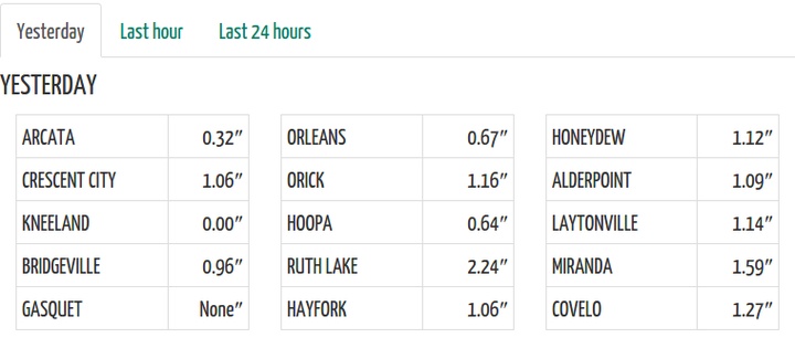
Regional rainfall totals for yesterday from LoCO Earth. Is the Kneeland gauge broken?
CLICK TO MANAGE