File photo by Neva Swenson.
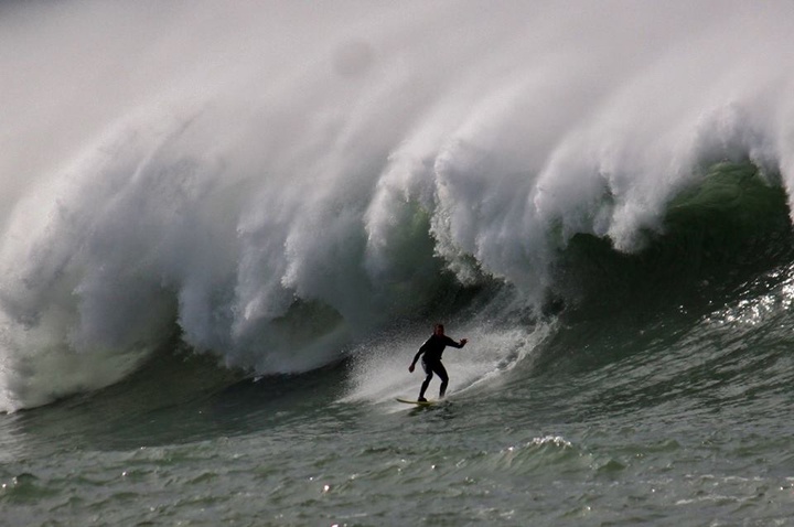
Admire the ocean’s magnificence this week Humboldt, but admire from a distance! According to the National Weather Service Marine Forecast, waves are expected to reach up to 27 ft by Friday night, and continue to be in the 20ft range through Monday.
While watching or even hearing these big booming waves, you might wonder, how are waves formed and where are they coming from? Here’s a little “waves 101” question and answer with NOAA Meteorologist Brian Garcia, and Meteorologist in Charge at NOAA’s National Weather Service, Eureka office, Troy Nicolini, to bolster your wave IQ.
###
Q: How is a wave formed?
GARCIA: Waves we experience in the ocean are most commonly created by wind. As wind travels across the water surface,the continual disturbance creates a wave crest. Any sort of displacement such as underwater landslides, earthquakes, or volcanic eruptions will also generate waves.
Q: What are the primary properties of a wave?
GARCIA: Two main properties of waves are height and period. Height or amplitude is measured by the vertical distance from the wave trough (bottom) to crest (top). Period measure by the horizontal distance from one wave crest to the next. Both are a function of wind and also how a wave travels due to the wind. As waves move away from the source region, where all the wind is, the period starts to elongate, but the waves still have all their energy.
Q: Why are waves in Humboldt so huge?
GARCIA: The North Coast is much closer to the storm source region of the Gulf of Alaska and the Pacific Northwest than Southern California. In Humboldt, we end up with more “storm surf,” or short period, chaotic, junky surf. Since waves separate overtime, Southern California receives longer period swell, after short period junk has been filtered out. Our coastal orientation in Humboldt is North/South which means our arms are wide open to receive all swell directions.
Q: Do swells vary by season?
GARCIA: To understand seasonal variations in waves, one first needs to understand basics of weather. Something called the “Jet Stream” exists to bring earth into equilibrium temperature. It moves cold air south towards the equator, and warm air north towards the poles. In the winter time, it’s much colder in the north, so the jet stream is intensified which generates storms. In the summertime it’s reversed.
Q: Why are the waves exceptionally big this week?
NICOLINI: Waves get biggest when the wind is strong and it blows over a large area for a long time. We have a storm that is south of the Aleutian Islands of Alaska, about 2000 miles from NW California, that is producing high winds over a large area. This storm also happens to be moving towards NW California along the same path that is traveled by the waves that it generates. This allows the storm to effectively continue to push against the growing waves for much longer, and this results in exceptionally large waves.
Q: How are swells predicted?
NICOLINI: We run atmospheric models all over the entire world that predict the wind that will result from any storm, such as the one we are watching now. We then use that wind information to drive a wave model to predict how big the waves will be and how they will travel after they leave the storm that generated them. We then apply local knowledge and experience to create the final swell forecast. For example, we know from experience that the model may be predicting that these waves will travel along the same path that the storm is taking, but if the storm ends up deviating slightly from that path, which they often do, then wave will come in small than the model is predicting.
###
Want to learn more? Listen to the full KHUM “Coastal Currents” interview with Brian Garcia below:
Coastal Currents with Brian Garcia, Jan. 11.
###
Delia Bense-Kang serves as the Northcoast Environmental Center’s Marine Protected Area Outreach Coordinator and chairs Surfrider Foundation’s Humboldt Chapter.
CLICK TO MANAGE