So much snow this winter! More coming! Careful on the highways!
Bulletin from the National Weather Service:
…WINTER STORM WATCH NOW IN EFFECT FROM SATURDAY AFTERNOON THROUGH MONDAY MORNING ABOVE 2000 FEET… SNOW ACCUMULATIONS…5 to 10 inches possible above 2000 feet.
LOCATIONS IMPACTED…Gasquet……Patrolia…Honeydew… Ettersberg…Willow Creek…Orleans…Garberville…Bridgeville… Weaverville…Burnt Ranch…Trinity Center…Hayfork…Ruth… Leggett…Laytonville…Willits… Covelo.
HIGHWAYS IMPACTED…Hwy 199…Hwy 101…Hwy 299…HWY 96…HWY 36…Hwy 3…Hwy 162.
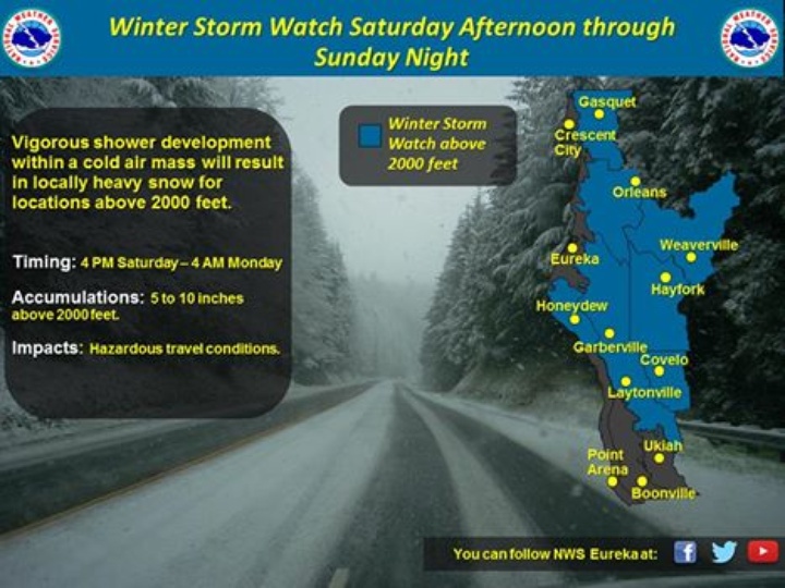
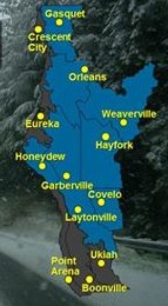
National Weather Service map showing where forecasters expect the snow to stick.
CLICK TO MANAGE