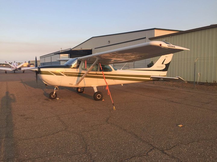
The little Cessna. Says PG&E spokesperson Deanna Contreras:”[This] is the main plane that has been and will continue to fly from Eureka but there are 6 planes flying daily across our service territory, so there may be a little overlap in flights over SoHum and Eastern County with tail numbers #N133PJ and 5731C. They fly above 3,000 feet, so I wouldn’t consider them low-flying.”
From Pacific Gas and Electric:
Pacific Gas and Electric Company (PG&E) is conducting its daily aerial fire detection patrols across hundreds of miles of its service area. This year, PG&E has added two new routes to the patrols which assist the U.S. Forest Service, CAL FIRE and local fire agencies with early fire detection and response. Early detection of smoke or fire allows fire agencies to quickly respond to accurate locations.
“Wildfires in California have grown in number, size and intensity in recent years. We all must adapt to this new normal and do even more to prevent and prepare for fires. That’s why we’ve increased the area and number of customers that our daily aerial patrols will cover to help keep communities safe,” said Pat Hogan, PG&E senior vice president of Electric Operations.
The patrols began on June 1 and will run until October 31, unless conditions allow for an earlier end or require an extension. Seven planes will fly daily routes from late afternoon until dusk.
Using fixed-wing aircraft, fire spotters will operate along these routes:
- Redding (out of Red Bluff) to Humboldt to Lake County (see picture)
- Redding to Auburn in the Northern Sierra
- Auburn to Sonora in the Central Sierra
- Sonora to Porterville in the Southern Sierra
- Vacaville to Solvang near the coast
- Redding to Hoopa to MacArthur (Siskiyou County and northeastern Shasta County)
- Mendocino County
The patrols are coordinated through PG&E’s aerial operations. The Mendocino County route is co-funded by PG&E and run by the Mendocino County Aerial Fire Patrol Co-Operative. The Co-Op patrols will run through October 15.
In 2017, PG&E patrols identified approximately 250 fires, 20 of which were first reports. The patrols totaled more than 3,500 flight hours. PG&E began operating the aerial patrols in 2014, after the governor issued a drought emergency declaration. PG&E has continued the patrols because of the scale of tree mortality in California.
CLICK TO MANAGE