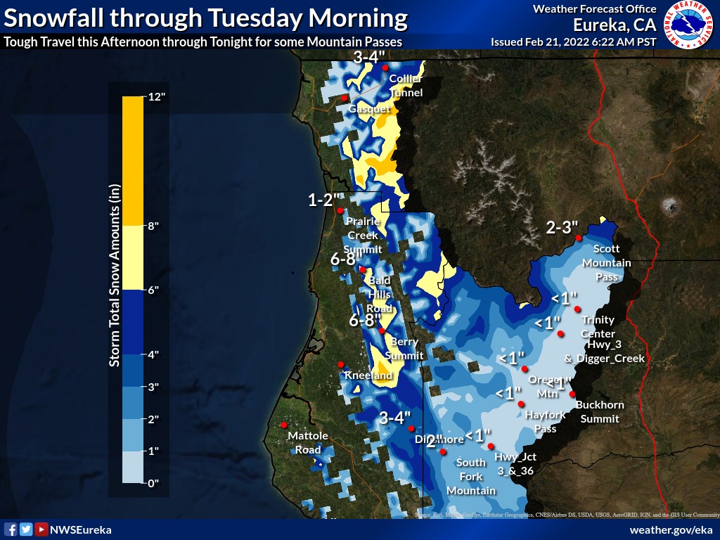
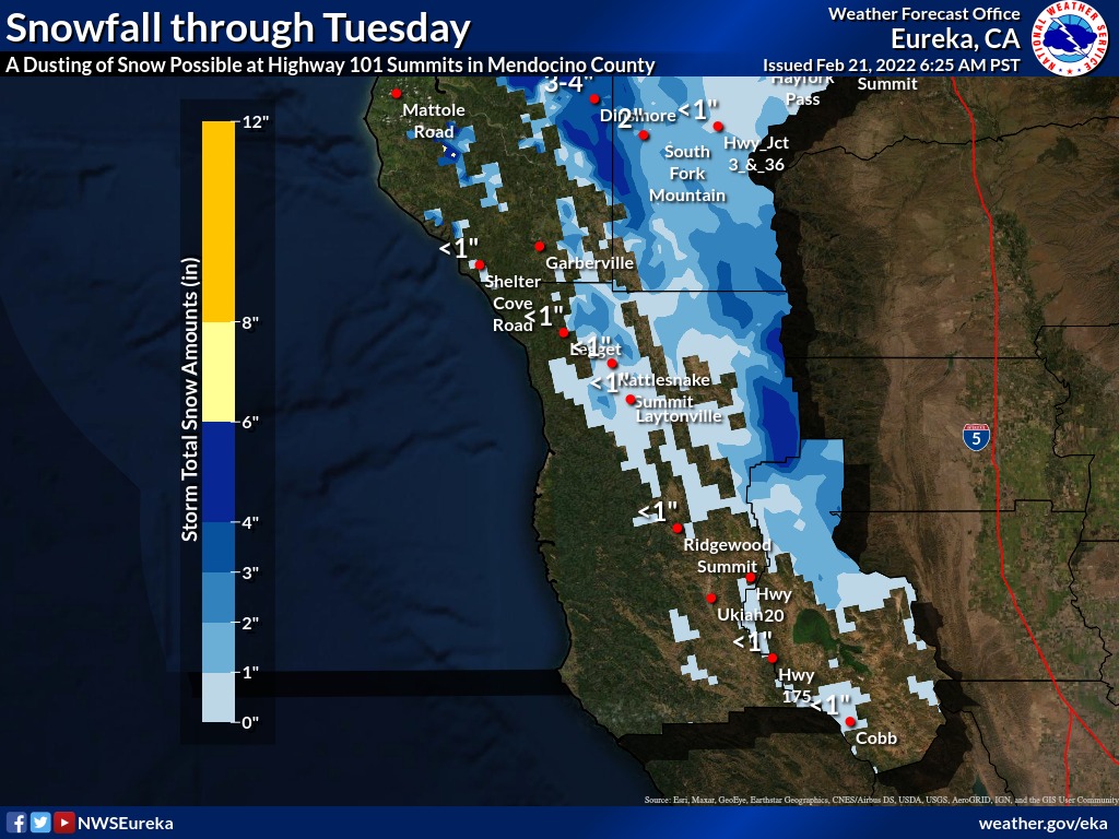
Projected snowfall across the North Coast region. | National Weather Service.
###
Brr, it’s chilly out!
Brisk winds overnight have given way to overcast skies and light precipitation on Monday, and according to the National Weather Service’s Eureka office, snow is expected to accumulate at higher elevations this afternoon through Tuesday morning.
It’s almost hard to believe that Eureka broke a daily high-temperature record just 11 days ago, hitting 71 degrees, but climate scientists say such “temperature roller coasters” are a hallmark of human-caused climate change.
So are droughts, and the vast majority of both Humboldt County and the whole state are experiencing moderate to severe drought conditions. So in that regard, today’s showers and snowfall are quite welcome.
But be careful if you’re doing any traveling. The National Weather Service warned folks Monday morning, “The trickiest travel is expected around Berry Summit on Highway 299 and the Collier Tunnel on Highway 199, especially late today and tonight.”
Snow levels are expected to fall in the 2,000-2,500-foot range this afternoon, dropping down to 1,500 feet or even lower overnight. More than six inches may fall at Berry Summit, according to the report.
“Some slushy accumulations may even occur late tonight at lower spots like Highway 101 Summits above 1500 feet, before shower activity diminishes Tuesday morning,” the NWS says. “Consider delaying your travel plans in these areas, but if you do go, remember to carry chains.”
Conditions should be “clear and crisp” by mid-week, with frigid temps in the mornings, but things ought to start warming up a bit by the weekend.
CLICK TO MANAGE