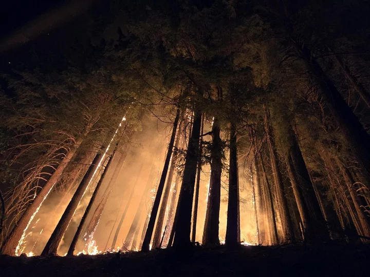
Hill Fire night operations from July 18. Photo: Matthew Brown, U.S. Forest Service - Hill Fire Incident Command.
###
Note: This post was updated at 1:30 p.m. to include an updated list of evacuation orders and warnings.
###
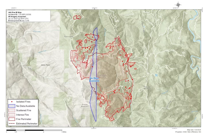
As of Saturday morning, the Hill Fire burning 11 miles south of Willow Creek is now listed at 5,248 acres with two percent containment.
Fire activity has moderated in recent days, with “short runs aligned with slope and majority of fire flanking and backing downslope into drainages,” according to the latest report from Incident Command. “Moderated conditions allowed for continued tactical firing operations in Division A to have success.” There are 1,512 personnel, 49 crews, 99 engines,18 pieces of heavy equipment, and 4 helicopters assigned to the fire.
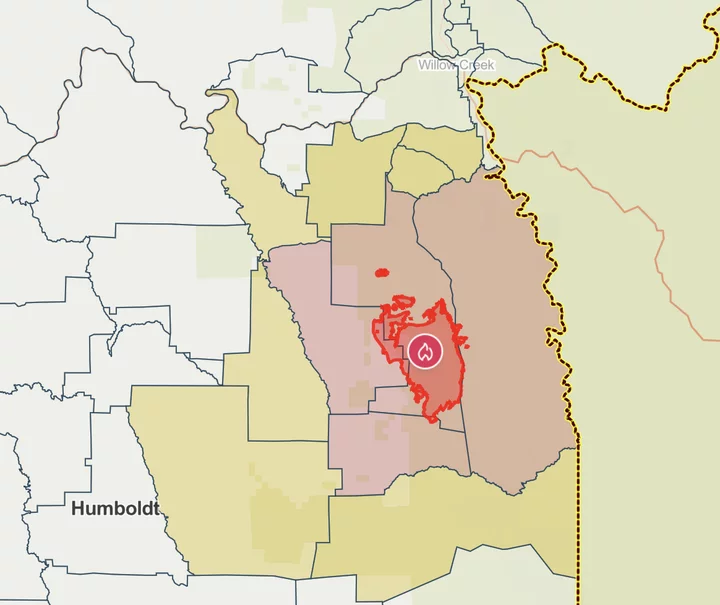
The Humboldt County Sheriff’s Office (HCSO) issued a new Evacuation Order for some communities surrounding the Hill Fire, as seen in the map below. Residents in zones HUM-E077-A, HUM-E077-B, HUM-E077-C and HUM-E076-A are urged to evacuate immediately.
“Residents who are already evacuated from these zones are not permitted to return to their residences,” according to HCSO. “Any residents remaining in these zones should evacuate immediately.”
An Evacuation Warning has been issued for the following areas:
- HUM-E076-B
- HUM-E077-B
- HUM-E100-A
- HUM-E114-D
- HUM-E063-A
- HUM-E063-B
- HUM-E052-A
- HUM-E062
Screenshot of updated evacuation map.
Residents should be ready to evacuate at a moment’s notice if conditions deteriorate. Find your evacuation zone at this link.
The Humboldt County Sheriff’s Office of Emergency Services (OES) has established an evacuation center at Trinity Valley Elementary School (730 State Route 96) in Willow Creek. Evacuees can access water and additional information about the Hill Fire. The evacuation center will be open until 6 p.m. today. Residents can also call 530-414-9056 for more information.
The following additional information comes from the Hill Fire Incident Command Team:
CURRENT SITUATION:
Last night activity continued in a southwest area of the fire and crews are currently working on holding lines in the area.
Yesterday afternoon, the fire showed an increase in activity along its south and southeast boundaries in the Mosquito Creek drainage driven by northwesterly winds. Air resources were able to utilize water to help slow the fire growth. Crews continue to construct and improve holding and control lines in this area; however, ground based heavy equipment use was limited due to ongoing fire activity.
Today on the south side of the fire, crews will be building a dozer line towards Mosquito Creek and go direct where possible. On the east side crews will continue doing road improvement on 6N06 road to Ammon Ridge to utilize as a holding line.
The fire continues to be influenced by terrain and increasing winds in the southern area of the fire. On the west the fire will continue to creep and in the interior islands and heavy accumulation of fuels will retain heat and smolder.
Click to enlarge.
WEATHER:
Today the area will come under the influence of an approaching upper-level disturbance. This will help slightly increase relative humidity. Winds will remain mostly modest out of the northwest with the strongest winds at low elevations in the late evening. Slightly increased mixing heights will aid in some smoke mixing, though high stability will inhibit any significant smoke transport out of sheltered areas. The disturbance moving overhead tonight will bring simultaneous much strong marine influence, especially to low elevations, but also a small (10%) chance of dry thunderstorms.
EVACUATIONS:
Evacuation order and warnings remain in effect. For current updates on evacuations, visit https://www.facebook.com/HumboldtSheriff and https://humboldtgov.org/2383/Current-Emergencies.
Conditions are subject to change at any time, visit https://protect.genasys.com/search for a full zone description. Sign up for Humboldt Alert emergency notifications at https://humboldtgov.org/2014/Emergency-Notifications
CLOSURES:
Forest Closure Order currently in effect for the area impacted by the Hill Fire. It is temporarily prohibited to be on any national forest system land, trail, or road within the closure area. To view the closure order and map of closure area visit the following link www.fs.usda.gov/Internet/FSE_DOCUMENTS/fseprd1191963.pdf.
Road closures are currently in place on Friday Ridge Rd. at Forest Service Route 6N06, Friday Ridge Rd. at Forest Route 5N01 and Friday Fridge Rd. at Forest Route 5N04. For updated road closure information, visit protect.genasys.com or humboldtsheriff.org/emergency.
FIRE RESTRICTIONS:
Forest fire restrictions also went into effect on July 12th . Campfires and stove fires are restricted to those developed areas listed in the forest order located at https://www.fs.usda.gov/Internet/FSE_DOCUMENTS/fseprd1188610.pdf.
Smoking, welding, and operating an internal combustion engine also have restrictions in place.
###
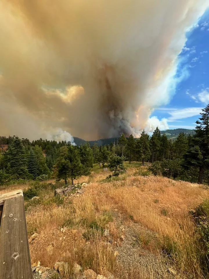
Photo taken from Route 1 on July 16. Photo Credit: Matt Manago, U.S. Forest Service - Hill Fire Operations Section Chief.


CLICK TO MANAGE