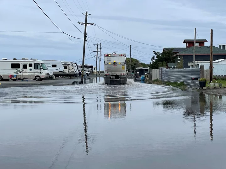
Last year’s King Tides in King Salmon. Photo via the California King Tide Project.
Every we time we post something about King Tides, some wiseacre pops in to say: “Uh, you mean high tides? Duh, they happen twice a day! Fake news! LoCO is dumb! I am smarter!”
This is why you are the dummy. While it is true that there is no strict scientific definition of a “king tide,” we’re generally talking about the highest of high tides, here. They happen a few times a year, when the sun and moon and Earth line up just right. Educate yourself.
King tides show us what sea level rise is going to mean for our coastline. If you are interested in taking photos of super-high tides around the county in November and December, the California Coastal Commission would be delighted if you would share your work with them in the name of citizen science.
Press release from the California Coastal Commission:
King Tides will inundate California beaches, roads and other coastal areas during the next two months, providing a glimpse into future erosion and flooding as the planet continues to warm and sea level rise accelerates.
The California Coastal Commission is asking the public to safely photograph the impact of waves and rising groundwater on shorelines and nearby communities during this winter’s King Tides — November 15 to 17 and December 13 to 15. Those interested can submit their photos to the California King Tides Project at www.coastal.ca.gov/kingtides, where people can also view photos from previous years.
Photographing these extreme high tides brings attention to the impact of climate change and helps prepare for the future. The images are used by climate researchers, as well as local and state officials, to validate sea level rise models and assess local vulnerabilities to erosion and flooding. The project is one of many similar community science efforts across the world to create a visual record of our changing coastlines.
King Tides are caused when the sun, moon and Earth are aligned, creating a stronger than normal gravitational pull. When these astronomical conditions are coupled with storm surges, the potential for property and other types of damage dramatically increases.
King tides are typically at least one to two feet above the average high tide. For comparison, ocean levels in California are projected to rise as much as 1.2 feet by 2050 and up to 6.6 feet by the end of the century.
Sea level rise is caused by climate change from burning fossil fuels such as oil, gas and coal, which releases greenhouse gases into the atmosphere. This pollution acts like a blanket, trapping heat that would otherwise escape, raising the global temperature of the land, air and ocean. Sea levels are rising because land-based glaciers and ice sheets are melting into the ocean and water expands when it warms.
The state of California’s sea level rise planning efforts include updating the California Coastal Commission’s Sea Level Rise Policy Guidance, which will be presented for adoption at the public agency’s November hearing in San Francisco. The guidance includes updates for new sea level rise science, environmental justice principles related to sea level rise and recent state law that requires local governments to incorporate sea level rise in coastal planning documents.
Details available on the website include local times for king tides, community events and resources for educators interested in teaching about climate change. The king tides photo upload form includes instructions in both English and Spanish.

CLICK TO MANAGE