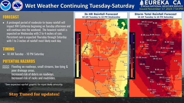
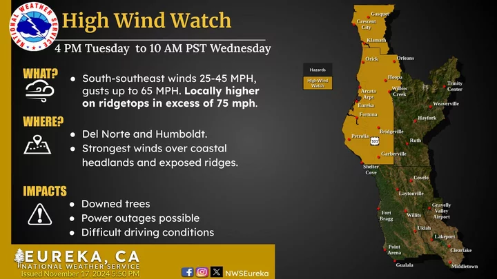
Graphics: National Weather Service.
Take note: Over the weekend, our “Weather Alerts” page — populated by the good people at the local National Weather Service office on Woodley Island — started to take note of a potentially wicked system coming our way this week. A lot of rain, wind and flooding looks to be our lot this week.
“Widespread power outages are expected,” the NWS says in its High Wind Warning, which warns of gusts of up to 60 miles per hour along the coast starting tomorrow night.
That’s the tip of the spear. All told, the storm is expected to continue until Saturday, and it’s going to bring a lot of rain.
“Steady moderate rain is expected during this period, with most areas seeing 2 to 4 inches of rain every 24 hrs during this period, with higher amounts expected in the mountains on SW facing slopes,” say the forecasters in their Flood Watch, which also warns travelers to brace for the usual landslides to block roads and highways.
The current version of the NWS’s Hydrologic Outlook paints the most complete picture of the storm to come. The office thinks that the worst rain will hit Wednesday, with steady downfall following for days after. It notes that the soils in Humboldt and Del Norte are already pretty much saturated, which means that the land is going to largely reject the water and send it straight downhill. That means localized flooding in flood-prone places, along with the havoc it the storm could play with our transportation system. The Eel River currently stands a 20 percent risk of busting its banks Thursday night, forecasters think.
So maybe it’s time to charge your batteries, reconsider your travel plans and such. It might be quite a week.


CLICK TO MANAGE