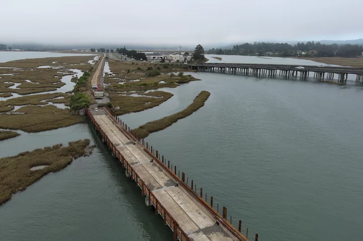
Humboldt Bay Trail South will cross a newly reinforced Eureka Slough railroad bridge just east of Target. | All photos via County of Humboldt.
###
Sorry, cyclists, joggers and other human-powered trail fans, but we’ll have to wait a few more months before we can traverse the Humboldt Bay Trail all the way from Eureka to Arcata (or vice-versa).
Even with this nice, dry fall weather we’ve been enjoying, construction of the trail’s southern portion — between the Bracut Industrial Park and the parking lot behind Target — won’t be finished as scheduled before Halloween, which is the hard cutoff date for ground-disturbing work in the county’s environmental permits.
Reached by phone earlier today, Humboldt County’s deputy director of environmental sciences and preeminent trail guy Hank Seemann said the contractor, Arcata-based McCullough Construction, has been working steadily since spring, but a number of contributing factors led to the delay.
“It’s a sensitive area next to the bay,” Seemann said. “It’s a very constrained corridor and construction area, so access and logistics are tricky. And then there’s just a lot of substantial work, including three new bridges.”
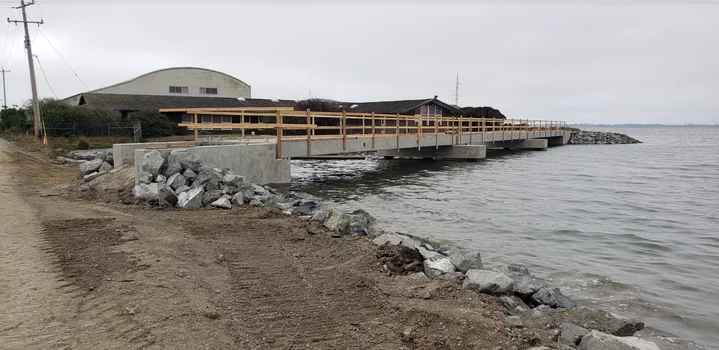
A new concrete bridge along the eastern edge of the Brainard Mill site.
###
Those bridges — including a brand new concrete bridge by the Brainard Mill site (above) — required cranes and pile-driving equipment to install piles deep in the ground under the bay. Plus, Seemann said, two of the three bridges are within the runway safety area for the Murray Field Airport, so construction work required coordination with the Federal Aviation Administration (FAA).
All steps in the project needed to be taken in a specific order, Seemann said, “like you need to put the piles in before you can bring the bridge decks in, and the bridge decks were manufactured out of the area and then trucked in and placed for the crane. And so all the sequencing had to be really choreographed, and any little bump in the schedule has a trickle effect.”
The new target completion date is May of next year, by which time the country will have a whole new president and some of us may be desperate for deep lung-fulls of fresh, clean air and unimpeded views at the distant horizon — but I digress. The good news is that this trail is shaping up to be one primo commuting route/leisurely weekend joy ride.
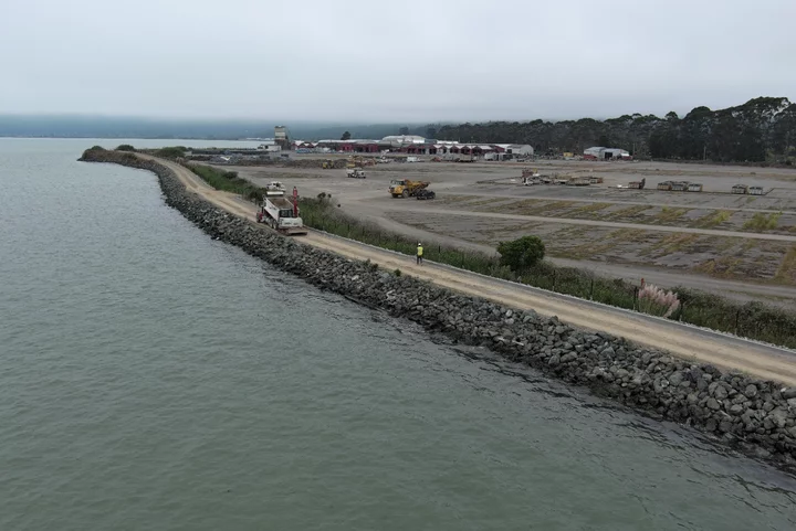
At the Brainard Mill site, the route will depart from the edge of Hwy. 101 and skirt around the back side of the yard, tracing the re-enforced edge of Arcata Bay. See below:
A construction crew works on the Bay Trail South as it skirts the perimeter of the Brainard Mill site.
###
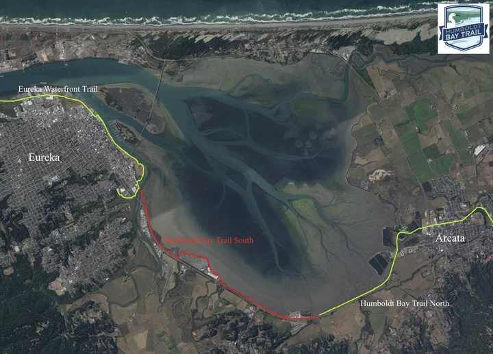
Look closely at the map below and you can see the uncompleted trail section (in red) popping out and away from the highway to run along the perimeter of the mill yard:
The piles have now been placed and the bridge decks are installed, but work continues on widening and raising the railroad prism on multiple stretches along the bay.
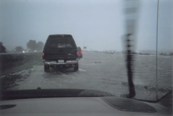
This work is part of the county’s sea-level-rise adaptation plan. If you were around these parts in 2005 you likely remember the New Year’s storm surge/King Tide double whammy that caused the bay water to rise some ten and a half feet, sending it spilling across Hwy. 101 on the Arcata-Eureka safety corridor.
Yikes! Humboldt Bay overflows its banks in the New Year’s storm of 2005.
###
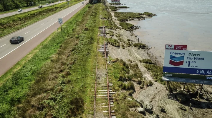
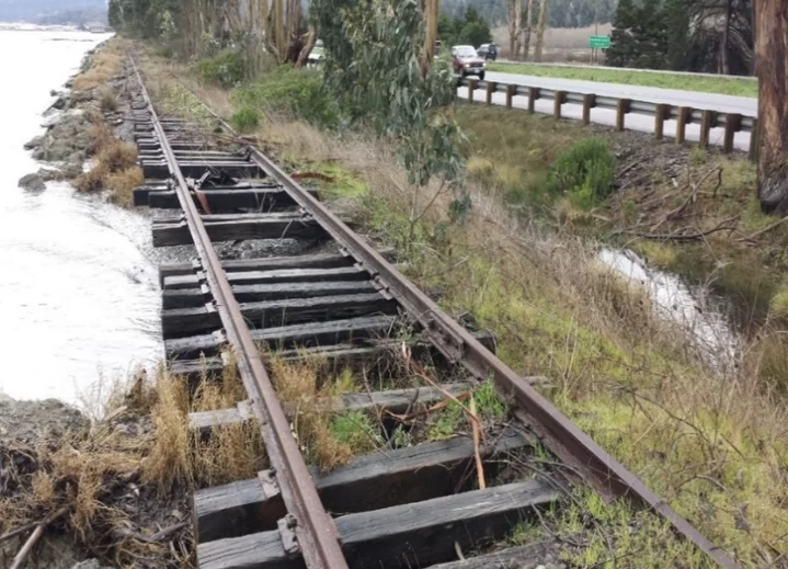
Similar (if slightly less extreme) surges caused a lot of erosion along the edge of the bay, eating away the soil along and underneath the railroad:
The above photos show how conditions looked pre-construction.
###
The newly raised and widened prism will prevent a surge the size of 2005’s from overtopping the bay’s perimeter, which, in turn, will protect Hwy. 101 and the adjacent land. Such protection will become increasingly necessary given the fact that the land surrounding Humboldt Bay is experiencing the most rapid sea-level rise on the West Coast.
Good deal, this new level of protection, though Seemann said this is where the construction crew hit another snag. The bay mud soils adjacent to the railroad were softer than expected, so engineers had to adjust the design to create a more stable foundation.
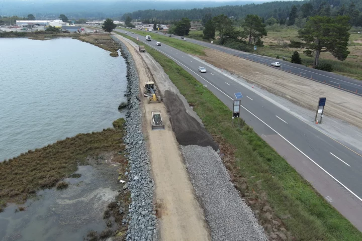
That redesign had the construction contractors do excavation work along a one-mile stretch and place “modest-size” rocks with a plastic fabric over it, then base rock atop that followed by a layer of soil, all of which was then compacted.
A skid and a grader work on a section of trail along Hwy. 101.
###
“That design adjustment is going to make for a much more durable and stable trail foundation,” Seemann said, adding that the project has stayed on budget. “It’s just we came up a little short on the calendar.”
Meanwhile, the county is conducting a study to analyze the feasibility of restoring salt marsh along this stretch of bay shore as another line of defense against rising seas. “We’ll know more about the feasibility of that probably in about a year and a half,” Seemann said.
A word of caution in case any of you are tempted to head out on the trail before it’s finished: Don’t. Seemann warned that the Bay Trail South remains an active construction zone. The bridges still need railings and grading needs to be completed to bring the trail surface up to the right elevation. “So they’re not safe for the public to use,” he said.
There may yet be time in the coming weeks for workers to pave some sections of the new trail, making them usable before the end of the year, but that will be based on suitable weather conditions, the supply chain and other variables.
“We’re going to do as much as we can … and then be ready to resume as soon as we can in the spring,” Seemann said.
The total cost of this section of the Bay Trail, including 4.25 miles of new bike path, removal of numerous eucalyptus trees, regional wetland mitigation and the three new bridges, comes to around $20 million.
Funding for construction is provided by the California Transportation Commission’s Active Transportation Program, California State Coastal Conservancy and Caltrans District 1.
CLICK TO MANAGE