By City of Eureka.
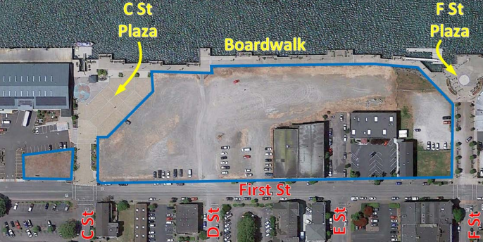
The City of Eureka is getting ready to prime the pump for what it hopes will be an ambitious new wave of development on some of the city’s choicest, most-underutilized real estate. The parcels in question occupy a four-and-three-quarter-acre stretch between Old Town and the boardwalk, offering views of Humboldt Bay and easy access to Eureka’s best shopping and tourism district. Sixty-two percent of this land is owned by the city, and despite its prime location and zoning (waterfront commercial), nearly 80 percent of it is undeveloped.
Last week, the city issued a request for qualifications (RFQ) for a project it’s calling the “C to F Street Waterfront Conceptual Master Plan Design Charrette.” The goal is to hire a consultant who will facilitate the creation of a “development vision” for these parcels — a master plan to guide development(s) in this languishing area.
If you walk around the perimeter of these parcels, down the boardwalk and through the two plazas that bookend it, you can see a lot of telling details that speak to both the city’s assets and its lingering problems. Start at the entrance to the C Street Market Square, a handsome, faux-cobblestone expanse (more triangle-shaped, really) developed as part of an $11.5 million improvement project back in 2010. At Waterfront Drive you’re greeted by a tall, color-coded map directory — the kind with a red arrow informing you, “You are here.”
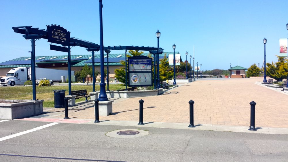
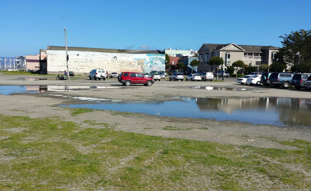
On this point, the map is correct. Elsewhere you’ll have to use your imagination. The middle section, for example, shows a large parking lot, neatly divided into parallel parking spaces. But if you actually glance right you’ll see that it’s just a big gravel patch — dusty, a bit weedy and bisected at D Street by a cement walkway. A good rain leaves mud puddles the size of small ponds, and the cars that park here (for free) leave muddy tire ruts. The map also includes outlines for six buildings that don’t exist yet. Instead of being brightly colored in, like Healthsport and the Fishermen’s Terminal buildings, these spaces are labeled with a single word in parentheses: “FUTURE.”
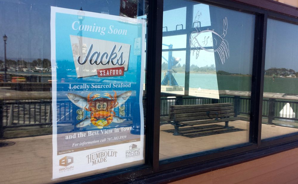 Walk north on the terra-cotta-colored cement until you reach C Street Market Plaza, with its inlaid circular map of Earth from above, the continents in burnished bronze and the oceans in oxidized green. From here you can peer into the Fishermen’s Terminal building, where Coast Seafoods and Wild Planet process their catch. The planned retail seafood counter has yet to materialize, though there’s a poster in the window announcing that Jack’s Seafood cafe is coming soon to the building’s corner space, which offers a bay view over the fishermen’s dock.
There, in the bay, you may spot a fishing boat, trawler or barge motoring past, and as you stroll east along the boardwalk — constructed of cement rather than wooden boards — you’re likely to see one or more of Eureka’s resident homeless population, who often sleep on or under the benches here. You might also encounter locals on their lunch break or families with ice cream cones from the nearby parlor.
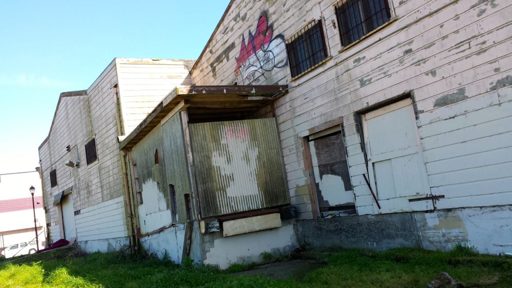 From here the proposed project area is off to the right. Across the gravel patch, two large, vacant building stand, or slump, really, looking haggard and a bit embarrassed. Their siding is a hodgepodge of peeling paint, graffiti and corrugated plastic. On the west wall of the conjoined buildings, which once housed the North Coast Co-op, there’s a faded, never-finished mural adorning sideboards that have warped with moisture and neglect.
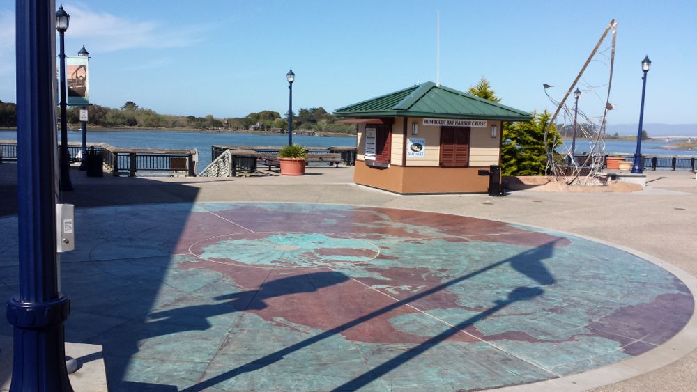
The boardwalk itself, a quarter-mile promenade lined with old fashioned light posts and a wide wooden railing, was the result of an earlier improvement project, completed 13 years ago at a cost of $7.9 million (including a $2 million gift from Eureka businessman Rob Arkley and his wife, Cherie). That project created the F Street Plaza, complete with a ring of flagpoles, a decorative 45-foot mast adorned with signal flags and an inlaid compass rose, nearly 30 feet in diameter.
This plaza is bordered by to Bayfront One, yet another ambitious development, this one a private investment anchored by a restaurant with Living the Dream ice cream next door and, on the second floor, frequently vacant vacation rentals. Bayfront One, the Fishermen’s Terminal and the C Street plaza were designed by Eureka firm Philippe Lapotre Architect, which is also doing the improvements for Jack’s Seafood.
 Now, walk back out to First Street — the northerly border of Eureka’s historic Old Town — turn right once more and stroll back to where you started, at the big map directory on the corner of First and C. All told, this path reveals some of Eureka’s best assets, including Old Town and the bay, as well as evidence of a civic pride expressed in the city’s willingness to invest millions to highlight and capitalize on those assets. But you’ve also seen some of Eureka’s obstacles, most notably an economic stagnation that has left people homeless and buildings vacant. The economy has also caused development projects to falter.
Eureka adopted a waterfront revitalization plan in 1993, and nearly a generation later the vision has yet to fully materialize. Progress has been made in fits and starts, though several proposed projects for this area — including a “pier hotel” at the foot of D Street — have come to nothing.
Robert Holmlund sees this area as a golden opportunity. A stern and handsome man in his late thirties, Holmlund was hired last fall to be Eureka’s new community development director. During a recent interview in his corner office at City Hall, Holmlund told the Outpost that he’s grateful to the business owners and city leaders of the past who developed First Street, the boardwalk and the plazas.
 “We’ve been handed this perfect development site,” he said of the space in between. “It’s surrounded on all sides by things that would make great development.”
This summer, after the city has hired a consultant, staff will facilitate a five-day design charrette, which Holmlund defined as a “concentrated, intensive period of collaborative design activity.” In a series of meetings with property owners, regulatory agents, utility providers, public safety officials, prospective investors and the general public, the city hopes to come up with a unified plan for this project area.
“To my knowledge, up to this point no one has looked at the whole vacant spot and said, ‘What is the overall vision?,’” Holmlund said. The city and private property owners could wind up agreeing on a vision and developing one big project collaboratively, or they could go separate ways and develop the space in a series of projects. But the design charrette, scheduled for July, is the key.
“It’s never been done before — coming up with a vision for this site,” Holmlund said.
But the vision, while important, is not really the goal. Nor are the conceptual drawings, permit approvals or even financing. The goal, Holmlund stressed, is the realization of the vision: a completed project (or series of projects) that attract tourism, serve the local community and fit in with the surrounding environment.
Below are some images from a PowerPoint presentation Holmlund recently delivered to the Eureka City Council, illustrating the scope and location of the project area.
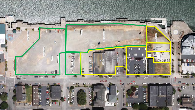 Green outlined property is owned by the City; yellow represents private property.
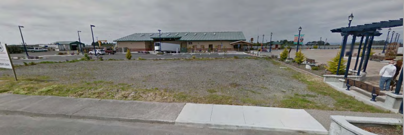 This small parcel in front of the Fishermen’s Terminal is also part of the project.
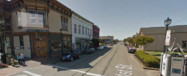 The (Google) view from the corner of First and F streets.
CLICK TO MANAGE