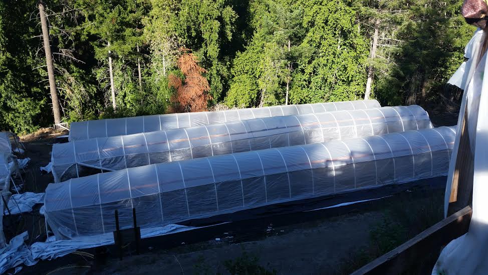
Hoop houses from Bridgeville bust. Source.
Tomorrow afternoon, the Board of Supervisors will take its first look at the commercial cannabis cultivation ordinance passed by the Planning Commission last week. When they do, the principal thing they’ll be looking at is questions of land use — what sizes of commercial grows will be allowed where, with which sorts of permits.
Why will the Board of Supervisors be looking at these questions? Why has the county been crafting this ordinance?
STATE OF THE WEED
- How Many Grows Are There in Humboldt County?
- Can You Guess Where Most of the Weed in Humboldt County is Grown?
- Here’s What the Board of Supervisors Needs to Know About Cannabis and Zoning
- Weed or No Weed Methodology
Because under the California constitution, local governments such as the county have an immense amount of control over land use. The ability to regulate what gets built where within their borders is the single greatest power retained by local governments in California — cities and counties. Generally speaking, it isn’t state law or federal law that prevents your neighbor from opening a hog slaughterhouse in his backyard, or a 10-story apartment building on his vacant lot, or a tire factory in the middle of the wilderness: It’s your city council, or your local board of supervisors.
There are only a couple of exceptions to this rule. For one, California government mandates that local governments may not develop “no growth” policies; every local jurisdiction in the state must plan to build sufficient new housing, in order to accommodate its share of the state’s expected population growth. For another, the California Coastal Commission retains significant land use power over property located near the state’s coast — the so-called “Coastal Zone.”
Humboldt County’s race to craft a regulatory regime for commercial cannabis is a direct consequence of its power over land use, combined with the fact everyone — from Washington D.C. and Sacramento on down — has quickly come around to the notion that legalization is in our very near future. Finally we can talk openly and unblushingly about the marijuana industry in Humboldt County. We can talk about the industry as an industry. And that means we can and must talk about how that industry should be regulated.
However, we find ourselves in the unique position of attempting to regulate an industry when we have no idea what that industry looks like. This STATE OF THE WEED series attempts, to the best of its ability, to fill at least some of the informational vacuum.
As noted above, the Board of Supervisors and the public will kick off their discussion of commercial cannabis cultivation and land use tomorrow afternoon with a reading of the Planning Commission’s draft commercial cultivation ordinance. You can read that draft in full at this link. You’ll note that it is divided into two sections — commercial cultivation within the Coastal Zone, and commercial cultivation outside the Coastal Zone. Each of these section includes the proposed county zoning designations that will allow cannabis cultivation.
We can look at our “Weed or No Weed” data to take an educated guess about how many parcels under these zoning designations are already growing weed, in one form or another. First, let’s divide our data by whether or not it is in the Coastal Zone. As we see, and as we probably could have expected, not much weed is grown near the coast:
| Total parcels (>1 acre) |
Est. # of parcels w/grows | % | |
| In Coastal Zone | 3,906 | 33-117 | 0.8% - 3.0% |
| Outside Coastal Zone | 24,602 | 3,003-3,488 | 12.21% - 14.18% |
Full calculations here. Refer to the first post in this series for instruction on how to read those tables.
In reaching this conclusion, as well as the ones we’ll be making subsequently in this post, we’re using Humboldt County’s Land Information System, a database freely downloadable from the county website. The LIS contains lots of data about most parcels in the county, including how it is zoned, whether it is developed or not developed, etc. (Full list of data in the LIS here.)
However, as is often the case with county parcel information — remember “shaded parcels”? — one county database of parcels does not often accord 100 percent with another county database. Only 28,517 parcels of the 28,545 parcels in our study have a corresponding entry in the LIS. An additional nine of our parcels are in the LIS, but the LIS has no information about whether or not they are in the Coastal Zone. So those missing 37 parcels —0.1 percent of the total — are chucked out, for the purposes of this section of the study.
The Planning Commission draft lists seven of the county’s land use zones as acceptable for commercial cannabis cultivation. Those zones are:
- RA: Rural Residential Agriculture
- AE: Agriculture Exclusive
- AG: Agriculture General
- TC: Coastal Commercial Timberland
- TPZ: Timber Production Zone
- FR: Forestry Recreation
- U: Unclassified
For more about these zones and what they mean, check the county’s zoning regulations.
The good news for the Board of Supervisors, “Weed or No Weed” suggests, is that little of the marijuana grown in the county currently is grown outside of one of these zones. That’s the bad news, too, though: Assuming those grows are commercial, they are the completely illegal ones that the county will have to shut down if the Planning Commission’s draft is adopted as written. The other bad news, perhaps, is that some of these zones are already impacted out the wazoo — it seems as though the public thinks of the “recreation” part of “forestry recreation” as largely the recreation of growing weed.
Let’s look at the way the current cannabis industry breaks down by county-designated zone. Programming note: Several parcels fall underneath more than one zoning designation. For instance, a parcel might be designated in the LIS as “U;TPZ,” meaning that part of the parcel is zoned U and part of it TPZ. Because we cannot know which portion of the parcel the grow lies on — the TPZ part or the U part — we count it twice, once under each heading. (Again, full calculations here.)
| Total parcels (>1 acre) |
Est. # of parcels w/grows | Est. % of parcels with grows | |
| RA | 1,024 | 18-65 | 1.76% - 6.35% |
| AE | 6,158 | 587-828 | 9.54% - 13.44% |
| AG | 3,019 | 188-326 | 6.22% - 10.79% |
| TC | 27 | - | - |
| TPZ | 7,889 | 570-815 | 7.22% - 10.32% |
| FR | 1,277 | 509-652 | 39.88% - 51.08% |
| U | 6,566 | 1,017-1,304 | 15.49% - 19.86% |
| None of the above | 5,681 | 154-299 | 2.7% - 5.26% |
For whatever reason, then, we see that the hottest properties for growing are zoned “FR,” with the more numerous “U” parcels a distant but solid second. The specially taxed TPZ lands — those that don’t pay any property tax to the county so long as they are not harvesting timber — are far behind, growing-wise, what the conventional wisdom would hold them to be. No grows at all were found on the county’s tiny number of Coastal Commercial Timberland-zoned parcels.
One last thing: The Planning Commission’s draft sets up a strict permitting regime for legal commercial grows depending on the size of the parcel that the grow happens on. We took one brief look at that in the first installment of this series — breaking out the parcels between one and five acres from those over five acres. But the planning commission draft includes parcel size tiers, which would culminate in legal grows a full acre in size, given a large enough parcel and a special use permit from the county.
Here is the “Weed or No Weed” state of the industry broken down by each of the Planning Commission’s tiers. Full calculations here.
| Total parcels |
Est. # of parcels w/grows | Est. % of parcels with grows | |
| 1-5 acres | 9,212 | 380-558 | 4.12% - 6.05% |
| 5-10 acres | 2,813 | 208-336 | 7.39% — 11.94% |
| 10-30 acres | 3,919 | 589-805 | 15.04% - 20.54% |
| 30 to 320 acres | 10,427 | 1,664-2,024 | 15.96% - 19.41% |
| over 320 acres | 2,171 | 6-47 | 0.28% - 2.17% |
Maybe the important thing to note in this table isn’t the number of parcels with grows, but the number of total parcels with potential grows. There are 12,598 parcels over 30 acres in size. Almost all of them — 12,254 — belong to one of the zoning categories that will allow commercial weed production under the Planning Commission draft. Each of them, under that draft, can grow at least 10,000 square feet of marijuana by right, so long as they meet certain minimum standards set by the county and state agencies. If all of them hop on board, that’s a pretty big crop — 2,813 acres of weed. And landowners are allowed to double or quadruple that limit with additional county permits.
OK! More STATE OF THE WEED later!
CLICK TO MANAGE