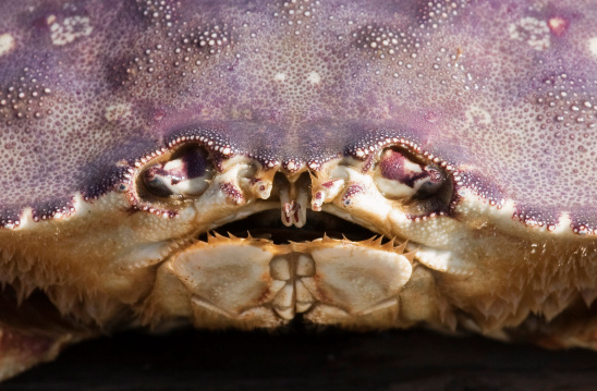
Eat me.
Get crabby, HumCo. California Department of Fish and Wildlife release:
Commercial and recreational rock crab fisheries are open along the mainland coast south of 36° 58.72′ N Latitude at Sand Hill Bluff, Santa Cruz County (approximately 9 miles north of Santa Cruz Harbor entrance) to the California/Mexico border. The recreational Dungeness crab fishery is now open south of 40° 46.15’ N Latitude at the northern jetty of Humboldt Bay, Humboldt County to the California/Mexico border, including ocean waters of Humboldt Bay.
Recent test results show that domoic acid levels in rock crab in Monterey and Dungeness crabs south of Humboldt Bay entrance and in Mendocino County no longer pose a significant human health risk, according to notice given today to the California Department of Fish and Wildlife (CDFW) and the Fish and Game Commission (Commission) by the director of the Office of Environmental Health Hazard Assessment (OEHHA), after consultation with the director of the California Department of Public Health (CDPH).
A closure for the recreational rock crab fishery remains in place north of 36° 58.72′ N Latitude and in the Channel Islands exclusion area between Santa Cruz and Santa Rosa islands (see coordinates below) while a closure for the recreational Dungeness crab fishery remains in place north of 40° 46.15’ N Latitude to the California/Oregon border.
The commercial rock crab fishery remains closed north of 36° 58.72′ N Latitude to the California/Oregon border and in the Channel Islands exclusion area between Santa Cruz and Santa Rosa islands (see coordinates below). The commercial Dungeness crab fishery remains closed north of the Mendocino/Sonoma county line.
The recreational Dungeness crab season in Humboldt and Mendocino counties is scheduled to end July 30 under regular open season regulations in the newly opened area while in counties south of Mendocino County, the recreational season closes on June 30.
Despite several weeks of test results that showed samples below alert levels, as a precaution, CDPH and OEHHA recommend that anglers and consumers not eat the viscera (internal organs, also known as “butter” or “guts”) of crabs. CDPH and OEHHA are also recommending that water or broth used to cook whole crabs be discarded and not used to prepare dishes such as sauces, broths, soups or stews. The viscera usually contain much higher levels of domoic acid than crab body meat. When whole crabs are cooked in liquid, domoic acid may leach from the viscera into the cooking liquid. This precaution is being recommended to avoid harm in the unlikely event that some crabs taken from an open fishery have elevated levels of domoic acid.
Pursuant to the emergency regulations adopted by the Commission and CDFW on November 5 and 6, 2015, respectively, the current open and closed areas are as follows:
Areas open to crab fishing include:
Recreational Dungeness crab fishery open along mainland coast south of 40° 46.15’ N Latitude, at the Humboldt Bay entrance, Humboldt County, including ocean waters of Humboldt Bay
Commercial Dungeness crab fishery open along mainland coast south of Sonoma/Mendocino county line – 38° 46.1’ N Latitude, near Gualala, Mendocino County
Commercial and recreational rock crab fisheries are open along the mainland coast south of 36° 58.72′ N Latitude at Sand Hill Bluff, Santa Cruz County (approximately 9 miles north of Santa Cruz Harbor Entrance)
Commercial and recreational rock crab fisheries are open in state waters of the Channel Islands except for an exclusion area between Santa Cruz and Santa Rosa islands (see coordinates below)
Areas closed to crab fishing include:
Recreational Dungeness crab fishery north of 40° 46.15’ N Latitude, near Humboldt Bay entrance, Humboldt County to the California/Oregon border
Commercial Dungeness crab fishery north of Sonoma/Mendocino county line – 38° 46.1’ N Latitude
Commercial and recreational rock crab fisheries are closed north of 36° 58.72′ N Latitude and in state waters between Santa Cruz and Santa Rosa islands within an exclusion area bounded by straight lines connecting the following points in the order listed:
(1) 34° 7.75’ N Lat. 120° 0.00’ W Long.;
(2) 34° 7.75’ N Lat. 119° 50.00’ W Long.;
(3) 33° 53.00’ N Lat. 119° 50.00’ W Long.;
(4) 33° 53.00’ N Lat. 120° 0.00’ W Long.; and
(5) 34° 7.75’ N Lat. 120° 0.00’ W Long.
CDFW will continue to closely coordinate with CDPH, OEHHA and fisheries representatives to extensively monitor domoic acid levels in Dungeness and rock crabs to determine when the fisheries can safely be opened throughout the state.
CLICK TO MANAGE