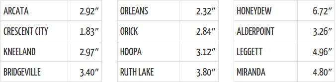
Yesterday’s rainfall totals via LoCO Weather.
So far, El Niño is delivering big on its promise of a wet 2016 winter. Weekend rains drenched the landscape — almost seven inches yesterday alone in Honeydew! — and liquefying our soils, causing some of them to pour down into the roadways.
We’re at 28.2 inches of precipitation in Eureka since the start of the rain year, in October. That’s nearly 150% ahead of a normal year’s schedule. And more is coming this week, according to National Weather Service forecasts.
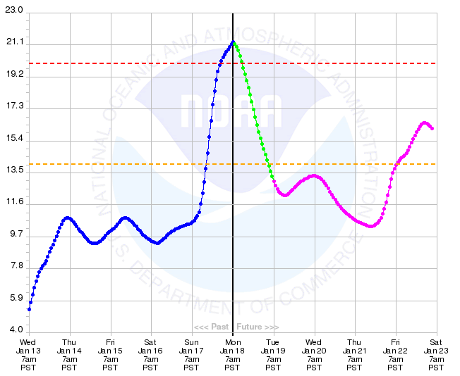
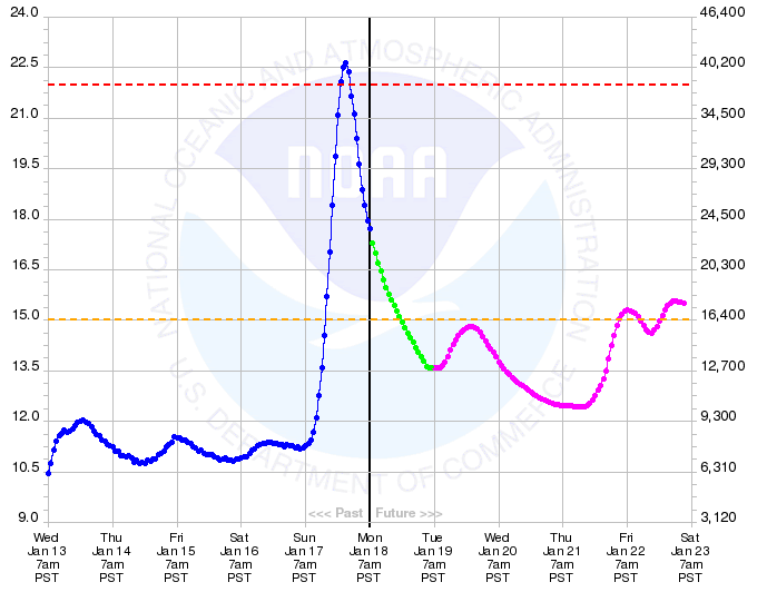
The flood warning that went into effect last night delivered on its promise. The Eel and Mad Rivers both overflowed late last night, and the Eel River remains above flood stage as of this writing. The Van Duzen, which was also under flood warning, barely peaked up at the “flood” level.
Eel River at Fernbridge.
Mad River at Arcata.
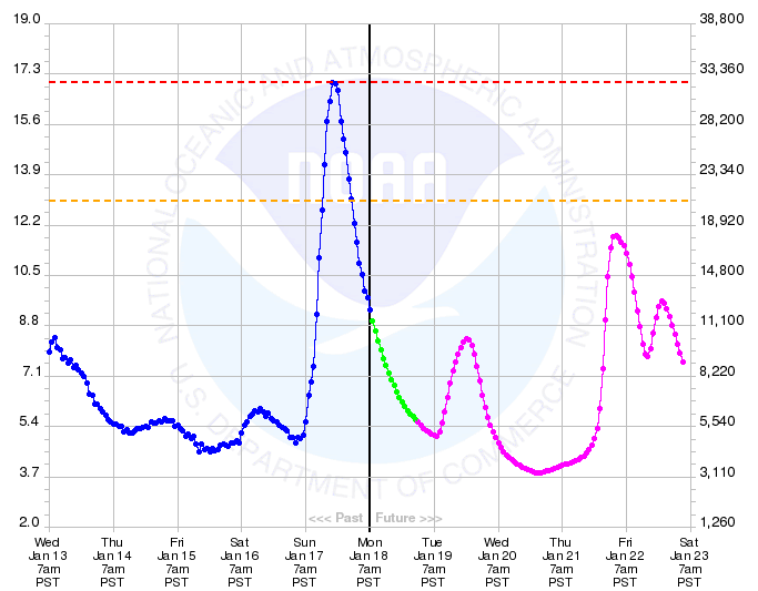
Van Duzen at Bridgeville.
The Outpost’s Andrew Goff took a drive over Fernbridge this morning to check it out. Here’s what the Eel looks like when it’s just over flood stage, if you can’t remember. Been a while, right?
… and the other way (with bonus MLK Day soundtrack).
###
PREVIOUSLY
CLICK TO MANAGE