National weather service.
UPDATE, Eureka National Weather Service 1:45 p.m.:
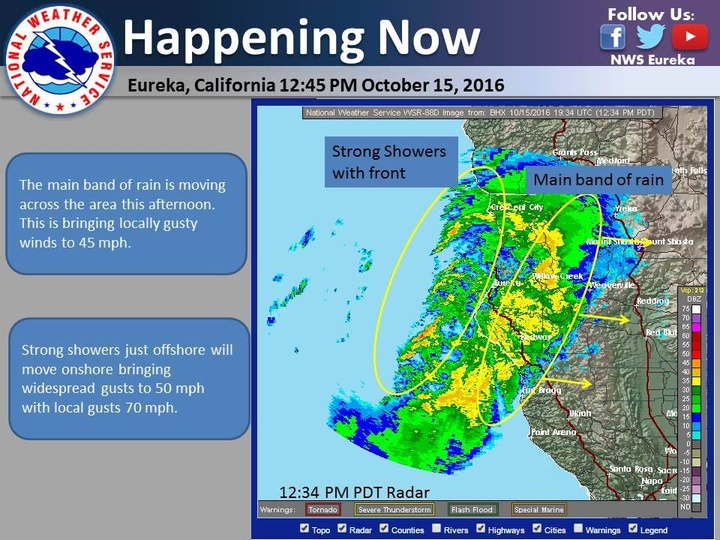
The main band of rain is moving across the area this afternoon. This is bringing locally gusty winds to 45 mph. Strong showers just offshore will move onshore bringing widespread gusts to 50 mph with local gusts 70 mph.
###
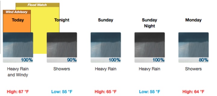
A flood watch and wind advisory have been issued for Humboldt and Del Norte Counties today.
The Eureka National Weather Service reports that heavy rain, and winds of 20 to 35 mph with gusts between 45 and 55 mph are expected across the entire humboldt coastline today.
The strongest winds will be felt along the coastal headlands and exposed areas, including Humboldt Bay and Trinidad Head.
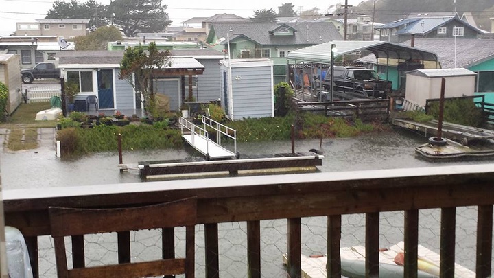
“Those dock ramps are usually angled down, not sure how much more we can handle down in King Salmon.’ -Chelsea Jensen.
One to three inches of rain is expected to hit Humboldt and Del Norte Counties in a short period of time, which may cause flooding along small streams and in urban areas. While higher elevation areas may see three to five inches of rain.
The storm will make for hazardous driving conditions along Highway 101 and 299, as water is expected to pool in low-lying areas. Be alert while driving mountain roads, as rock and mudslides may occur at any time.
Humboldt’s forecast.
Storm watchers are also advised to keep their distance from the surf, as 15 to 19 foot waves are expected throughout the weekend.
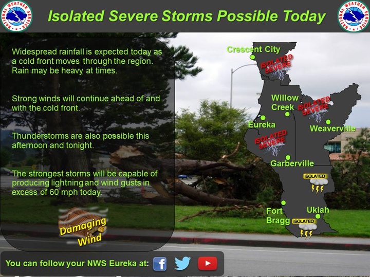
The weather service also reports a chance of severe thunderstorms and 60 mph winds throughout northern Humboldt today. Although the chances are highly unlikely, an isolated tornado is also possible for our area.
Track current wind conditions and rainfall totals throught the day with LoCO Earth.
CLICK TO MANAGE