NWS.
National Weather Service of Eureka:
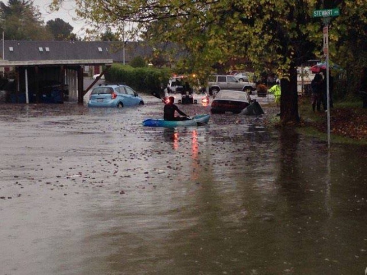
File photo of Arcata flooding from last October. Photo by Ashley Garrett.
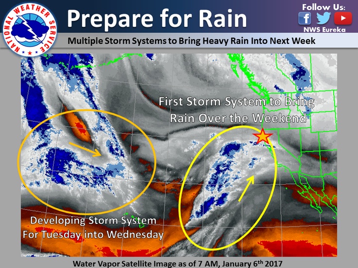
An Atmospheric River will bring copious amounts of moisture to northwest California resulting in significant rainfall amounts from Friday night through late next week.
Widespread moderate to heavy rainfall totals are expected across Del Norte, Humboldt, Mendocino, and Trinity Counties. The highest rainfall totals are expected in the coastal mountains.
Three weather systems are expected to bring significant rainfall to the region. The first arrives Friday night and continues through Monday afternoon. The second system arrives Monday night and persists through Wednesday. The third system arrives Thursday morning and continues through Friday evening.
With these systems, expect steep and rapid rises on the mainstem rivers. Standing or ponding water is also expected in low-lying areas in and in areas with poor drainage.
Also urban street flooding is expected where storm drains are unable to keep up with the rainfall. Current forecast rainfall amounts for Friday night through Tuesday:
Del Norte county: 5 to 10 inches, highest amounts in the higher terrain and lowest amounts in the coastal plain.
Humboldt County: 5 TO 11 inches, highest amounts in the higher terrain and lowest amounts near Humboldt Bay.
Mendocino County: 6 TO 10 inches, highest amounts in the high terrain Trinity County: 5 TO 10 inches, highest amounts in the southern half of the county.
Details related to exact location and timing of flooding currently remains uncertain. Watches and warnings will be issued by the National Weather Service as the situation warrants.
Listen to NOAA Weather Radio or your local media for later updates on this developing situation.
CLICK TO MANAGE