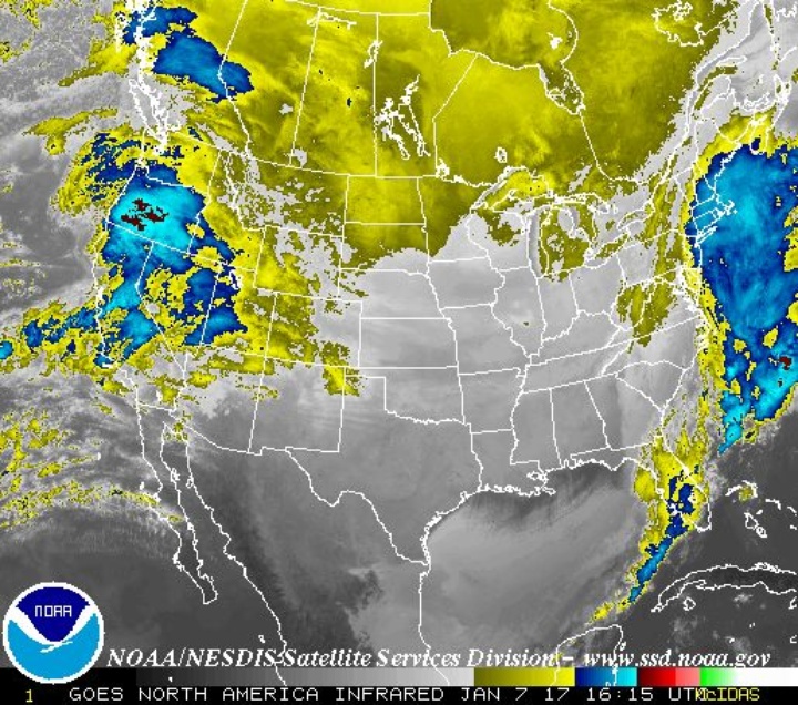
Infrared storm map. Infographics provided by the NWS.
The atmospheric river predicted to deliver consecutive rainstorms to Northwest California appears to be holding course.
The National Weather Service of Eureka reports that widespread heavy rainfall will drench Humboldt County for at least the next five days.
“Periods of widespread, heavy rainfall will persist through the weekend with a secondary push of moisture for the middle of next week as a robust low pressure system taps into more tropical moisture as it tracks towards the Pacific Northwest,” the NWS stated in today’s weather report. “Higher totals around 8 or so inches will be possible across some favorable higher terrain due to orographic effects”
Flooding will be possible along small streams, mainstem rivers and low-lying areas. Rock slides are also likely in areas of steep terrain.
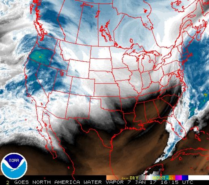
Water vapor map.
Snow is already affecting mountain roads, as chain restrictions were put into effect last night for Highways 36, 3, and 299. Snow levels are expected to rise this afternoon.

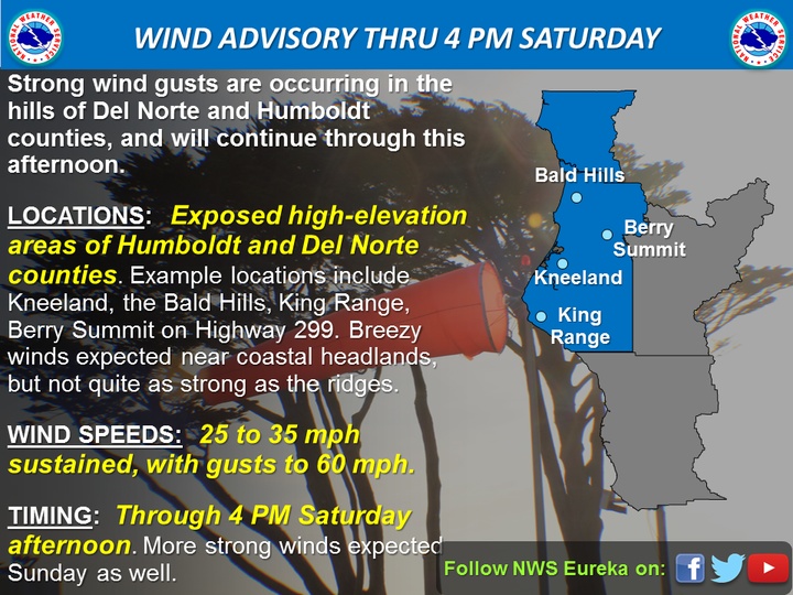
Costal areas will see moderate gusts of wind this afternoon, while exposed ridgetop areas may see gusts over 40 mph.
Conditions will subside Monday night. However, another storm is predicted to hit Humboldt County Tuesday afternoon and persist through Wednesday.
The NWS predicts that the second storm may push through Northwest California faster than the first, but heavy rainfall will still continue to impact our area. Flooding will be a growing concerns as these storm continue to dump their payload into Humboldt waterways.
We’ll keep you updated as the storms pass through our area.
CLICK TO MANAGE