UPDATE, 20 minutes later:
Oopsie! Clerk of the Board Kathy Hayes originally confirmed to us that the item discussed below had, in fact, been passed on the board’s consent calendar as expected Tuesday morning.
Then she wrote back:
Oops! Excuse me Ryan. I was incorrect. It was pulled from the agenda to be brought back at a later date. It did not pass yesterday.
So — all the below hasn’t happened quite yet, but the Humboldt County Board of Supervisors will consider making it happen soon. The Outpost regrets the error, and we are sure the clerk’s office does as well.
###
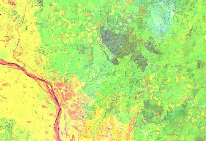
Different vegetation types are easily distinguished from their surroundings in this false-color image of Fortuna and Headwaters Forest made using data from different shortwave and deep blue sensors on the LANDSAT 8 satellite.
For years, Humboldt County weed farmers lived in fear of helicopters. Now they can get busted from a much higher altitude.
On Tuesday the Humboldt County Board of Supervisors approved put off [see above] a contract with San Francisco-based Planet Labs Inc. to provide regularly updated high-resolution satellite imagery of the Humboldt County backwoods. These images will allow county code enforcement officers and other staff members to spot un-permitted cannabis cultivation, grading and building without stepping away from their computer screens.
Enforcement of the county’s cannabis land use ordinance has been a hot topic. As Willow Creek resident E.B. Duggan told the board yesterday during deliberations on a comprehensive rewrite of the county’s pot regulations, “This ordinance doesn’t mean doo-diddly beans if it’s not enforced properly.”
And Larry Glass of the Northcoast Environmental Center called on the county to issue thousands of notices of violations, saying it would help rein in the industry’s environmentally destructive renegade grows.
The county’s building inspector division unveiled a new punitive approach to enforcement last summer when it started issuing letters to the owners of parcels with un-permitted grows, threatening them with fines of up to $10,000 per day. The contract approved yesterday will make it much easier for county employees to identify such rogue operations.
Historically, code enforcement investigators have conducted site inspections in person. The staff report for yesterday’s action noted, “Many of the site visits are in remote locations which limits the number of sites that can be visited in a day. Using imagery that is recent and at a high resolution can enable staff to accomplish much of what a site visit provides without the travel time and cost.”
The contract with Planet Labs Inc. will cost the county $199,500. Those funds will be taken from the building inspector division of the planning and building department, and the staff report says onsite inspections could drop by a third with this new technology in hand, generating direct savings of $135,000.
And it’s not just illegal grows that the county plans to spy from on high. With new imagery provided at least five times a year, staff members will use the high-res pictures to assess site conditions and progress being made by legit growers, too, those who possess cultivation permits.
Until now county staff has been relying on free online satellite imagery, such as that provided by Google Earth.
“The most consistent imagery data set we have is from 2016 and does not sufficiently represent the current state of the land and structures in the county,” the staff report notes. With these new, regularly updated images, staff will be able to track both permitted and un-permitted activity throughout the year.
And as you can see from the image at the top of this post, it’s not just photographs that these satellites can capture. Images captured in spectral bands invisible to the human eye can reveal extra details about vegetation types and other surface characteristics.
One last thing: If you, like us, were wondering about the constitutionality of such warrantless satellite surveillance, here’s a précis from the Fordham Environmental Law Review offering an overview and brief history.
CLICK TO MANAGE