The water at Fernbridge was 18.5 feet high and rising this morning | Video: Andrew Goff.
Humboldt County got a pretty good dousing yesterday. Monitors maintained by the National Oceanic and Atmospheric Administration registered nearly two and a half inches at its Arcata station, and more than eight inches at its perpetually waterlogged Honeydew station.
Over in Eureka, we now register almost 28.5 inches of total precipitation for this rain year (October through September), which puts us over the average year-to-date total of 27.5 inches.
RAINFALL YESTERDAY
| ARCATA | 2.48″ |
| CRESCENT CITY | 2.22″ |
| KNEELAND | 2.76″ |
| BRIDGEVILLE | 3.80″ |
| GASQUET | N/A |
| ORLEANS | 1.83″ |
| ORICK | 1.84″ |
| HOOPA | 2.92″ |
| RUTH LAKE | 4.08″ |
| HAYFORK | 1.64″ |
| HONEYDEW | 8.24″ |
| ALDERPOINT | 2.96″ |
| LAYTONVILLE | 3.86″ |
| MIRANDA | 3.24″ |
| COVELO | 2.10″ |
More is coming. Another strong wave of wet weather is supposed to hit us here on the coast of Humboldt Bay — oh, any minute now. The current forecast is for heavy rain today and tomorrow, a bit of a reprieve on Thursday and Friday, then more rain on the weekend.
The usual streams and low-lying areas that are prone to flood will certainly flood again when these storms hit, and this time the Eel River at Fernbridge is scheduled to rise well above flood level, and just under what they categorize as major flood level.
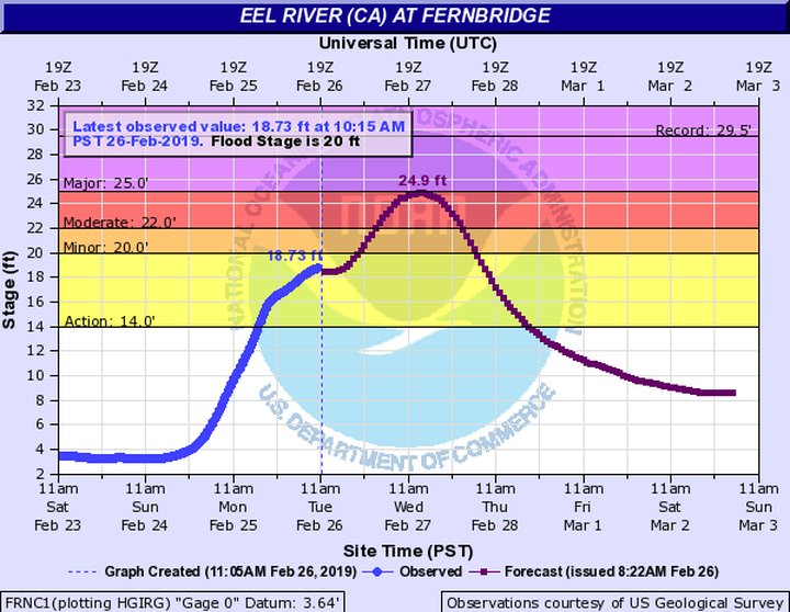
The peak of the flood is forecast to hit at about 2 p.m. tomorrow.
Earlier this morning, Cliff Berkowitz of KHUM spoke with Chris Builing, forecaster with the National Weather Service office on Woodley Island, about the current storm, the coming storms, and what to expect when the river starts really flooding at Fernbridge tomorrow. Be prepared for Highway 211, the road between Fernbridge and Ferndale, to be a dicey proposition for most of the day.
Chris Builing of the National Weather Service on KHUM. Feb. 26, 2019
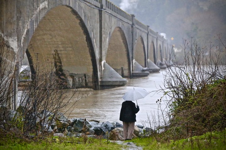
An amateur flood watcher surveys the Eel | Photo: Andrew Goff
CLICK TO MANAGE