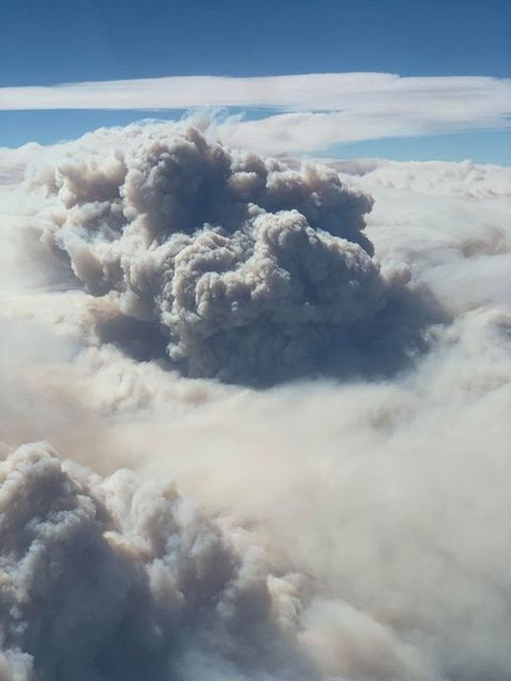
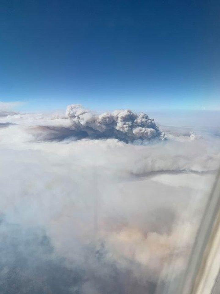
CORRECTION: A sharp Outpost reader, Cynthia Elkins of the Center for Biological Diversity, wrote to ask whether this smoke plume really was from the Oak Fire, as our original post stated.
“It well may be,” she said, “but the usual route for that flight flies far east from 101, and I’m thinking it is more likely in the Mendo Nat’l Forest or Yolla Bolly’s.”
We checked the flight data, and sure enough, Dodd’s flight took him over a number of fires further inland, including the massive August Complex in the Mendocino National Forest. The Outpost regrets the error.
###
Original post:
###
Eureka resident and LoCO reader Daniel Dodd was on a (nearly full) flight from SFO back to Humboldt County today when he captured these images of the Oak Fire, which has forced the closure of Hwy. 101 and destroyed an untold number of residences north of Willits.
Evacuations are in effect, and as of this morning the fire had grown to 863 acres and was 5 percent contained, according to CalFire. There has been no estimated reopening time for 101.
CLICK TO MANAGE