
A construction project expected to take two years will bring multiple kayak launches and open public access to the Eel River Estuary Preserve. Photos by Sage Alexander.
###
Down a winding levee road, deep into the marshy flats near the mouth of the Eel River, the landscape suddenly turns to an expanse of brown sludge. Nearby, heavy-duty equipment that has been ripping out a new 200-foot-wide channel that will reconnect floodplains and tidal habitat, sat idle near the mud.
Emily Afriat, North Coast Regional Director of the Wildlands Conservancy, is relieved work is finally happening.
“I’ve been waiting 10 years to get kids out here,” she said. “So for me, that’s going to be the best part.”
The Russ Creek and Centerville Slough Restoration Project, envisioned in some form for decades, has entered its first year of construction. It’s at the roughly 1,500-acre Eel River Estuary Preserve, a narrow stretch of beach and marshland between Centerville Beach County Park and the mouth of the Eel River.
It’s one of the largest tidal marsh restoration projects in California and aims to reconnect tidal processes across 550 acres. The effort will soon expand free public access on the stunning wetlands. (Before, the preserve required advance reservations.)
Folks working on the project took reporters and Congressman Jared Huffman on a tour of the site Thursday.

Rep. Jared Huffman inspects a map of the project.
We started at a parking lot surrounded by pasture, traversing a levee road that passes through the network of waters ripe with birds and mosquitoes. The broken remains of coastal dunes follow us.
Afriat pointed to spots where kayakers will one day launch to explore serpentine channels and sloughs. Paddlers will explore four and a half miles of slough channels, and tons of side channels, in a few years. People will be able to hike and bike along levee berms.
“Keep an eye out for river otters,” she said — they enjoy eating crabs and drink fresh water out of troughs left out by the preserve’s caretakers.
This estuary is dynamic. It’s shaped by the wily Eel River, tectonic activity, sea level rise and legacy dikes and levees put in by ranchers generations ago. Sediment has clogged some channels.
This adds layers to the project’s planning phase.
“It’s a really complex landscape because we have a lot of sediment coming off the [ridge] in these streams, which tends to fill this area,” said Conor Shea, GHD engineer for the project, as we passed meandering channels. “And just in the last 100 years, you can see that the fan, the alluvial fan, is just this big deposit of sediment that’s moved out onto this surface. Then we also had a system of coastal dunes that eroded out, and that’s what caused some of the overwash.”
Historically, the river would change course, shifting its route through the estuary, which acts as a nursery for fish, including juvenile salmon and an endangered species of goby.
But much of the marshland was blocked off, as people cut up wetlands to use for cattle grazing, adding dikes and levees.
“A lot of what we’re doing here is trying to remove this, from being a diked and drained wetland, to being a wetland that’s allowed to adjust with sea level processes and flood processes from the Eel and the sediment coming off the hillsides,” said Shea.
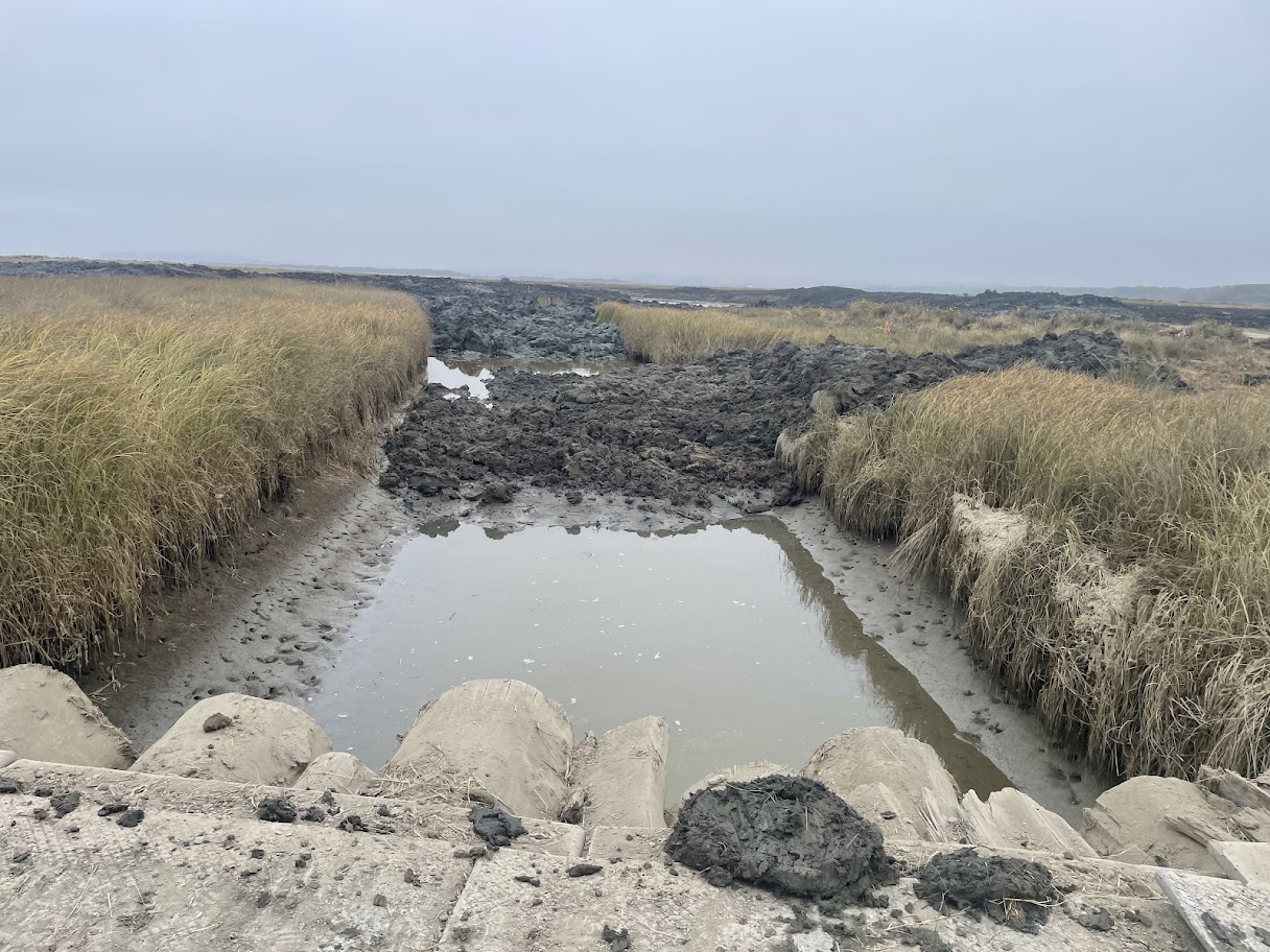
The project also has flood control measures aimed at protecting neighboring land.
Jay Russ, whose family has been on the land for five generations, said he noticed in the 1990s that salt water was washing over dunes onto pasture land.
“Once the pastures are flooded with salt water, it kills the fresh water grass species,” he said. If fresh water can wash the salt water away again, it grows back. But the salt water would get trapped on some agricultural pastures because of changes over the years.
He said the restoration project, which includes about 200 acres of the family’s land, seemed like a solution to changing conditions.
“This is basically restoring the natural function while protecting the remaining agricultural land,” he said.
The work involves building and lowering levees, realigning creeks, invasive plant removal (particularly Spartina grasses) and changing tidal gates so fish can pass through.
“Much of this project area is isolated from the main stem of the Eel,” said Shea. “We are recreating a slough system that was here historically, which will restore nursery habitat for marine species and also provide rearing habitat for juvenile salmonids.”
The project site is mostly land acquired by the Wildlands Conservancy back in 2008, a few decades after a Fish and Wildlife report found the site was ripe for restoration. It includes a few private landowners and a partnership between the Wildlands Conservancy, Humboldt County Resource Conservation District, Natural Resources Conservation Service and the U.S. Fish and Wildlife Service.
Construction is scheduled to take two years. This work is limited by the nesting season of snowy plovers, an endangered population.
“It’s nice to see something productive and beneficial happening,” said Congressman Huffman, after the tour.
“It’s great to celebrate the partnership that is necessary to do something this ambitious, and to know that, you know, although it’s a pretty frustrating time for most of us, politically and existentially, good things are still happening, and this is one of them,” he said.

Huffman, Shea, and others at the site of a new channel.
The funds for the project includes about $11 million from the federal government and $10 million from the state. According to people working on the project, they need $2.3 million more to complete the work.
CLICK TO MANAGE