
Several communities around Humboldt Bay are at risk of inundation from sea level rise or tsunamis. Photo: NWS Eureka.
###
The first draft of a big update to a 1980s-era Humboldt County planning document was released this week.
The Humboldt Bay Area Plan Update, which sets the policy direction for land use of 21,500 acres in the unincorporated bay area and over 20 miles of coastline, has new modifications aimed at guiding the future of the region through a spread of projected hazards and opportunities.
“Some things have definitely changed in the last 40 years. We’re dealing with climate change, which is resulting in sea level rise and wildfire and other things like that, that weren’t even thought of back in 1983,” said John Ford, director of Humboldt County’s Planning & Building Department.
This draft has added guidelines for addressing hazards like sea level rise and tsunamis, and proposes new policies to set a process for approving offshore wind energy support facilities.
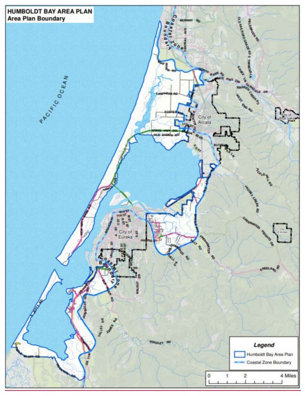
The plan’s area. Map: Humboldt County
A big update to this plan has been discussed for about a decade, Ford said, and has been in the works for the past six years. It’s considered a long-range plan, something that will ultimately shape zoning and development choices in the years to come.
With the bay poised to see serious sea level rise in the coming decades, key changes in the plan include policies that aim to address rising sea levels, like spelling out guidelines for shoreline protection and provisions for hazard planning.
Humboldt Bay is experiencing the highest rate of relative sea level rise in the U.S. West Coast, because the ground beneath the bay is sinking as global sea levels rise. Communities like King Salmon are particularly threatened.
Ford said the plan’s provisions will help give guidance to future developers, or people who might want to purchase a home, so they’re knowledgeable about what’s happening and what’s appropriate to do in certain areas.
Plus, “you want to be able to outline how we’re going to minimize those hazards as we move into the future,” he said.
The plan also lays out standards to limit or shape development in areas most subject to tsunamis— about 25% of structures in the Humboldt Bay area are in the tsunami evacuation area. One measure would prevent new development in the plan’s area unless there is a tsunami refuge point relatively nearby.
Ford described the 1983 plan as largely looking at what was already there, not thinking about what “could be.” Another key part of the updates are to allow for the future of offshore wind.
Along with proposed wind turbines to be attached west of Eureka in the ocean, a wind manufacturing and vertical assembly hub is proposed near Samoa, the Humboldt Bay Offshore Wind Heavy Lift Multipurpose Marine Terminal.
A Port Overlay Zone for the proposed heavy lift marine terminal in Humboldt Bay is introduced in this plan, a special designation that would allow for standards to be shifted to accommodate the proposed facilities. Ford noted developers would still need to apply for these projects and there would be an opportunity for community input in the process.
“Rather than trying to do a permit or a variance or something like that, this will create an environment whereby they can just define what they need and the community gets to weigh in on it. Then, the ultimate decision maker there will be the Board of Supervisors,” he said.
There’s also language that excludes any new or expanded oil and gas development from a “coastal dependent industrial facility” (which Ford noted stems from a Coastal Act change).
The 214-page draft is filled with a spread of clarifications and technical changes, like removing now-irrelevant names of property owners or the existence of now-defunct pulp mills.
Many of these standards were shaped by changes to the Coastal Act — 1976 legislation that regulates development along the coastline and makes land use decisions appealable to the powerful California Coastal Commission.
A more meaningful update to the language is an acknowledgement of local tribes; previously the Wiyot people were described in the past tense, and along with fixing that error, the new draft includes a land acknowledgement and chapter on tribal history. The plan similarly includes provisions in support of environmental justice.
Overall, Ford said the draft includes no prohibitions of existing uses. Many of the updates aim to protect the public and, as much as possible, protect improvements from future hazards, he said.
Ford says the draft is a work in progress, and encouraged public comment.
The department is planning a Planning Commission workshop on July 16. The Planning Commission will hear additional public comment and tinker with it over the next months, and hearings for Commission adoption will come later in September.
Then, the Board of Supervisors would consider it — perhaps even at the end of the year, if things go “extraordinarily well,” said Ford.
“I hope that it presents a vision that Humboldt Bay is a good and stable place to live and do business, and [will] guide future decision makers and attract quality development, and be of benefit to the community,” he said — he wants to have his cake and eat it too, he joked.
The department is encouraging public comments and questions on this draft to be sent to LongRangePlanning@co.humboldt.ca.us
Read more about the update at: humboldtgov.org/1678/Local-Coastal-Plan-Update.
CLICK TO MANAGE