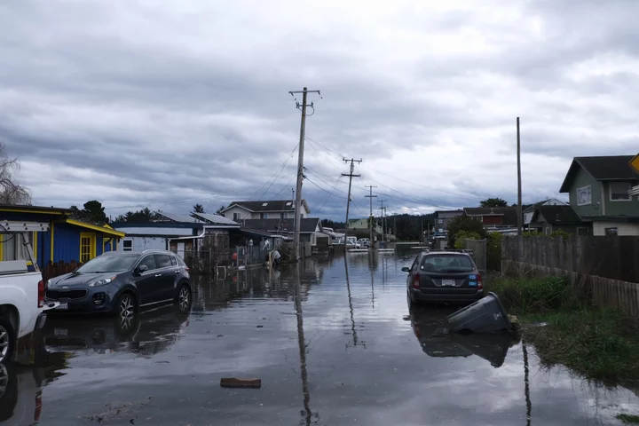
King Salmon, flooded at the beginning of this year. Photo: Fields Landing King Salmon Living with Water
The National Weather Service published a notice yesterday afternoon advising residents in low-lying coastal areas to keep an eye on the tides, and the NWS’s predictions. Tides are rising as the winter approaches, which is normal. But this year’s El Niño is pushing them higher than usual, NWS meteorologist Matthew Kidwell told the Outpost Wednesday, as warmer water tends to expand more than cold water.
A Kelvin wave is raising tides too. It’s a phenomenon caused by equatorial ocean waves traveling up the coast after nearing South America, a gravity wave of warm ocean water that forces colder water deeper into the ocean. Scientists call a planetary-scale wave; it’s not a big wall of water. Kidwell described it as water “sloshing” back towards the coast.
King Salmon usually floods a tad when the tides are 8.8 feet or higher, Kidwell said, and the NWS is currently predicting a high tide of 8.06 feet on Oct. 28. (That’s the peak — it’ll rise from about 7.5 feet on Oct. 25 and return to that on Oct. 30.) Major flooding occurs higher than 9.5 feet. Normally, they wouldn’t have enough confidence to predict flooding almost a week out, Kidwell said, but the warm El Niño waters and the Kelvin wave have made the NWS’s tide predictions consistently about a foot lower than the actual tides since late spring. Now, many of them are closer to a foot and a half higher. In most years, they’re usually close to right on, Kidwell said. The discrepancy made the NWS decide to put out the notice.
“This first event is definitely something for the people in those low-lying areas to watch,” Kidwell said. “But at this point, we’re not expecting anything real serious.”

Predicted tide tables vs. the actual tides. Data is preliminary. Screenshot from NOAA.gov.
Residents should prepare for higher water levels and avoid driving through ocean water; the salt can thrash a vehicle worse than fresh water does. There may also be flooding in the Arcata Bottoms and along the Humboldt Bay Trail, Kidwell said.
Heavier flooding may occur later in the season, when high southerly winds may join the El Niño and Kelvin wave duo and raise tides to the point of major flooding. If that happens, the NWS will issue a warning or a less serious advisory.
CLICK TO MANAGE