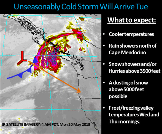
The US National Weather Service is saying that inland temperatures will be in the low 80’s today and coastal temperatures in the 60’s (See map here.) However, tomorrow will bring possible rain showers north of Cape Mendocino and Wednesday and Thursday could start off with an unseasonable frost. The US National Weather Service says,
An approaching low pressure system will bring an unseasonably cold airmass to Northwest California Tue night into Wed. This storm system will bring rain showers and high elevation snow showers to the region late Tue through Thu. Light snow accumulations will be possible across the highest elevations Wed and Thu with frost and/or freezing temperatures possible in the mornings. Unsettled weather will continue through Fri as this storm lingers over the region.
CLICK TO MANAGE