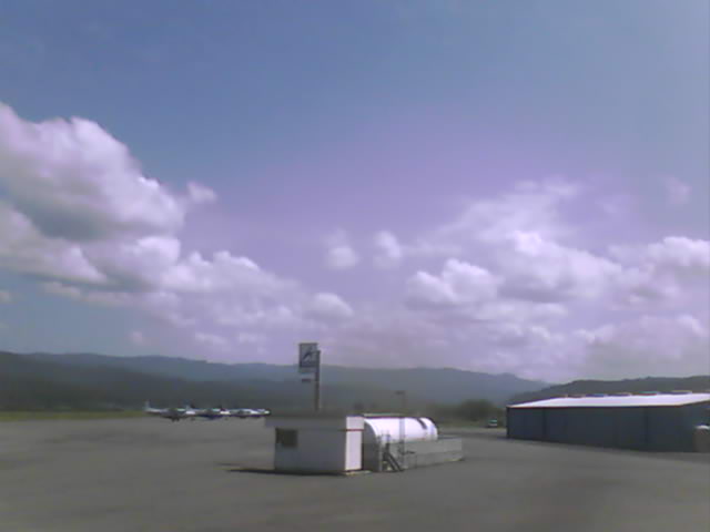
Photo from Sunny Fortuna’s Murray Field (East) Cam, 2:21 p.m. today. See more at CAMMED.
Been a pretty day so far, right? The sun has been shining and the birds have been tweeting. Little bit of bracing breeze, maybe. But that’s OK.
WATCH OUT!
Behold the Hopperesque image at right, which was just captured at Murray Field Airport. Clouds are gathering. And soon, according to the National Weather Service, clouds will be pouring rain and snow and maybe even some hail all over the county. Maybe not the same clouds that you see in the picture — we’re not really clear about that — but some kind of clouds.
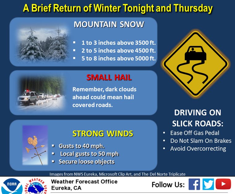
One hundred percent chance of precipitation tonight and tomorrow, folks. And you know what else? It’s going to be windy, and there might be thunder, and it’s gonna snow up the dickens up there in the hills. We’re looking at up to three inches sticking down to 3,500 feet in elevation.
Here’s the latest all-caps winter weather advisory from the National Weather Service, which —- hold the phone! — will soon be dropping its all-caps format in light of recent technological innovations that have superseded the telegraph:
 ...WINTER WEATHER ADVISORY REMAINS IN EFFECT FROM 10 PM THIS
 EVENING TO 9 PM PDT THURSDAY ABOVE 3500 FEET...

 * SNOW ACCUMULATIONS...1 TO 3 INCHES AS LOW AS 3500 FEET. 2 TO 5
   INCHES FROM 4500 TO 5000 FEET. 5 TO 8 INCHES POSSIBLE AT
   HIGHER ELEVATIONS.

 * HIGHWAYS IMPACTED...HWY 36 AT SOUTH FORK MOUNTAIN AND HWY 3 AT
   SCOTT MOUNTAIN.

 * FOR A DETAILED VIEW OF THE HAZARD AREA...VISIT
   HTTP://WWW.WEATHER.GOV/EUREKA/HAZARDS...
PRECAUTIONARY/PREPAREDNESS ACTIONS... * SLOW DOWN...ALLOW EXTRA TIME AND BE PREPARED FOR CHANGING CONDITIONS. * CHECK THE LATEST FORECASTS AND CALL 1-800-427-7623 FOR CURRENT ROAD CONDITIONS AND CHAIN REQUIREMENTS BEFORE TRAVELING. * BE ALERT FOR ROCK SLIDES IN MOUNTAINOUS TERRAIN.
Look at this infographic:
CLICK TO MANAGE