NWS of Eureka.
A deep cyclone headed straight for San Francisco will likely bring residual stormy conditions to Humboldt on Friday.
But what is a deep cyclone? A tropical storm, a hurricane, a very profound cyclone?
After putting in a call to local National Weather Service Meteorologist William Iwasko, LoCO has learned that it is none of these things.
“A deep cyclone is just a center of low pressure more or less, it’s just very strong low pressure,” Iwasko said. “We’ll likely get showers. The strongest winds will be out over the ocean, and on land we’ll have not very strong winds up to 20 mph.”
There you have it. It’s just a big scary word that means we’re gonna get some rain.
You can read more from the NWS below:
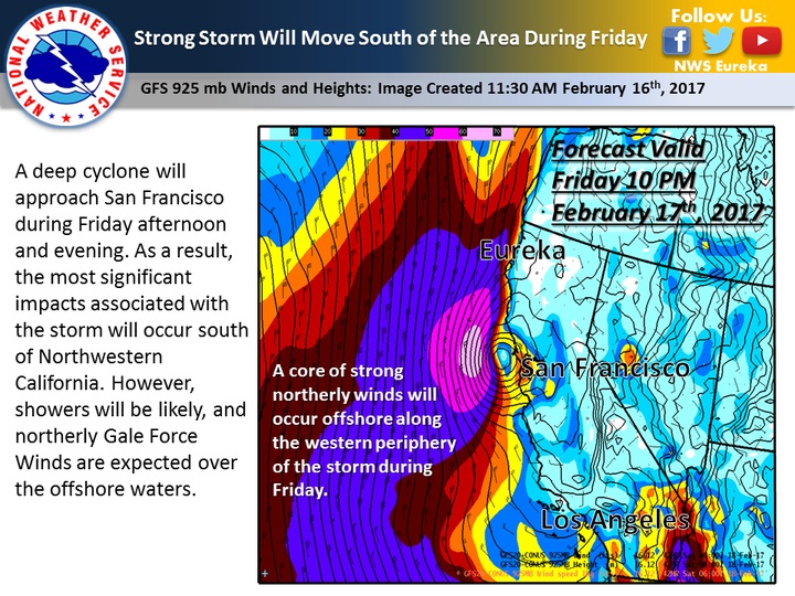
A deep cyclone will approach San Francisco during Friday afternoon and evening.
As a result, the most significant impacts associated with the storm will occur south of Northwestern California.
However, showers will be likely, and northerly Gale Force Winds are expected over the offshore waters.
CLICK TO MANAGE