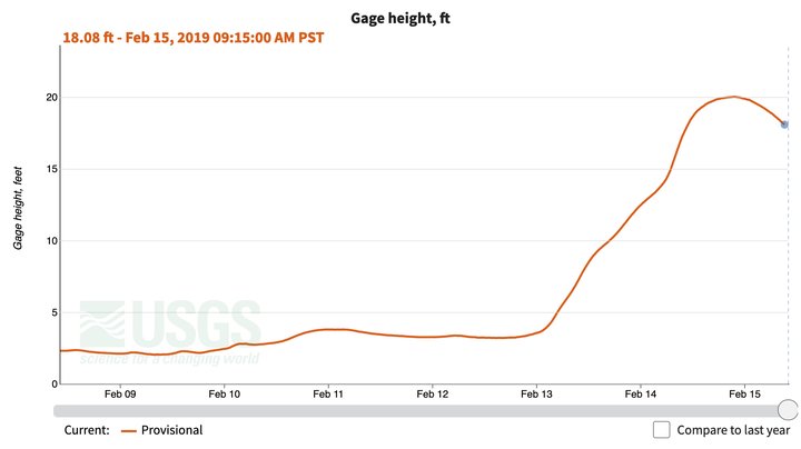
UPDATE, 2/15: …aaand it juuust made it. At 9:15 last night the Eel River peaked out at 20.02 feet. Thanks for playing.
# # #
The swollen banks of the Eel at Fernbridge earlier today.
PREVIOUSLY:
###
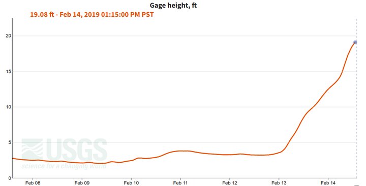
As of this writing, the Eel River has not yet reached flood stage. The latest reading available from the USGS near-real-time monitor was at 1:15 p.m., and it shows the river at 19.05 feet — just a hair under 20, which is considered “flood stage.” And still it rises!
This isn’t expected to be as hectic a flood as we had two years ago, when Fernbridge was shut and the road into Ferndale was impassible due to high water. But the people who watch these things do expect the river to crest out at about 22 feet later this afternoon, before falling again.
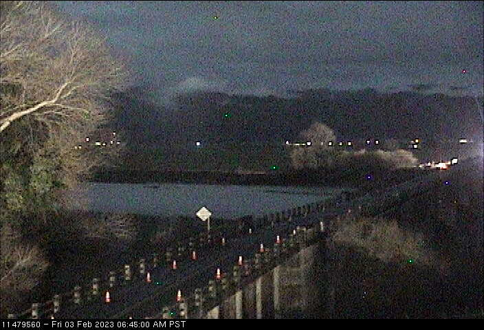
Live images from the USGS’s Fernbridge rivercam.
Hawks Hill Road earlier today. Photo: Andrew Goff.
They don’t expect to have to shut down Fernbridge this time.
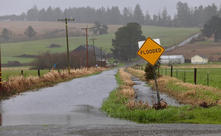
This are a bit soggier downriver, where the land gets flat and wide and the Eel meanders though its bayou before meeting the sea. Hawks Hill Road, which crosses Cannibal Island Road, was shuttered earlier this morning, and word just came that the county has marked down all of Cannibal Island itself — the Loleta Bottoms’ main thoroughfare — as flooded.
Follow along with hourly river monitor readings at this link, if you like, and pop a cork when it crosses the 20-foot line. Godspeed, cattlemen!
The height of the Eel at Fernbridge over the last week. Graphic: USGS.
CLICK TO MANAGE