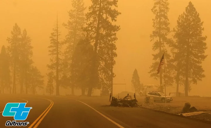
The McKinney Fire has consumed 55,493 acres in Siskiyou County and is 0 percent contained.| Caltrans District 2
###
Two people were found dead inside a burned-out vehicle in the McKinney Fire zone in Siskiyou County over the weekend, officials said, marking the first fatalities in the state’s largest wildfire of the season.
The vehicle was found in a driveway along Doggett Creek Road, just off Highway 96, near the town of Klamath River on Sunday morning, according to a news release from the Siskiyou County Sheriff’s Office. The identities of the two individuals are being withheld pending notification of next-of-kin.
The McKinney Fire, burning on either side of Highway 96 approximately 20 miles west of Interstate-5, has grown to 55,493 acres and is 0 percent contained.
“Much of the McKinney Fire saw rainfall overnight, keeping fire growth minimal,” the U.S. Forest Service (USFS) stated this morning. “The fire continues to actively back toward structures in the Walker Creek area, and night crews were on hand to do structure protection there. The southern and eastern edges of the fire, closest to Fort Jones and Yreka, showed very little growth.”
However, vegetation remains extremely dry throughout the area and the continued threat of thunderstorms and strong winds could increase fire behavior.

The McKinney Fire | Inciweb
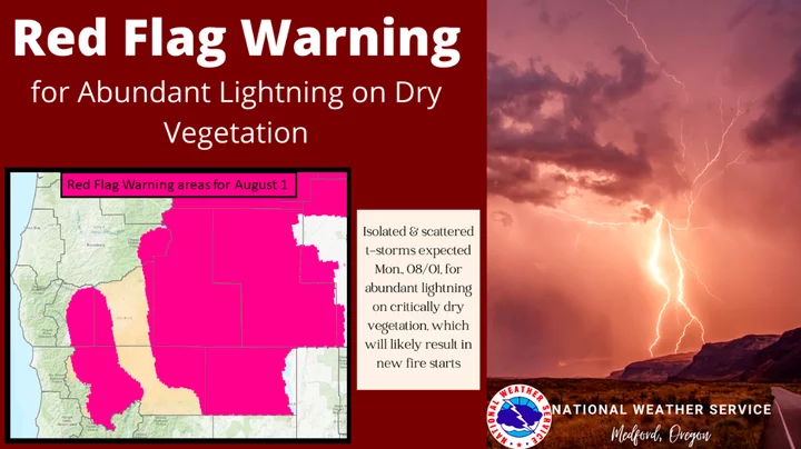
“There have been numerous lightning strikes in the area in the last 48 hours, and at least 12 holdover fires have been detected on the Klamath National Forest, in addition to the ones listed above,” the USFS stated. “They range in size from less than 1/10th acre to several acres. All are being fully suppressed.”
The China 2 Fire, burning west of Seiad Valley and south of Highway 96, has consumed 1,989 acres and is 0 percent contained.
Highway 96 remains closed from Hamburg east to Interstate-5 with no estimated time of reopening. Interstate-5 is open.
Roughly 4,912 structures are threatened by the two fires. The amount of buildings destroyed by the fire remains unknown.
Evacuation orders and warnings remain in effect for numerous Siskiyou communities as firefighters work to slow the fire’s progression toward Beaver Creek and smaller communities between Horse Creek and Scott Bar. The latest evacuation updates can be found on the Siskiyou County Sheriff’s Office and Siskiyou County Office of Emergency Services Facebook pages. A map of the evacuated zones is viewable on the website Zonehaven.
A shelter for fire evacuees is set up at the Weed Community Center at 161 E. Lincoln Ave. in Weed. The Church of Latter Day Saints has also set up a shelter at the LDS church at 111 Clay Street in Ashland, Oregon.
The McKinney Fire ignited on Friday afternoon. While the cause of the fire remains under investigation, fire officials say “it is clear [the] fire was not caused by lightning.”
A Red Flag Warning remains in effect for Siskiyou County and areas of Southern Oregon.
U.S. National Weather Service
Fire officials will hold a community meeting at 5 p.m. at the Siskiyou Golden Fairgrounds Livestock Arena. The meeting will be streaming live on Facebook and Youtube.
PREVIOUSLY:
CLICK TO MANAGE