

DIY SUGAR BEAR: Here’s How to Get a Permit Online to Cut Down Your Own Christmas Tree in Six Rivers National Forest
LoCO Staff / Tuesday, Oct. 26, 2021 @ 2:30 p.m. / News

You could be like a festive kind of lumberjack | Recreation.gov
The Christmas tree new is plentiful Six Rivers National Forest release:
Six Rivers National Forest Supervisor Ted McArthur has announced that Christmas tree permits will again only be available for purchase online from Recreation.gov this holiday season. The opportunity to purchase Six Rivers Christmas tree permits online this year through Recreation.gov replaces in-person transactions at offices that remain closed due to the COVID-19 pandemic. Online sale of Six Rivers’ Christmas tree permits begins on November 1.
“We are excited to have the opportunity to have our Christmas tree permit sales online this year again, especially with our offices still closed. Due to this easy, at home technology, more families can venture out to the Six Rivers to cut their own Christmas tree for the Holidays,” said Forest Supervisor Ted McArthur. He added, “While this might be a family tradition passed down for generations for some, it could be the start of a fun, new tradition for others and this year you can cut a tree from the same forest the U.S. Capitol Christmas tree is from!”
Prior to purchasing a Christmas Tree permit for the Six Rivers National Forest here, carefully review the Need-to-Know and Planning Your Trip information provided on that page. Visitors to the Recreation.gov site will need to create a new account—or log in to an existing account—to complete their transaction. Permits are $10 plus a $2.50 service fee. All sales are final with no refunds.The program for fourth-grade students continues for a Christmas tree permit for $2.50 under the Every Kid Outdoors program. Every Kid Outdoors introduces fourth graders to the public lands in their own backyards and beyond. For more information about Every Kid Outdoors, visit go here.
There are some places on the Six Rivers National Forest that are closed to Christmas tree cutting, including administrative sites, wilderness areas, research natural areas, or botanical/geologic/cultural areas, active timber sales, within 200 feet of any building, campground, state highway, river, stream, pond, lake, or other water body. In addition, certain areas affected by wildfires might also be closed. Maps of closed areas for tree cutting and the fire closure areas can be found at here, under the heading Christmas Trees – 2021.
To ensure your visit to the forest is an enjoyable and safe experience, please follow these important tips:
- Let someone know where you’re going and your estimated return time.
- Bring cold weather clothing, even if the day is nice when you start out.
- Bring emergency food and water, first-aid kit, tire chains, and shovel.
- Have a full tank of gas in your vehicle and don’t forget to bring a map
For additional information about cutting Christmas trees on the Six Rivers National Forest, visit click here.
BOOKED
Today: 3 felonies, 8 misdemeanors, 0 infractions
JUDGED
Humboldt County Superior Court Calendar: Today
CHP REPORTS
13764-13863 Us101 (HM office): Live or Dead Animal
ELSEWHERE
100% Humboldt, with Scott Hammond: #129. You Don’t Have to Be Wealthy to Give Back | Sara Dronkers
RHBB: Trinity County Marks 25th Anniversary of September 11 with First Responder Commemoration Ceremony
RHBB: CDPH Issues Immunization Recommendations for 2026-27 Respiratory Virus Season
RHBB: Redway Transfer Station to Close an Extra Day for Construction
These Fun and Cool People Have a Flippin’ Blast Taking Care of the Trails, and You Can Join Them and Be Fun and Cool Too
LoCO Staff / Tuesday, Oct. 26, 2021 @ 2:27 p.m. / Environment
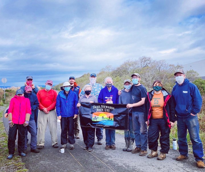
Do you know what the Wigi Wetlands are? Here are Volunteer Trail Stewards cleaning up the Wigi Wetlands. Join them and they will share their secrets to life, love and wetlands. Photos: Humboldt Trails Council.
Press release from the Humboldt Trails Council:
The Volunteer Trail Steward (VTS) program started 11 years ago on the Hammond Trail and has since expanded to have a presence at nine locations. In the year ending in July, 754 community members contributed more than 3,600 hours to maintaining, removing graffiti and invasive species, collecting trash, and improving trails through the VTS program. This October, the Humboldt Trails Council Board of Directors attended six workdays and distributed breakfast burritos, fruit, coffee, and pastries to the volunteers. In addition, people like Supervisor Steve Madrone, Eureka Mayor Susan Seeman, and Arcata’s Director of Environmental Services Emily Sinkhorn came to express their appreciation for the work of the VTS program.
Volunteer work on community trails not only lowers maintenance costs for cash-strapped local governments, it increases the sense of ownership for the trails people enjoy. Having a visible and vibrant VTS program also reinforces the priority placed on the addition of new trails and the importance of taking care of the ones that already exist. After attending each of the six workdays, Rachael Garcia, the Trail Steward Coordinator, observed that it is “remarkable to see how many people band together around their love of the outdoors and their love for our community. Given these challenging times, this is more important than ever.”
At each of these October workdays, the Trails Council asked volunteers what they love about volunteering. They heard statements like these: “It is a rewarding way to give back to my community.” “It is so much fun!” “I have learned about invasive species.” “I love getting out in our beautiful forest and helping keep it clean.” “It inspires others to care.” “I have really enjoyed working with a great group of diverse community members.” “It feels good to make a positive difference.”
Interested community members can find out more about the VTS program and upcoming workdays at humtrails.org. No prior experience is required and all volunteers are welcome.
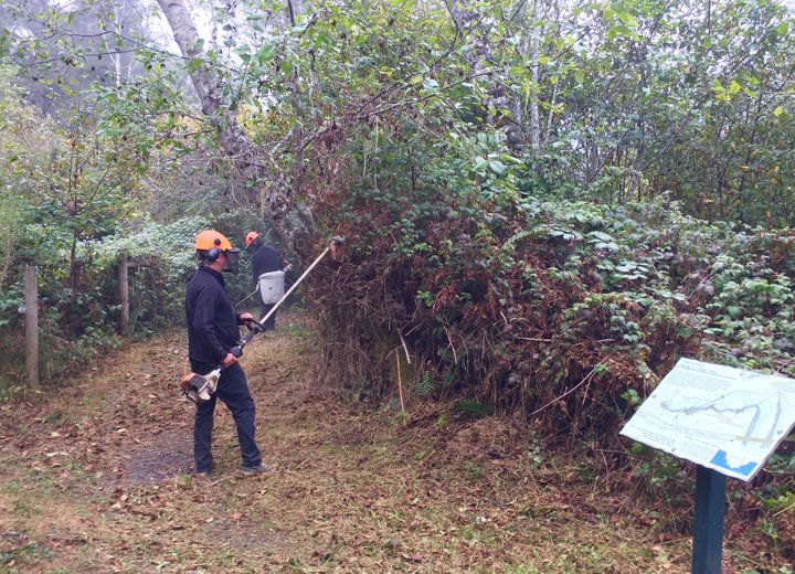
Weed-eatin’ stuff on the Hammond Trail!
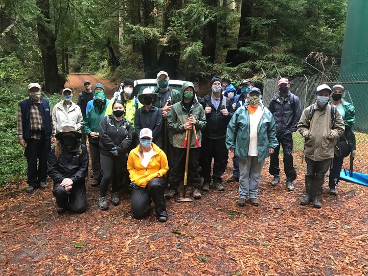
Arcata Community Forest, the Trail Stewards stand ready to serve.
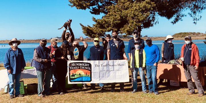
Why’d that guy bring his cat to the Hikshari’ cleanup?
OBITUARY: Randolph Varney, 1950-2021
LoCO Staff / Tuesday, Oct. 26, 2021 @ 6:49 a.m. / Obits
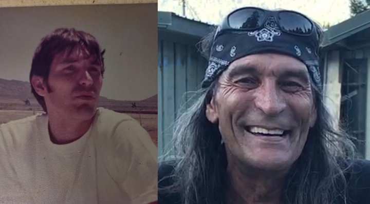
Randolph Varney, also known as Randolph Robison or more familiarly know as Randy Oqua aka The Aquaman, passed away October 22, 2021 at Valley Of The Moon Post-Acute, Napa, after battling cancer.
Randy was born February 9, 1950 in Tucson to Gail Frances Hill and Ronald Warner Varney. He was the oldest of three with two baby sisters Robin and Rikki (Breezin). He talked about his childhood very seldom, but mostly talked about his love for his grandma Tee-Doll. He had a rough upbringing and adolescent years and moved to Orleans in the late 70s to start a new chapter and was considered family up and down the river. He was a jack of many trades — gardening, carpentry, plumbing — and a ladies man.
Randy was a jokester and had a sarcastic sense of humor. He could break any silence and knew how to make people smile. With his model-like walk/stroll, you could tell him from a mile away, shades on, hat or bandanna and can’t forget those cut off shorts. He loved football Sundays, playing baseball and slow-pitch softball. He had several all-tourneys and trophies, was a hell of a pool player and always looked forward to the old timers parade and ball game, barbecues and Dr. Pepper. A gambler, you could find him playing keno at the Lucky Bear for days on end, and most of all he loved his kids and grandbabies. Leaving his athletic gift to his kids and grandkids, he loved hearing about their talents and achievements. At the end of the day, he was too old and shouldn’t have been out there! HA!
Randy survived by his children Randi Castillo (Oqua), Tee Oqua, Nolan Colegrove, Sammi Martinez, god son BJ Jackson(and family) and son-in-law Luis Castillo. Grandchildren KayLee McCovey, Madisyn McCovey, Melia Castillo, Romero Castillo, Emily Castillo, Sophia Castillo, Naiya Castillo, Callista Colegrove, Ashlyn Alameda Hayley Peters, Darrell McCovey, and Eugene Goodwin. He never forgot his Angel babies: his son Shade(Val) and daughter Darian Rose McLaughlin (Amy) He was a father, brother, uncle, nephew, cousin, and friend to countless people, too many to name without leaving anyone out. If you loved my Randy, know he loved you too!
There are no services at this time. My dad did not wish for one to be held. Please contact his daughter Randi if you have any you’d like the family to share any memories or photos with them. (707) 798-0528.
###
The obituary above was submitted on behalf of Randolph Varney’s loved ones. The Lost Coast Outpost runs obituaries of Humboldt County residents at no charge. See guidelines here.
The County’s Redistricting Process Has Been a Shambles, and the Maps it is Now Considering are Both Measurably Worse Than the Status Quo
Hank Sims / Monday, Oct. 25, 2021 @ 4:44 p.m. / Local Government
PREVIOUSLY:
- CENSUS RESULTS! The Northern Part of the County Has Boomed, and It’s Going to Make Local Redistricting a Little Tricky
- Redistricting Surprise? The County’s Advisory Committee is Looking Seriously at a Plan That Would Move a Distant Quarter of Eureka Into Arcata’s Supervisorial District
- (UPDATED WITH BETTER MAPS) The County’s Draft Redistricting Maps Have Been Released, and a Couple of Them Are Real Doozies
- More Later, But Here are Pirated Versions of the County’s Newly Revised Redistricting Maps if You, Like Many, Can’t Get the County’s Versions to Work for You
###
The primary reason for drawing new political districts every 10 years, after the decennial census, is to make sure that the districts are balanced — that every representative elected by the people represents the same number of constituents. Complete balance is impossible, but the goal is to get as close as you can.
By that measure — the most important one — Humboldt County’s redistricting process so far has been a failure. At its Wednesday meeting, the county’s Redistricting Advisory Committee will look at the two final maps it has produced, and will forward one or both of them on to the Humboldt County Board of Supervisors.
Both of the final maps are, in fact, less balanced than if the redistricting had not happened at all. Despite the jostling population over the last 10 years, the supervisorial map drawn in 2010 is more balanced, today, than any of the maps on the table in 2020.
The county’s Redistricting Advisory Committee does not know this, because it has never been presented with a map based on the status quo, and it hasn’t asked for such a map to be produced. What’s more, it hasn’t been much interested in the question of population balance, at least in its deliberations thus far.
So we’ll get to all that in a minute, along with a deeper look at the two maps recently produced by the committee. First, a quick note about the shambolic county process to date, with some advice about how to best proceed if you have strong feelings about any of this.
First of all: As mentioned Saturday, the county solicits feedback on these draft maps via a cumbersome questionnaire on its “Open Humboldt” website, which you can find via a link on the its Redistricting web page. At this point in the process, the feedback received via that method seems to have received little to no attention from county staff or members of the Redistricting Advisory Committee.
For instance, when the county released the first set of draft maps — we’re on round two now — it published a different questionnaire. One respondent to that questionnaire very reasonably asked for the mapmakers to break down the Native American population in each proposed district, as they had done for the Black, Asian and Latinx populations. This is important because country redistricting is governed, in part, by the California Voting Rights Act, which seeks to ensure that minority voters are not being disenfranchised through gerrymandering.
However, despite the request, and despite the fact that Humboldt County is home to California’s two largest tribes and has the largest Native American population in the state — it is our third-largest ethnic group — the current round of maps does not, in fact, bother to break out the Native American population in that way, though such data is eminently available to the mapmakers, as it is for the less populous Black and Asian groups in our county.
It’s unclear if anyone involved actually read that respondent’s request. If someone had — either members of the Redistricting Advisory Committee, county staff, or representatives of the various partners hired by the county to work on this — they didn’t only do the respondent and the Native American community a disservice; they potentially left a tiny door cracked open for legal action under the California Voting Rights Act.
Another example will follow, but this is all by way of saying that if past history is anything to go by, people who have thoughts on county redistricting should probably not rely on being heard through the questionnaire — or not only through the questionnaire. The Redistricting Advisory Committee’s next meeting is scheduled for Wednesday at 10 a.m. A link to the meeting should be available on this page. Here are instructions to submit your thoughts to the committee via email.
Next week, at its Nov. 2 meeting, the Humboldt County Board of Supervisors will receive recommendations from the advisory committee and take the issue up on its own. The board will have the final approval over any new map, and it’s required by law to take action by Dec. 15.
Now let’s take a closer look at the advisory committee’s two current draft maps, and let’s also compare them to the current map, which the committee is not considering at all.
Draft Map A2
This map represents the latest iteration of the most eyebrow-raising idea to come out of the Redistricting Advisory Committee — the idea that the Third District, which represents Arcata, should reach down across the Samoa Peninsula to take in a chunk on the far side of Eureka.
The current iteration is the most radical yet. As you can see, if you zoom in, not only is the northwestern corner of Eureka swallowed by the Arcata district — nearly the entirety of downtown Eureka, including Old Town, is subsumed into Arcata as well.
That’s far from the only oddity of this map. The Arcata Bottoms would no longer be in the same district as Arcata. And the First District, represented in blue in the above map, would cut an insane path across the county from the northeast to the southwest. It would no longer include Willow Creek, but it would include Titlow Hill and everything else south of Highway 299 to the Trinity border. And from there it would snake along to Blue Lake, to Kneeland and Indianola and Cutten, over to Ferndale and all the way down to Shelter Cove.
Given the transparently odd geographies outlined above — odd to anyone with eyes, but particularly odd to people actually familiar with Humboldt County — it’s hard to object to anyone who wants to call Draft Plan A2, here, that dirty word: A gerrymander, a map drawn for political ends. That would particularly be the case for supporters of Natalie Arroyo, the popular Eureka City Councilmember who had already announced her intention to run for the Eureka seat on the Board of Supervisors next year, but who is (conveniently?) drawn out of the Eureka seat entirely, by a margin of one block.
But if it’s a gerrymander, what is its aim? And how is it being accomplished?
The latter question is easier to answer. Before any maps were drawn, the Redistricting Advisory Committee took public testimony on “communities of interest” — places that feel like places, to the people that live in them. When drawing lines, redistricters are supposed to take these communities of interest into account, and to attempt to keep them whole if possible.
During this testimony, a handful of people, almost all anonymous, said that they wanted to see the West Side of Eureka, in which some of the anonymous commenters purported to live, joined up with Arcata. They had two talking points: Renters and public transportation. The West Side of Eureka formed a natural community of interest with Arcata, they said, because both places are home to a lot of people who rent. The talking points fell down a little bit when it came to mass transportation: Sometimes the commenters said that both the West Side and Arcata were in dire need of mass transit options, and sometimes they said that the West Side and Arcata were natural partners because of the superabundance of wonderful mass transit options. (See this document — a record of “community of interest” testimony — for the amusing breakdown of this talking point.)
Still others fully admitted that they did not live in the area in question, but nevertheless held that it formed a natural “community of interest” because it kept both of the urban centers in question out of their own backyards. A writer who identified himself only with by the first name of “Rob” and a handscrawled email address of either “rdmcbeth77@gmail.com” or “romcbeth@gmail.com” said that he lived in the Freshwater/Kneeland area, but wished to submit a “community of interest” map for the Eureka/Arcata area rather than his own:

(Rob McBeth of O&M Industries, the longtime Humboldt County conservative activist, lives in the Freshwater area.)
But what was the goal of the gerrymander, if gerrymander it was? It might not be simply to bounce Arroyo out of contention. Rather, by packing as many left-leaning city-dwellers into the same district as is physically possible, more conservative rural voters would have more of a sway in county politics going forward.
As should be apparent by now, for whatever reason — perhaps the general paucity of “community of interest” testimony — the Redistricting Advisory Committee took all this at face value and ran with it, and the Eureka-Arcata union has now made it through two rounds of map revisions and looks likely to be passed onto the Board of Supervisors.
This is despite the fact that public opinion on the first round of draft maps, as registered through the county questionnaire system mentioned above, was near-universally against this plan — 60% of the respondents said that the map “didn’t represent their community well, as opposed to 22% who said it represented their community “well” or “adequately.” But as stated above, at its last meeting the committee referred to the questionnaire results glancingly or not at all.
Is there anything good to be said about this map, community-of-interest-wise? Sure. The Samoa Peninsula is a coherent political unit, which at least one person asked for. Rio Dell and Scotia are reunited — perhaps the most glaring fault of the current map — and the southern part of Eureka is united with the eastern part of Eureka. But the main thrust of it — that downtown and northwestern Eureka form a natural community of interest with Arcata, or that Titlow Hill forms one with Shelter Cove and Cutten — should be recognized as patently absurd.
And while the populations of each of the districts is not as balanced as it could have been, it is not as bad as it might otherwise be. See the chart below. The total population of the county, according to the 2020 Census and after prisoners and other institutionalized people have been returned to their home counties, is 138,810. That means that ideally, each district has 27,362 residents.
Here’s how that shakes out in Draft Plan A2:
| Pop. | Diff. | Diff. % | |
|---|---|---|---|
| 1st | 26,791 | -571 | -2.1% |
| 2nd | 26,087 | -1,275 | -4.7% |
| 3rd | 28,315 | +953 | +3.5% |
| 4th | 27,278 | -84 | -0.3% |
| 5th | 28,339 | +977 | +3.6% |
| Largest deviation: 4.7% | |||
| Average deviation: 2.84% | |||
The maximum deviation allowed by law is 10 percent. So this is within the range, but you can do both better and worse.
Draft Map C2
One way to do worse, in regards to population balance, can be seen in the latest iteration of the “C” series of maps — which are, themselves, meant to be based on the county’s current map, with not-so-radical adjustments.
C2, though, ends up being pretty radical as far as population balance goes. If the county adopts this map, the new Fifth District, centered around McKinleyville, will have almost 3,000 more people than the new First District:
| Pop. | Diff. | Diff. % | |
|---|---|---|---|
| 1st | 26,447 | -915 | -3.3% |
| 2nd | 27,421 | +59 | +0.2% |
| 3rd | 26,706 | -656 | -2.4% |
| 4th | 26,941 | -421 | -1.5% |
| 5th | 29,295 | +1,933 | +7.1% |
| Largest deviation: 7.1% | |||
| Average deviation: 2.9% | |||
Why is this? Well, again, it all traces back to the “community of interest” testimony, which seems to be this Redistricting Advisory Committee’s sole concern. During the course of that testimony, the committee heard from a few people in the Blue Lake, Glendale and Fieldbrook areas who said that they wished for some combination of those three locales to be in the same district.
So at the last meeting the advisory committee asked the mapmakers to incorporate those people’s suggestions into the next version of Map C. The mapmakers — a Sacramento-based contracting firm called Redistricting Partners — followed those orders, and so incorporated all three of those areas into the Fifth District. (Blue Lake currently belongs to the Third.)
This ended up lopsiding the map powerfully, population-wise. Again: The whole point of redistricting after a census — or at least 90 percent of the point — is to bring population into balance. This map sacrifices that in order to please a handful of people in Blue Lake, Fieldbrook and Glendale, who may or may not continue to be pleased after finding out that their political voice has been so diluted, that each resident of Ferndale gets 10 percent more of a supervisor than they do.
Status Quo
So look at the population charts above — the ones corresponding to each of the draft maps — and then look at the chart below, which corresponds to the current supervisorial districts, as represented in the preceding map. That map is the status quo.
| Pop. | Diff. | Diff. % | |
|---|---|---|---|
| 1st | 27,116 | -246 | -0.9% |
| 2nd | 26,817 | -545 | -2.0% |
| 3rd | 28,296 | +934 | +3.4% |
| 4th | 26,407 | -955 | -3.5% |
| 5th | 28,174 | +812 | +3.0% |
| Largest deviation: 3.5% | |||
| Average deviation: 2.56% | |||
The current supervisorial map is more balanced than either Draft Map A2 or Draft Map C2. Its largest deviation from the ideal is quite a bit smaller than either of the draft maps. Its average deviation from the ideal is also smaller than either of the draft maps.
So why draw new maps at all?
Well, you can do it to balance the population further — not the case and seemingly not the goal at the Humboldt County level. If the advisory committee, or eventually the Board of Supervisors, wished to rebalance the population, it could go a long ways to that simply by giving 3.5 percent of the population of Arcata’s Third District to Eureka’s Fourth District — the Manila end of the peninsula, say, or maybe even more sensibly, the southeast corner of Eureka near Redwood Acres, Mitchell Heights and the like.
You can also do it to redress ganky lines drawn in the past. The current map, despite being more balanced than either of the draft maps, has its own oddities, though none so odd as those offered to us in Draft Map A2. As mentioned before, Rio Dell and Scotia are currently in different districts, and to compensate for that fact the First has grown a weird protuberance down the Highway 101 corridor. That could be cleaned up, and the draft maps do clean it up — though either at the cost very dramatic population imbalance, or else through the introduction of much more dramatic crimes against communities of interest.
It didn’t have to be this way, and maybe it doesn’t. As I said before, no one is looking at the current map. I had to reconstruct the 2010 map myself. It’s not the exact same map, given that the Census Bureau alters the building blocks every 10 years — imagine being handed a very slightly different mix of 7,138 Legos to recreate the same Death Star you made in 2010 — but it’s mathematically as close as you can get. If anyone wants to check my work, here’s a 27-megabyte block-level GeoJSON file that you can plug into your favorite GIS.
(PHOTO) Dead Humpback Whale Found on Humboldt Beach
Andrew Goff / Monday, Oct. 25, 2021 @ 4:20 p.m. / Wildlife
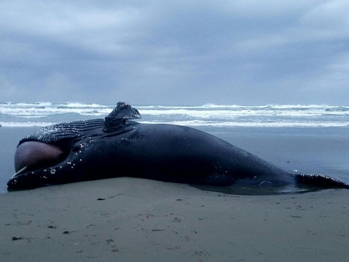
There it is.
A deceased 28-foot-long sub-adult female humpback whale was discovered on a stretch of beach about a mile south of the Mad River Beach parking lot, according to a staff member with the Northcoast Marine Mammal Center.
We don’t have a lot of details to share past that. The photo above was sent in by Lynda Stockton, an NMMC stranding coordinator, who also tells us that members of Humboldt State University’s Marine Mammal Education and Research Program (MMERP) have made their way to the scene to take samples from the whale.
The Outpost has left a message for the MMERP crew inquiring about their findings and will update this post if we hear back anything noteworthy.
County Supervisors to Consider Returning to In-Person Meetings
Ryan Burns / Monday, Oct. 25, 2021 @ 4:03 p.m. / Local Government
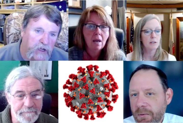
Screenshots (and a virus image) from the Aug. 5 Board of Supervisors meeting.
###
Supervisor Michelle Bushnell has never attended a Board of Supervisors meeting — not in person, anyway, not since defeating incumbent Second District Supervisor Estelle Fennell in the 2020 election.
Of course, that’s only because here haven’t been any in-person meetings during her tenure on the board. Thanks to that pesky and tenacious nemesis COVID-19, the board has been meeting remotely for more than a year and a half.
At tomorrow’s VIRTUAL meeting, Bushnell will ask her board colleagues to consider returning to real-life meetings — everyone together inside board chambers at the county courthouse.
“I would like to be in chambers when it’s safe, and I think we’re getting there,” Bushnell told the Outpost on Monday. She noted our declining case rates and said most of the county’s school boards are meeting in person, as are many other county boards of supervisors. Plus, she’s been getting requests from her constituents.
“All of our county people are working and masked,” she said, referring to county employees. “I don’t think we should be any different; we’re not special. I definitely think we need to have the discussion again.”
Bushnell hopes the board will set a target date for resuming in-person meetings and consider whether or not to allow a Zoom option so people can still participate remotely if they so choose.
You might remember that the board was all set to go return to its chambers back in August. But then came the Delta variant-fueled surge in COVID cases, hospitalizations and deaths, leading the board to quickly change course and back out of that plan last minute in favor of sticking to video-conferenced meetings.
Since the board made that decision on Aug. 6 — not quite three months ago — the number of COVID deaths in the county has more than doubled, from 54 to 109, and the number of hospitalizations has nearly doubled, going from 240 to 420.
Those dramatic numbers attest to both the seriousness of the Delta variant and the fact that more than two in five Humboldt County residents have yet to get fully vaccinated. Tragically, vaccination continues to be a divisive political issue, as you can tell by listening to recent public comments at supervisor meetings or, you know, being anywhere in America right now.
With that in mind, we’ll go ahead and repeat this for the record: Evidence continues to show that while breakthrough cases do occur, vaccines dramatically lower your chances of contracting the virus and they remain highly effective at preventing serious illness and death, even with the Delta variant.
But we digress. As Bushnell observed, some of Humboldt County’s COVID numbers have improved since the board’s Aug. 6 decision to remain on Zoom. Our rolling seven-day average of new cases, for example, has dropped from 49 to 23, and our test positivity rate, while subject to dramatic day-to-day variation, has declined quite a bit.
Does that mean it’s safe to return to in-person meetings? Well, define “safe.” The staff report for this item notes “many counties in California have successfully continued to hold in-person Board meetings during the pandemic while following all of the state and local guidelines for protecting its employees and citizens from the Covid-19 virus.”
We shall see if Bushnell’s fellow supes are on the same page.
Also on the agenda for tomorrow: A controversial cannabis project near Blue Lake comes back before the board. Applicant Rocci Costa had agreed to move a planned 10,000 square
feet of new cannabis cultivation out of the Blue Lake Community Plan Area in an attempt to appease neighbors, but he and his wife Laura have been unable to find a new spot. They’re asking the board to reconsider that particular condition of approval and allow them to go ahead and grow at the end of Warren Creek Road.
And at at 9:30 a.m. — time certain, allegedly — the board will hear an annual report about the county’s unmet transportation needs.
The meeting is scheduled to begin at 9 a.m. You can find a link to start streaming it shortly before showtime here.
Identities Released for Two Bodies of Transient Men Found in Blue Lake Within a Month; Both Ruled Homicides
LoCO Staff / Monday, Oct. 25, 2021 @ 1:03 p.m. / Crime
Press release from the Humboldt County Sheriff’s Office:
The purpose of this press release is to provide an update to the public regarding two death investigations occurring in the Blue Lake area. Despite the close proximity of these cases in location and date of discovery, investigators have not officially determined a connection between the two incidents at this time. However, the cases are still under active investigation.
- Case Number: 202104733
On Sept. 11, 2021, a deceased male was located near a trail off of Hatchery Road. The male has been identified as 65-year-old Eugene Steven Segal. Segal was known to live a transient lifestyle in the Trinidad area. His death has been determined to be a homicide.
- Case Number: 202105261
On Oct. 10, 2021, a deceased male was located near a trail off of Taylor Way, near the Mad River Levee. The male has been identified as 29-year-old Levi Harold Hernandez Howard. Howard was known to live a transient lifestyle in the Blue Lake area. His death has been determined to be a homicide.
Autopsies have been completed for both victims, however, cause of death information is being withheld pending the ongoing investigation. Anyone who may have information about either of these cases should contact the Humboldt County Sheriff’s Office Major Crimes Division at (707) 445-7251 or the Sheriff’s Office Crime Tip line at (707) 268-2539.
The Humboldt County Sheriff’s Office has received numerous inquiries from members of the public regarding concerns for safety and use of the trail system near the Mad River Levee. Members of the public are encouraged to take regular safety precautions while out recreating anywhere in Humboldt County, including:
- If possible, recreate during daylight hours and don’t go alone.
- Choose a route well-traveled by other recreators.
- If you see anyone or anything suspicious, change course and go into a store or public building to avoid danger.
- Stay alert at all times. If you’re listening to music as you walk, turn down the volume so you can still hear bike bells and warnings from other walkers and runners coming up behind you.
- Stay on an established trail.
- Do not hitchhike or accept rides from strangers.
- Inform a friend of where you are going and when you plan to return. Stick to that schedule and if extending your stay, be sure to update that friend.
- Put your phone away and don’t carry large sums of cash.
- Consider taking a basic self-defense class.
- If you are experiencing an emergency, call 9-1-1.

PREVIOUSLY:


